Alert
Alerts
Monastery and Signal des Voirons Tour

Description
A hike so you can explore incredible sights, the Monastère des Voirons and its craftsmanship and the Chapelle des Voirons and its Black Madonna.
Duration: 3 hours 30
Difference in altitude: +600m
Altitude at start point: 800m
Altitude at end point: 1480m
Map reference: IGN TOP 25 - 3429ET map
Signage: PDIPR panels
Difficulty: Family-friendly
The first chapel was built on the peaks of Les Voirons in 1451. Over time, over chapels were built and a hermitage also appeared. A statue of the Black Madonna attracted many pilgrims from the end of the 15th century. It is now kept in the Eglise de Boëge. The monastery buildings now house a hundred nuns who have a terracotta and earthenware workshop open to visitors.
From Pennaz car park, go up the road across the prairies before you head into the forest. After 5 minutes, be sure to visit the little waterfall running into the stream on your left. At the end of the visit, retrace your steps along the path. For approx. 20 minutes, climb into the forest before you reach the houses dotted all over the meadows. You are now in "Lilette". The path now goes up to "Chez Ruffieux". When you leave the forest you arrive at Les Voirons Monastery. Visit the chapel then continue to the Signal des Voirons. If you have time, follow the ridge on your left for 10 minutes until you reach the overhang of a cliff called "Le saut de la pucelle". Return via the same path.
Technical Information
Altimetric profile
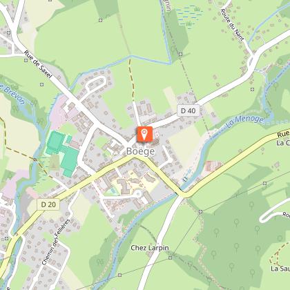
Starting point
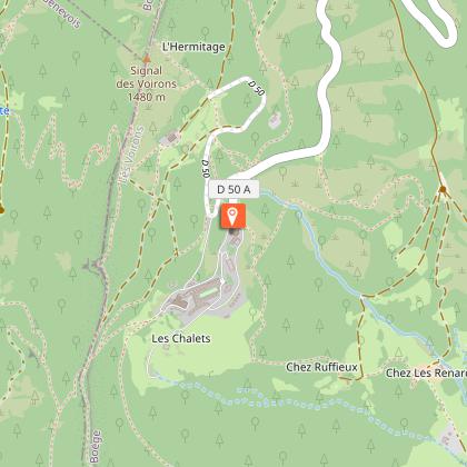
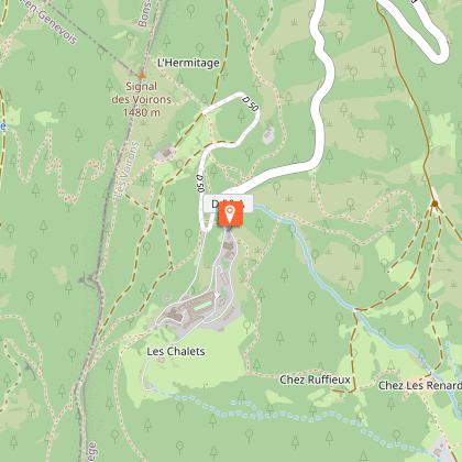
Points of interest

Additional information
Updated by
Office de Tourisme des Alpes du Léman - 04/09/2025
www.alpesduleman.com
Report a problem
Environments
Forest location
Lake view
Mountain view
Mountain location
Close to GR footpath
Open period
From 01/04 to 31/10.
Subject to favorable weather.
Contact
Phone : 04 50 39 54 46
Email : info@alpesduleman.com
Website : https://www.alpesduleman.com
Topo guides and map references
Topo guides references :
Les Alpes du Léman map and hiking guide is available at the Tourist Offices (Bellevaux and Habère-Poche)
32 paths + a map: 8 €
Type of land
Not suitable for strollers
Reception complements
Les Alpes du Léman map and hiking guide is available at the Tourist Offices (Bellevaux and Habère-Poche)
32 paths + a map: 8 €
Animals
Yes
Data author
