Alert
Alerts
Hiking : Lac de Darbon via the 3 passes
Description
A hike of medium difficulty, which will allow you to cross the authentic mountain pastures of the Chablais and to discover the Darbon lake, nestled under the beautiful peaks which surround it.
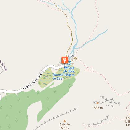
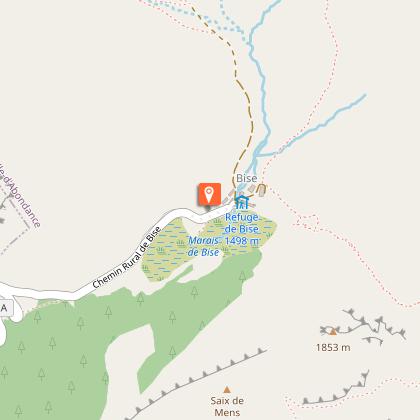
Departing from Chalet de Bise, the Lac de Darbon hike is an invitation to discover the wide-open spaces of the mountains. Lac de Darbon is a very fragile natural environment. To avoid damaging this ecosystem and to respect the tranquillity of the area, please do not swim in it or let your dogs swim in it.
You'll first cross the Bise mountain pastures, a Natura 2000 listed site and emblematic of the Chablais UNESCO World Geopark.
You will cross 3 passes during your walk.
First, you'll climb to the Col de Bise (1915 m), where you'll enjoy a magnificent panorama of Lake Geneva, the Dent du Vélan, and below, Lake Neuteu, with the tête de Charousse ridge on your right and the Pointe de Pavis cliffs on your left.
You will then reach the Col de Pavis (1944 m) and the Lac de Darbon (1813 m), an ideal spot for a picnic.
Your final pass is the Col de Floray (1940 m).
A steep descent takes you back to the chalets de Bise.
Technical Information
Altimetric profile
Starting point
Points of interest


Date and time
- From 01/06/2026 to 15/10/2026
- From 01/06/2027 to 15/10/2027
Additional information
Open period
From 01/06 to 15/10 daily.
Check with tourist offices in advance to find out the current access conditions.
Subject to favorable snow and weather conditions.
Sustainable tourism
Lake Darbon is a very fragile natural environment. To avoid damaging this ecosystem and to respect the tranquillity of the area, please do not swim in it or let your dogs swim in it.
To respect agricultural practices, natural areas and wildlife, please keep your dogs on a leash and pick up after them.
Keep and sort your garbage, stay on the paths and close the fences.
Swimming in Lac de Darbon is strictly prohibited, including for pets.
Within a 200-meter perimeter around Lac de Darbon:
- Dogs must be kept on a leash (this zone adjoins the Cornettes de Bise nature reserve).
- Wild camping, bivouacs and campfires are prohibited day and night.
Any infringement of this decree will be recorded in an official report.
Updated by
Conseil Départemental de la Haute-Savoie - 21/04/2026
hautesavoiemontblanc-tourisme.com/
Report a problem
Environments
Town location
Lakeside or by stretch of water
Mountain view
Lake view
Mountain location
Sensitive Natural Area
Presence of livestock and guard dogs
Contact
Phone : 04 50 73 51 41
Email : lachapelledabondance@ot-peva.com
Website : https://leman-mountains-explore.com
Type of land
Not suitable for strollers
Stone
Grit
Ground
Location complements
Access (Car): From Thonon-les-Bains, follow signs for Vallée d'Abondance, Châtel.
Enter Vacheresse and head for Bise-Ubine, then Bise.
Park in the Bise parking lot near the refuge.
Topo guides and map references
Topo guides references :
Hiking maps and guidebooks are available for purchase at tourist offices throughout the Evian and Abondance Valley region.
Map references :
- Map guide to 65 walks and hikes in the Evian region and Abondance valley
- Map of walking routes in the Portes du Soleil area in France and Switzerland
- IGN TOP 25 No. 3528 ET Morzine Chablais Massif Portes du Soleil
Reception complements
Whatever your hike, remember to take good walking shoes, and in your backpack, cereal bars, sufficient water, sunglasses, sunscreen, a small first aid kit, as well as clothes adapted to your outing depending on the season and the weather forecast.
Guidebook with maps/step-by-step
1/ Take the track to the left of the stream through the hamlet of Bise, without crossing the bridge. After a flat area, the track splits in two (at a place called "la Salle").
2/ Turn right towards "Col de Bise" (GR5).
3/ At Col de Bise, head for Col de Pavis. Go around the "Pavis" and down to an intersection. The terrain is uneven, and you need to cross a few small gravel pits. Climb left towards the pass.
4/ Descend to Lac de Darbon. Go around the lake to the left and take the path rising to the left towards the Col de Floray. Follow the ridge and plunge left. The slope is steep.
5/ Then follow the pastures at the start of the hike to reach the Bise chalets.
Animals
Yes. Dogs must be kept on a leash due to the presence of livestock and wildlife.
Livestock guard dogs are present in this area, so it is recommended that you adapt your behaviour to minimise disturbance to the livestock and avoid triggering the dogs (barking, approaching, etc.). If the dogs approach,
Data author
