Hiking track - Le Môle
Description
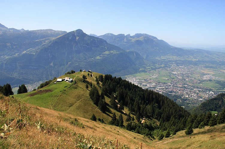
Belvedere of Faucigny, nicknamed Fuji-Yama of the Alps, especially when the first snows offers it a white hat on its summit.
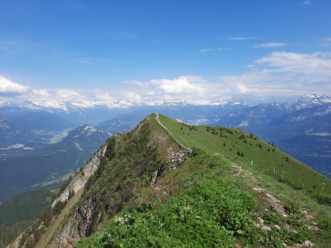
360 °view, with a panorama of the chain(channel) of the Mont Blanc, Aravis, La Pointe d'Andey, the Lac Léman and its fountain...
The hike begins on the parking lot of the refreshment room.
Take the path which rises in laces in the forest.
At the first crossing, continueacross until the second crossing indicating "The Plan Meulet" on the left and take this direction.
Follow the way which winds in the forest up to the high mountain pastures of "Plan Meulet".
Follow the path on the crests which leaves to the right.
The summit is not still visible but take time to observe the magnificent view of the valley which opens in front of you.
Continue to the top of the Mole, don't hesitate to go to the cross.
The descent is made by the Small Mole and the Locality "La Ladère" then the Locality "La Ravire". The following of the descent is then made by a long and wide way of track.
Technical informations
8 km
|
min. 99999 m
750 m
750 m
| |||
Altimetric profile
Starting point
Points of interest
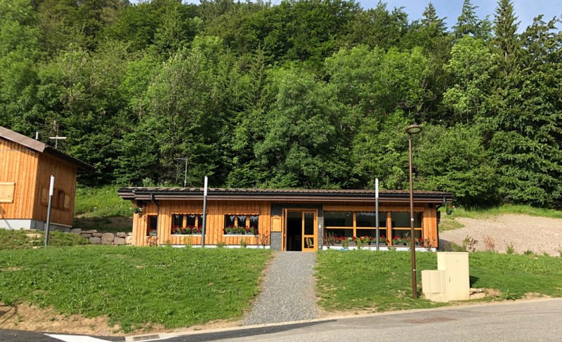
Auberge du Môle
Between tradition, simplicity and generosity, this local restaurant invite you to discover and taste the savoyardes specialties they're cooking in the heart of an amazing spot.
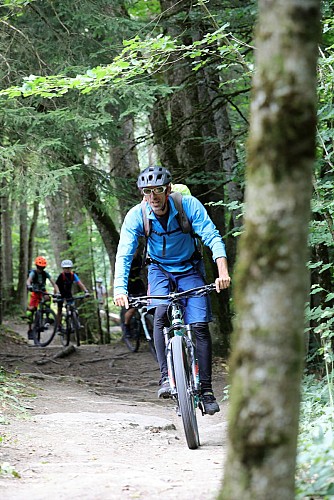
Môle Open Bike
Let yourself be guided by David, BPJEPS MTB graduate, state graduate in Nordic Skiing and certified in shooting instruction.He will make you discover the most beautiful trails in the region and allow you to improve your practice. Individually or in groups, everything is possible, outings, hikes, courses, cycles of several sessions and private lessons are offered. In complete safety, adapted to the level of each of the smallest to the largest.
Additional information
Updated by
Môle et Brasses Tourisme - 08/03/2024
www.mole-brasses.com/fr
Report a problem
Open period
All year round.
Contact
Phone :
04 50 36 49 18
04 50 36 49 18
Email : info@mole-brasses.com
Website : www.mole-brasses.com/fr
Facebook : www.facebook.com/molebrassestourisme/
Data author
