Alert
Alerts
Type of practice
Mountainbiking
Easy
Presentation
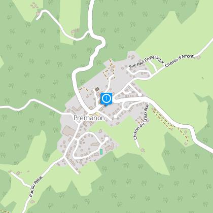
Map
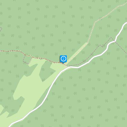
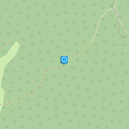
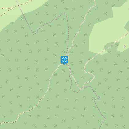
Steps
Cirkwi brief's
Ratings and reviews
See around
Tour of Mont Fier
The Cirkwi brief
Explore Mont Fier by Bike: An Adventure in Prémanon
Delve into an exhilarating journey across the picturesque landscapes of Prémanon with the Tour du Mont Fier. Crafted meticulously by the Office de Tourisme de la Station des Rousses, this route transports you through dense forests and serene valleys, unveiling mesmerizing vistas of Lac des Rousses, Dent de Vaulion, Noirmont, and La Dôle. With every pedal, embrace a unique blend of adventure and tranquility, perfect for those yearning to connect with nature on a deeper level. The spirit of exploration awaits you on a circuit designed to challenge and inspire.
Technical Insights on Mont Fier Route
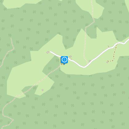
This 11km journey, starting from Prémanon, demands a moderate level of fitness, given its 357m elevation gain and the total ascent/descent of approximately 421-422m. Riders face a multifaceted terrain, where the maximum altitude peaks at 1285m, and the minimum rests at 1069m. This configuration necessitates a well-maintained mountain bike (MTB) capable of navigating both gradual inclines and potentially sharp descents. Mastery over gear shifting and endurance for continuous pedaling over undulating surfaces is essential for completing this circuit satisfyingly.
Safety and Seasonal Tips for Travelers
Regardless of the season, adventurers embarking on the Mont Fier circuit should prioritize safety and preparedness. During summer, ensure adequate hydration and sun protection. Autumn and spring present unpredictable weather; layers and waterproof gear are advisable. Winter requires special caution; only attempt with proper snow tires if the trail is accessible. Always inform someone of your itinerary, carry a map or GPS device, and check weather forecasts. Respect local wildlife and stay on marked trails to preserve the natural beauty of Prémanon and its surroundings.
Prémanon: Heart of Jura History
Prémanon, nestled in the Jura department, is a gem steeped in history and culture. This area, part of the broader Franche-Comté region, has been a crossroads of civilizations and trade routes since ancient times. Known for its breathtaking landscapes, it also played significant roles during various periods, including the resistance movements in World War II. The natural beauty, combined with a rich cultural tapestry, makes Prémanon and the surrounding areas an enchanting place, offering more than just scenic trails but a journey through time.
Weather Patterns and Best Visit Times
The climate in Prémanon and the larger Jura region is classified as continental, characterized by warm summers and cold, snowy winters. For biking adventures like the Mont Fier circuit, late spring to early autumn presents an ideal window. During these months, temperatures are comfortable, and the reduced likelihood of snow offers clearer paths. However, always anticipate sudden weather changes and prepare accordingly. Apt timing and thorough preparation will enhance the enjoyment and safety of your journey through this stunning landscape.
Delve into an exhilarating journey across the picturesque landscapes of Prémanon with the Tour du Mont Fier. Crafted meticulously by the Office de Tourisme de la Station des Rousses, this route transports you through dense forests and serene valleys, unveiling mesmerizing vistas of Lac des Rousses, Dent de Vaulion, Noirmont, and La Dôle. With every pedal, embrace a unique blend of adventure and tranquility, perfect for those yearning to connect with nature on a deeper level. The spirit of exploration awaits you on a circuit designed to challenge and inspire.
Technical Insights on Mont Fier Route
This 11km journey, starting from Prémanon, demands a moderate level of fitness, given its 357m elevation gain and the total ascent/descent of approximately 421-422m. Riders face a multifaceted terrain, where the maximum altitude peaks at 1285m, and the minimum rests at 1069m. This configuration necessitates a well-maintained mountain bike (MTB) capable of navigating both gradual inclines and potentially sharp descents. Mastery over gear shifting and endurance for continuous pedaling over undulating surfaces is essential for completing this circuit satisfyingly.
Safety and Seasonal Tips for Travelers
Regardless of the season, adventurers embarking on the Mont Fier circuit should prioritize safety and preparedness. During summer, ensure adequate hydration and sun protection. Autumn and spring present unpredictable weather; layers and waterproof gear are advisable. Winter requires special caution; only attempt with proper snow tires if the trail is accessible. Always inform someone of your itinerary, carry a map or GPS device, and check weather forecasts. Respect local wildlife and stay on marked trails to preserve the natural beauty of Prémanon and its surroundings.
Prémanon: Heart of Jura History
Prémanon, nestled in the Jura department, is a gem steeped in history and culture. This area, part of the broader Franche-Comté region, has been a crossroads of civilizations and trade routes since ancient times. Known for its breathtaking landscapes, it also played significant roles during various periods, including the resistance movements in World War II. The natural beauty, combined with a rich cultural tapestry, makes Prémanon and the surrounding areas an enchanting place, offering more than just scenic trails but a journey through time.
Weather Patterns and Best Visit Times
The climate in Prémanon and the larger Jura region is classified as continental, characterized by warm summers and cold, snowy winters. For biking adventures like the Mont Fier circuit, late spring to early autumn presents an ideal window. During these months, temperatures are comfortable, and the reduced likelihood of snow offers clearer paths. However, always anticipate sudden weather changes and prepare accordingly. Apt timing and thorough preparation will enhance the enjoyment and safety of your journey through this stunning landscape.
Automatically generated.
Technical Information
Mountainbiking
Difficulty
Easy
Dist.
11 km
Type of practice
Mountainbiking
Easy
Show more
Altimetric profile
Starting point
39220
Prémanon
Lat : 46.46252Lng : 6.03207
Steps
Data author

Ratings and reviews
To see around