Alert
Alerts
Type of practice
Walking
Very easy
2h
Presentation
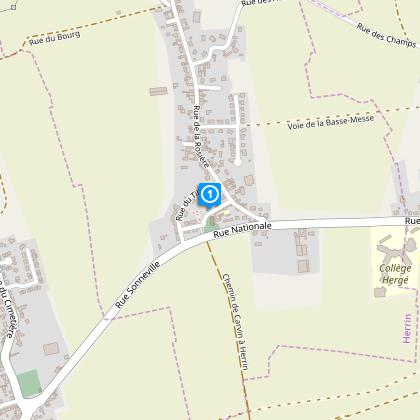
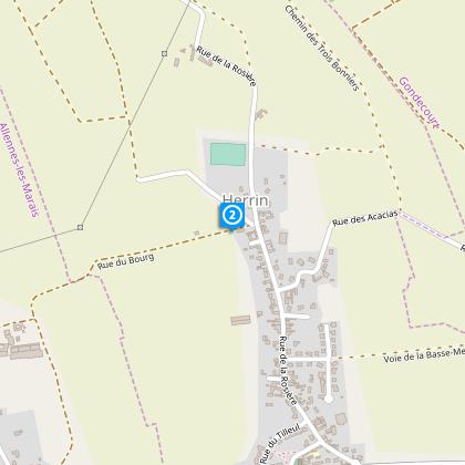
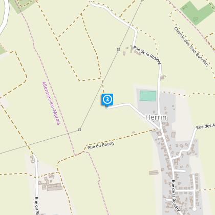
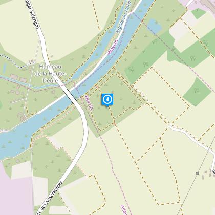
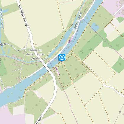
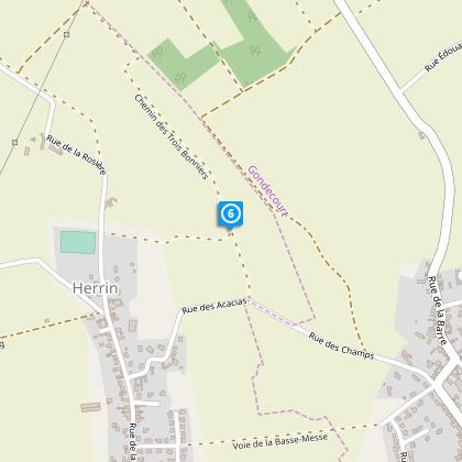
Map
Steps
Cirkwi brief's
Ratings and reviews
See around
Shuttle Circuit


Credit : Département du Nord
The Cirkwi brief
Explore the Enchanting Canal Walks of High Deûle
Discover the serene beauty of High Deûle's canal paths with an itinerary presented by Nord Tourisme that beckons families to immerse in the tranquility of its waterways. This accessible year-round trail offers a glimpse into the bustling fluvial traffic while meandering through lush, adjacent wetlands. Perfect for those seeking an escape into nature, its charm is most vivid from April to October. While embracing the harmony of these landscapes, one experiences the unique interplay of historic waterways and vibrant ecological life.
Key Technical Insights of the Trail
Spanning exactly 5.61 km, the trail starts at an altitude of 20 meters, reaching a peak of 26 meters. It features a minimal positive altitude change, around 6-7 meters, marking it as an easy venture for all ages. The routes through wetlands call for waterproof footwear, especially during the rainy seasons. Nord Tourisme's effort to design a route with such user-friendly specifications underlines its suitability for family outings and its welcoming nature for both casual strollers and avid walkers.
Seasonal Tips for Trail Adventurers
For a pleasant journey, equip yourself with waterproof shoes during wetter months and sunscreen in the sunny season. April to October stands out as an ideal period to explore, offering dryer paths and a comfortable climate. Always respect the canal's wildlife and plants - they are part of what makes this experience special. Bringing along water and snacks is advisable, as amenities along the trail can be sparse.
Cultural Heart of Haute Deûle Region
Herrin, the starting point of our journey, is a testament to the rich cultural tapestry of the Haute Deûle region. Known for its beautiful waterways and historical significance, the area presents a unique blend of natural beauty and architectural legacy. Walking these paths, one treads through centuries of history, where each step recounts the stories of trade, industry, and the everyday lives of people who shaped the landscape.
Local Climate and Best Visit Times
The Haute Deûle region experiences a temperate climate, with rainfall evenly distributed throughout the year. Nevertheless, the period from April to October is particularly favorable, offering mild temperatures and a lesser likelihood of encountering those wet pathways. This window seamlessly aligns with the best time to fully appreciate the flora and the more active canal traffic, setting the stage for an invigorating and visually enriching experience.
Automatically generated.
Technical Information
Walking
Difficulty
Very easy
Duration
2h
Dist.
5.6 km
Type of practice
Walking
Very easy
2h
Show more
Altimetric profile
Starting point
Eglise
,
59147
HERRIN
Lat : 50.5434505304Lng : 2.96564474662
Steps
Data author

Ratings and reviews
To see around