Alert
Alerts
Type of practice
Walking
Very easy
3h30mn
Presentation
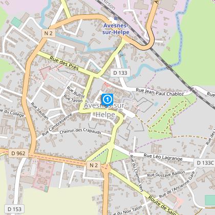
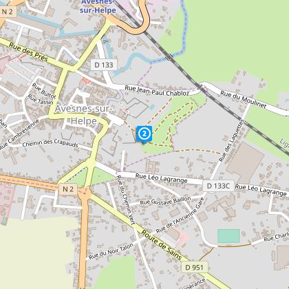
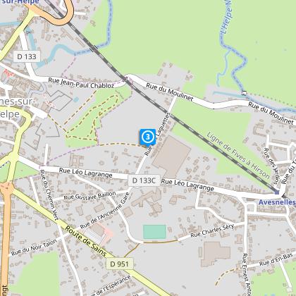
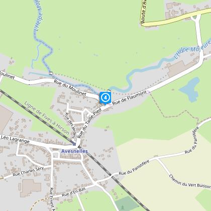
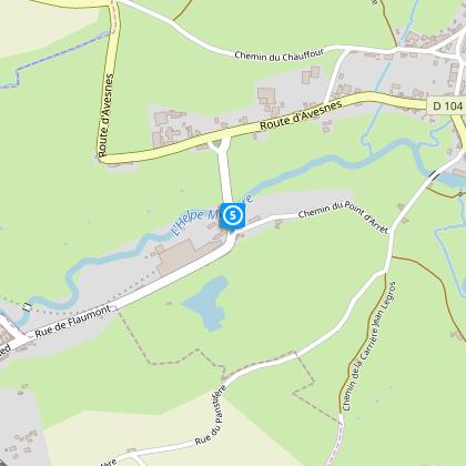
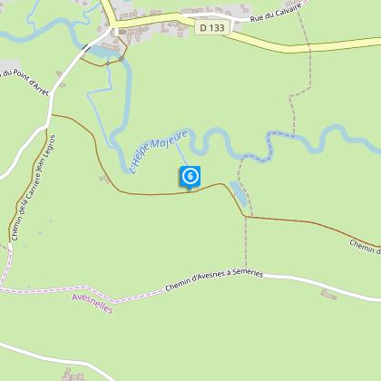
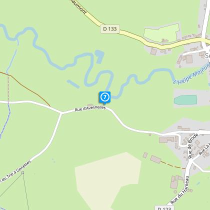
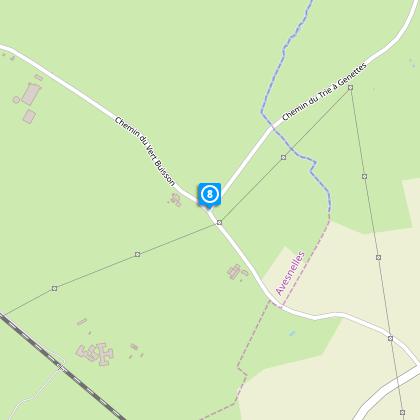
Map
Steps
Cirkwi brief's
Ratings and reviews
See around
Caesar's Camp Circuit


Credit : Département du Nord
The Cirkwi brief
Explore Avesnes-sur-Helpe: A Historical Hiking Experience
Nestled in the picturesque landscapes of the Avesnes region, the "Circuit du Camp de César" offers an engaging escape into nature and history. Designed by Nord Tourisme, this family-friendly trail spans 3.7 km, providing an accessible adventure throughout the year. As you embark on this journey, the blend of scenic views and the whispers of the past create an immersive experience. It's not just a walk; it's a step back in time. The careful planning by Nord Tourisme ensures that every step is an opportunity to connect with the rich tapestry of the area's natural beauty and historical significance.
Brief Technical Overview
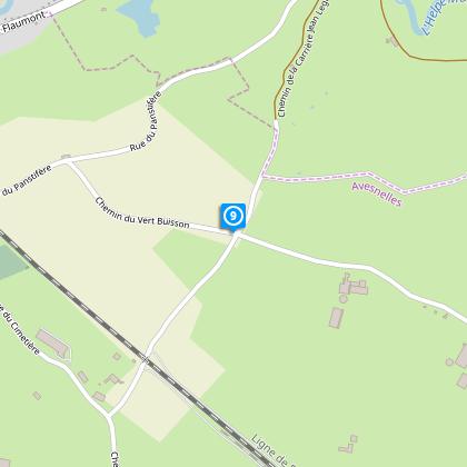
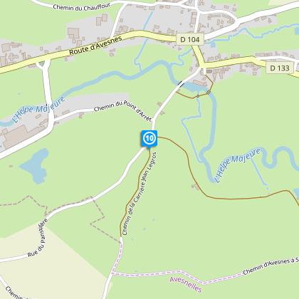
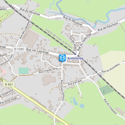
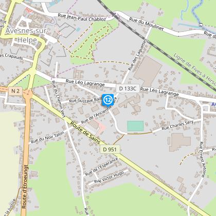
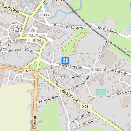
This route covers a total distance of 11.702 km, with an altitude range from 150 meters (min) to 199 meters (max). The total positive elevation change is 112 meters. Specifically designed for walking, the path navigates through various terrains, making it essential for participants to have appropriate footwear, especially during rainy seasons. The journey begins at the church parking in Avesnes-sur-Helpe and is marked with care to guide adventurers along the RD 133, ensuring a blend of safety and exploration.
Seasonal Tips and Safety
No matter the season, the "Circuit du Camp de César" has its charm and challenges. In spring and summer, the lush landscape unveils its full glory, though rain can make the trails slippery. Autumn brings a palette of colors, turning every view into a painting, but also requires vigilance for wet leaves. Winter, while sparse, demands waterproof gear and caution for icy paths. Remember, safety is paramount along the RD 133, and proper footwear is a must year-round. Always come prepared for changes in weather and terrain.
Historical Insights of Avesnes-sur-Helpe
Avesnes-sur-Helpe, a gem in the Hauts-de-France region, has a rich tapestry of historical and cultural significance. The town and its surroundings, including the "Circuit du Camp de César", are steeped in history dating back to Roman times and beyond. This area served as a strategic outpost and bears witness to centuries of evolving landscapes and societies. Hiking through this territory offers more than scenic beauty; it is an exploration of the depths of time, where every pathway tells a story of endurance, evolution, and the enduring spirit of the region.
Weather and Climate Insights
The climate in Avesnes-sur-Helpe is classified as temperate oceanic, with mild summers and cool winters, making it a year-round destination for nature enthusiasts. Rainfall is spread throughout the year, with no distinct dry season, highlighting the importance of waterproof gear for hikers. The best time to visit would arguably be late spring through early autumn, when the weather is generally milder, and the natural beauty of the region is at its peak, offering an ideal setting for exploring the wonders of the "Circuit du Camp de César".
Nestled in the picturesque landscapes of the Avesnes region, the "Circuit du Camp de César" offers an engaging escape into nature and history. Designed by Nord Tourisme, this family-friendly trail spans 3.7 km, providing an accessible adventure throughout the year. As you embark on this journey, the blend of scenic views and the whispers of the past create an immersive experience. It's not just a walk; it's a step back in time. The careful planning by Nord Tourisme ensures that every step is an opportunity to connect with the rich tapestry of the area's natural beauty and historical significance.
Brief Technical Overview
This route covers a total distance of 11.702 km, with an altitude range from 150 meters (min) to 199 meters (max). The total positive elevation change is 112 meters. Specifically designed for walking, the path navigates through various terrains, making it essential for participants to have appropriate footwear, especially during rainy seasons. The journey begins at the church parking in Avesnes-sur-Helpe and is marked with care to guide adventurers along the RD 133, ensuring a blend of safety and exploration.
Seasonal Tips and Safety
No matter the season, the "Circuit du Camp de César" has its charm and challenges. In spring and summer, the lush landscape unveils its full glory, though rain can make the trails slippery. Autumn brings a palette of colors, turning every view into a painting, but also requires vigilance for wet leaves. Winter, while sparse, demands waterproof gear and caution for icy paths. Remember, safety is paramount along the RD 133, and proper footwear is a must year-round. Always come prepared for changes in weather and terrain.
Historical Insights of Avesnes-sur-Helpe
Avesnes-sur-Helpe, a gem in the Hauts-de-France region, has a rich tapestry of historical and cultural significance. The town and its surroundings, including the "Circuit du Camp de César", are steeped in history dating back to Roman times and beyond. This area served as a strategic outpost and bears witness to centuries of evolving landscapes and societies. Hiking through this territory offers more than scenic beauty; it is an exploration of the depths of time, where every pathway tells a story of endurance, evolution, and the enduring spirit of the region.
Weather and Climate Insights
The climate in Avesnes-sur-Helpe is classified as temperate oceanic, with mild summers and cool winters, making it a year-round destination for nature enthusiasts. Rainfall is spread throughout the year, with no distinct dry season, highlighting the importance of waterproof gear for hikers. The best time to visit would arguably be late spring through early autumn, when the weather is generally milder, and the natural beauty of the region is at its peak, offering an ideal setting for exploring the wonders of the "Circuit du Camp de César".
Automatically generated.
Technical Information
Walking
Difficulty
Very easy
Duration
3h30mn
Dist.
12 km
Type of practice
Walking
Very easy
3h30mn
Show more
Altimetric profile
Starting point
parking de l'église
,
59440
AVESNES-SUR-HELPE
Lat : 50.1177799954Lng : 3.94728046184
Steps
Data author

Ratings and reviews
To see around