Alert
Alerts
Type of practice
Walking
Medium
3h30mn
Presentation
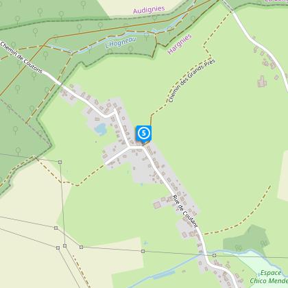
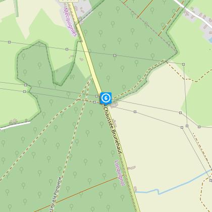
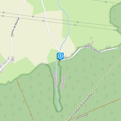
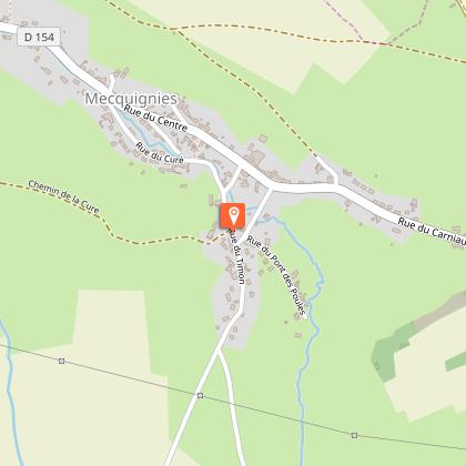
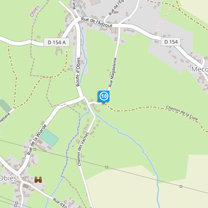
Map
Steps
Cirkwi brief's
Ratings and reviews
See around
Circuit of the sabotiers
The Cirkwi brief
Explore the Enchanting Circuit des Sabotiers in Mecquignies
Nestled at the edge of the stunning Forêt de Mormal, the Circuit des Sabotiers offers an invigorating escape for those with a penchant for the great outdoors. Crafted by Nord Tourisme, this trail weaves through a picturesque blend of agricultural paths, country lanes, and forest trails, providing a thorough immersion into the region's natural beauty. Embarking on this journey is not just a walk, but an adventure through the heart of Mecquignies, punctuated by the rhythmic rustle of leaves and the tranquil stillness that only nature can provide. Perfect for the seasoned walker, it promises an experience replete with serenity and challenge, where every step rewards you with breathtaking views and a profound sense of connection to the earth.
Brief Technical Overview
Spanning approximately 10.94 kilometers, the Circuit des Sabotiers features a cumulative positive elevation gain between 70 to 71 meters, with the highest point reaching up to 164 meters and the lowest at 128 meters. This information underscores the moderately challenging nature of the trail, suitable for regular walkers familiar with mixed terrain. The path navigates through varied landscapes, necessitating cautious navigation at the RD 961 crossing near the forest. Technical highlights underline the necessity of preparation, with emphasis on wearing waterproof footwear during rainy periods, showcasing the trail's demand for both physical readiness and tactical approach.
Seasonal Guide and Safety Tips
When embarking on the Circuit des Sabotiers, considering the season is crucial for an enjoyable experience. In spring and summer, lightweight clothing along with sunscreen and plenty of water will make your journey comfortable under the lush, green canopy. During autumn and winter, the trail's beauty is undeniable, yet be prepared with warm layers and waterproof gear to combat cooler temperatures and possible rain. Always prioritize safety by staying mindful at the RD 961 crossing, especially amidst the forest's tranquil but potentially disorienting surroundings. Reminder: the changing seasons might affect trail conditions, so choosing sturdy, reliable footwear is paramount all year round.
Historical and Cultural Insights
The territory around Mecquignies, particularly near the Forêt de Mormal, holds a rich tapestry of history and culture. For centuries, this region has thrived as a testament to human resilience and nature's bounty. Particularly, the Circuit des Sabotiers pays homage to the traditional craft of clog making, a significant livelihood for many in the bygone days. This trail not only offers a physical journey through scenic landscapes but also a voyage back in time, inviting walkers to tread the paths once walked by the saboters, or clog makers, whose artistry has left an indelible mark on the region's cultural heritage.
Local Weather Insights
The climate in the Mecquignies region presents a balanced array of seasons, making it a year-round destination for outdoor enthusiasts. However, the most opportune time to visit for those looking to fully enjoy the Circuit des Sabotiers would be between late spring and early autumn. During these months, the weather is typically mild, with temperatures conducive to hiking, and the rainfall is moderate, ensuring trails are neither too muddy nor slippery. Although winter treks offer a unique snowy landscape, they demand thorough preparation against the cold. Regardless of when you choose to visit, the region's climate promises an ever-changing backdrop to this beautiful trail.
Automatically generated.
Technical Information
Walking
Difficulty
Medium
Duration
3h30mn
Dist.
11 km
Type of practice
Walking
Medium
3h30mn
Show more
Altimetric profile
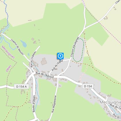
Starting point
Parking du cimetière
,
MECQUIGNIES
Lat : 50.2779699425Lng : 3.79476304914
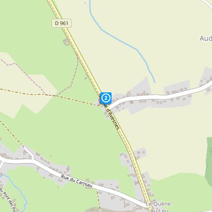
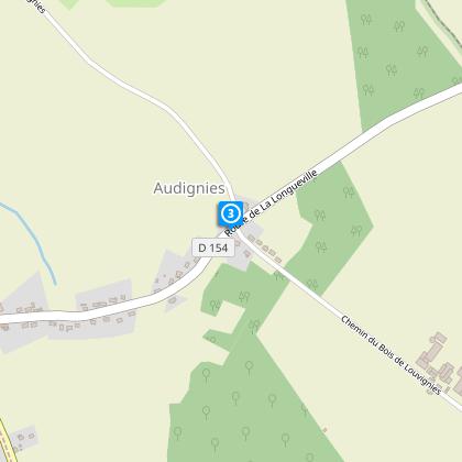
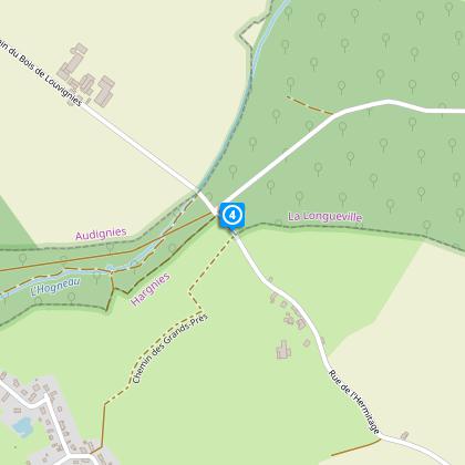
Steps

Data author

Ratings and reviews
To see around