Alert
Alerts
Type of practice
Walking
Very easy
1h30mn
Presentation
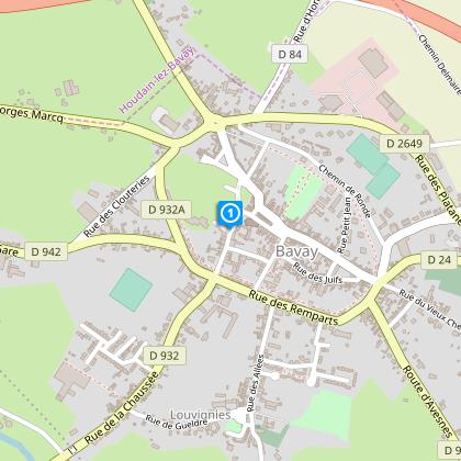
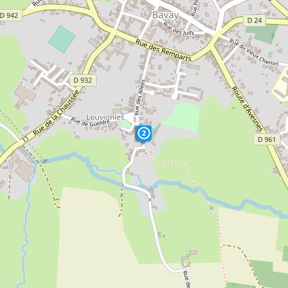
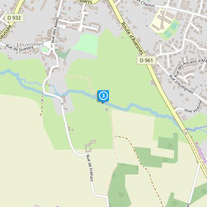
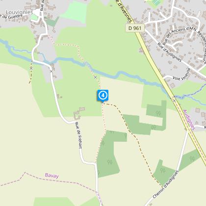
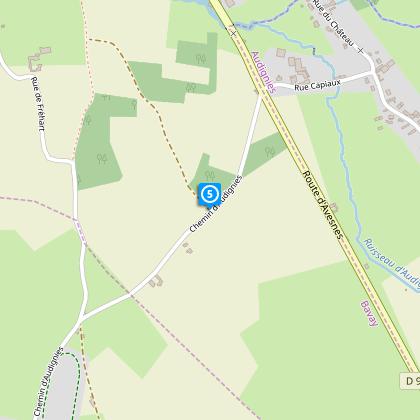
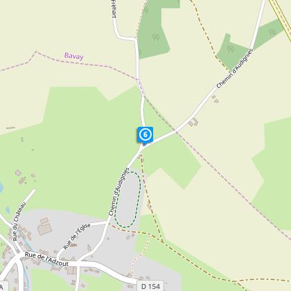
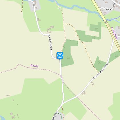
Map
Steps
Points of interest
Cirkwi brief's
Ratings and reviews
See around
Path of the springs

Credit : Département du Nord
The Cirkwi brief
Discover Bavay's Enchanting Trails: A Cultural and Natural Odyssey
Embarking on the Sentier des Sources offers more than just a simple walk. Crafted by Nord Tourisme, this itinerary weaves through the picturesque landscapes of Bavay, making for a memory-rich outdoor adventure. As you amble through paths flanked by historic sites and meandering streams, you're invited into a world where the whispers of the past meet the natural serenity of the present. It's a unique blend of history and nature - where the legacy of the Romans and the tranquil beauty of the French countryside come together to create an experience that's as educational as it is breathtaking.
Trail Specs: Distance and Elevation Brief
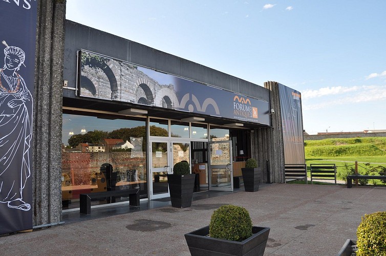
This route spans about 5.05 km, starting from the parking of the Forum Antique Museum and stretching through varied landscapes. The elevation profile shows a minimum altitude of 123 meters, peaking at 150 meters, making for a total positive elevation gain of approximately 61-62 meters. This technical summary underlines the trail's moderate difficulty level, suitable for families and enthusiasts alike, demonstrating its accessibility for a broad range of hikers seeking both historical insight and natural beauty.
Seasonal Tips for Explorers
Regardless of the season, the Sentier des Sources has something unique to offer. In spring, the flowering landscapes accentuate the historical ambiance, making for idyllic walking conditions. Summer brings lush greenery, though one should always have water and sunscreen. Autumn showcases a kaleidoscope of colors, perfect for photography. However, paths can be slippery with fallen leaves, so appropriate footwear is advised. During winter, the crisp air complements the scenic frost-covered trails, but layers and caution on potentially icy paths are key. Always check weather forecasts before setting out to ensure a safe journey.
Insights into Bavay's Rich History
The town of Bavay, nestled within the Nord department, holds a significant place in both French and Roman history. It's acclaimed for housing the largest Gallo-Roman site north of the Loire, highlighted by the Forum Antique with its monumental ruins, offering a vivid glimpse into the past. This region, situated on the Chaussée Brunehaut, flourished as a bustling commercial hub during Roman times. Understanding this historical context enriches the Sentier des Sources experience, melding the enjoyment of natural landscapes with a profound appreciation of our ancestors' engineering and cultural achievements.
Weather Patterns and Ideal Visit Times
Bavay's climate is characterized by mild temperatures with adequate rainfall year-round, fitting the typical Western European maritime climate. This ensures the Sentier des Sources can be approached any time of the year. However, to capture the essence of Bavay's natural beauty combined with comfortable weather, late spring through early autumn (May to September) is recommended. During this period, you'll experience the vibrant hues and mild temperatures perfect for hiking, offering an ideal backdrop for both the historical and natural elements this unique trail offers.
Embarking on the Sentier des Sources offers more than just a simple walk. Crafted by Nord Tourisme, this itinerary weaves through the picturesque landscapes of Bavay, making for a memory-rich outdoor adventure. As you amble through paths flanked by historic sites and meandering streams, you're invited into a world where the whispers of the past meet the natural serenity of the present. It's a unique blend of history and nature - where the legacy of the Romans and the tranquil beauty of the French countryside come together to create an experience that's as educational as it is breathtaking.
Trail Specs: Distance and Elevation Brief
This route spans about 5.05 km, starting from the parking of the Forum Antique Museum and stretching through varied landscapes. The elevation profile shows a minimum altitude of 123 meters, peaking at 150 meters, making for a total positive elevation gain of approximately 61-62 meters. This technical summary underlines the trail's moderate difficulty level, suitable for families and enthusiasts alike, demonstrating its accessibility for a broad range of hikers seeking both historical insight and natural beauty.
Seasonal Tips for Explorers
Regardless of the season, the Sentier des Sources has something unique to offer. In spring, the flowering landscapes accentuate the historical ambiance, making for idyllic walking conditions. Summer brings lush greenery, though one should always have water and sunscreen. Autumn showcases a kaleidoscope of colors, perfect for photography. However, paths can be slippery with fallen leaves, so appropriate footwear is advised. During winter, the crisp air complements the scenic frost-covered trails, but layers and caution on potentially icy paths are key. Always check weather forecasts before setting out to ensure a safe journey.
Insights into Bavay's Rich History
The town of Bavay, nestled within the Nord department, holds a significant place in both French and Roman history. It's acclaimed for housing the largest Gallo-Roman site north of the Loire, highlighted by the Forum Antique with its monumental ruins, offering a vivid glimpse into the past. This region, situated on the Chaussée Brunehaut, flourished as a bustling commercial hub during Roman times. Understanding this historical context enriches the Sentier des Sources experience, melding the enjoyment of natural landscapes with a profound appreciation of our ancestors' engineering and cultural achievements.
Weather Patterns and Ideal Visit Times
Bavay's climate is characterized by mild temperatures with adequate rainfall year-round, fitting the typical Western European maritime climate. This ensures the Sentier des Sources can be approached any time of the year. However, to capture the essence of Bavay's natural beauty combined with comfortable weather, late spring through early autumn (May to September) is recommended. During this period, you'll experience the vibrant hues and mild temperatures perfect for hiking, offering an ideal backdrop for both the historical and natural elements this unique trail offers.
Automatically generated.
Technical Information
Walking
Difficulty
Very easy
Duration
1h30mn
Dist.
5.1 km
Type of practice
Walking
Very easy
1h30mn
Show more
Altimetric profile
Starting point
Parking du Musée Départemental Forum Antique
,
59570
BAVAY
Lat : 50.296525738Lng : 3.79406530954
Steps
Data author

Ratings and reviews
To see around