Alert
Alerts
Hiking to "La Croix des Salles"

Description
Walking through Combloux alpine pastures, with a stunning view of Mont-Blanc, the Aravis massif and the aiguilles de Varens.
Arrival at the top of Combloux ski area.
Technical Information
Altimetric profile
Starting point
Points of interest


Date and time
- From 01/05/2026 to 15/11/2026
- From 01/05/2027 to 15/11/2027
Additional information
Services for children
Panoramic playground at the top of the Jaillet gondola, on the way down from La Croix des Salles.
Tips
Yo can stop for lunch in one of our mountain restaurants: le Coeur d'Or, la P'tite Ravine, Les Terrasses du Cuchet, le chalet d'Emilie.
Updated by
Office de Tourisme de Combloux - 28/04/2026
www.combloux.com/
Report a problem
Environments
Mountain view
Mountain location
Tips for the photographer
The view from the Croix des Salles is even more beautiful at sunset, when the sky and mountains take on a rosy hue. Don’t forget your headlamp for the way down!
Open period
From 05/01 to 11/15 : open daily.
Type of land
Stone
Not suitable for strollers
Contact
Phone : 04 50 58 60 49
Email : info@combloux.com
Topo guides and map references
Map references :
IGN TOP 25 3531 OT - Megève col des Aravis
For more details, a hiking map is for sale at the tourist office for 6€.
Reception complements
In spring, snow may still be present on certain sections (mainly in April), and muddy conditions may occur after snowmelt or following rainfall.
The weather changes quickly in the mountains, so be sure to check the forecast before heading out and take a warm, waterproof layer with you.
The Croix des Salles is exposed to a steep drop — stay safe by keeping close to the cross.
Guidebook with maps/step-by-step
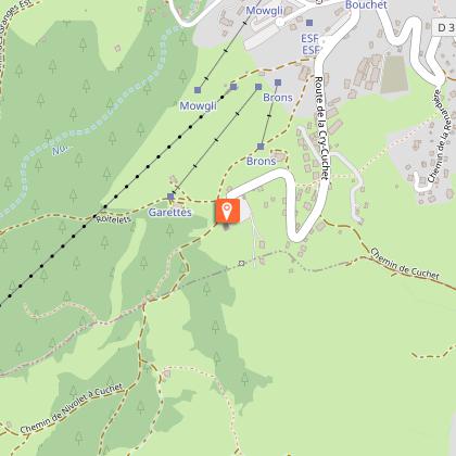
1/ From the Cuchet car park, take the flat trail in front of the Chalet d'Emilie's terrace, heading toward Le Châble. You’ll pass near the Mont-Blanc Bike Park.
2/ Continue to the right in the direction of Châble d'en Bas - Sommet des Salles.
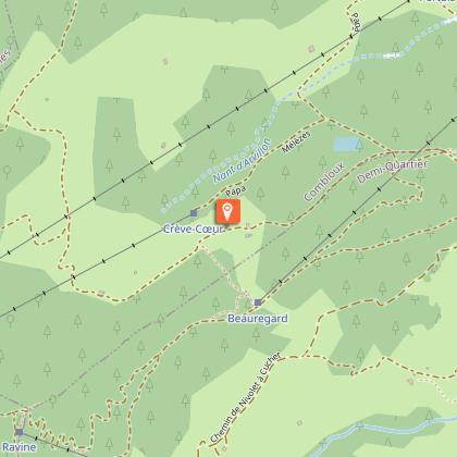
3/ Keep going uphill toward the Sommet des Salles.
4/ The climb ends at the top of the ski area, where the ski lifts converge.
5/ Begin the descent toward Le Jaillet.
6/ You'll see the arrival of a chairlift. On the left, a small trail leads you to La Croix des Salles, an unmissable viewpoint!
7/ Retrace your steps and head toward the Jaillet gondola. Near the arrival station, you’ll find a children’s play area and a food truck open in July and August.
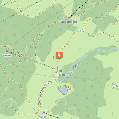
8/ Continue downhill toward La Ravine / Alpage de Beauregard. You’ll pass close to Lac du Jaillet—don’t hesitate to make a small detour to see the surprising orientation table above the lake.
9/ Pass in front of the restaurant "La P’tite Ravine" and keep descending toward the "Alpage de Beauregard".
(This is where Milka filmed its famous ad: “And the marmot wraps the chocolate in foil.”)
10/ At the "Alpage de Beauregard", turn right to return to the Cuchet car park.
Animals
Yes
Data author
