Alert
Alerts
Type of practice
Walking
Hard
4h30mn
Mountainbiking
Easy
Riding
Easy
Presentation
Description
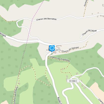
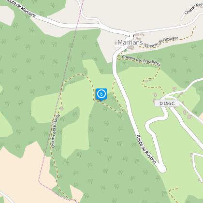
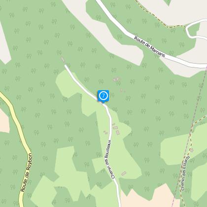
Map
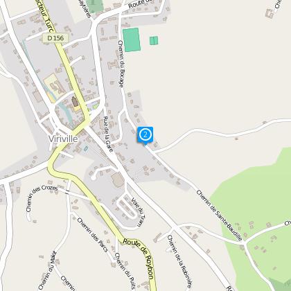
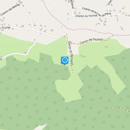
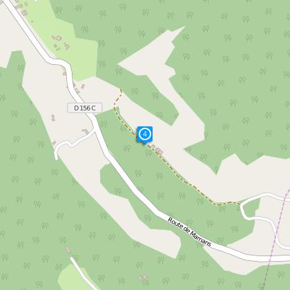
Steps
Cirkwi brief's
Ratings and reviews
See around
Viriville : Saint Baudille, Les bonnettes
Description
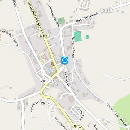
Departure Viriville
Distance : 13.1 km
Duration : 4 h 30
Difference in height :+ 489 m
Level : Difficile
Technical Information
Walking
Difficulty
Hard
Duration
4h30mn
(1d)
Dist.
17 km
Type of practice
Walking
Hard
4h30mn
Mountainbiking
Easy
Riding
Easy
Show more
Altimetric profile
Starting point
38980
Viriville
Lat : 45.31663Lng : 5.2058
Steps
Data author

proposed by
Office de Tourisme Terres de Berlioz
40 place du maquis de Chambaran 38940 ROYBON France
The Cirkwi brief
Discover Viriville's Hidden Heritage: A Hiking Adventure
Embarking on this exquisite trek through Viriville, you're not just taking a walk through nature, but stepping into a realm where the rural and religious history of Chambaran unfolds beneath your feet. Crafted meticulously by the Office de Tourisme Terres de Berlioz, this journey is a deep dive into an area where every step tells a story: from the age-old wine-making traditions to the serene vistas that have cradled these lands through the ages. Imagine wandering through landscapes dotted with historical vineyard cabins and ancient presses that whisper tales of a bygone era. This is not just a hike; it's a time-travel experience into the heart of a land rich with heritage.
Technical Trek Overview
This hike spans a challenging distance of 13.1 kilometers, with an elevation gain that's a testament to its difficult rating. Given the substantial +489 meters of ascent, hikers are advised to prepare for a rigorous journey. From the starting point in Viriville, traversing steep inclines and exploring the depth of the Chambaran's rural beauty will not only test your endurance but also reward you with unparalleled views and historical discoveries. The path's demanding nature makes it an ideal choice for seasoned hikers seeking to explore the heritage-rich terrains of Viriville.
Seasonal Guide and Safety Tips
Whether you're venturing through the blooming landscapes of spring or the crisp air of autumn, Viriville’s trails offer diverse beauties across the seasons. However, preparation is key. Ensure to wear suitable hiking boots for rough terrains and carry water, especially during summer to avoid dehydration. Winter hikes can be magical, yet bear in mind that shorter days mean you should start early to avoid dusk. Always check weather forecasts pre-departure, and it's wise to inform someone of your hiking plan for safety reasons. Remember, each season brings its charm and challenges, so plan accordingly for a safe and enjoyable adventure.
Viriville: A Tapestry of History
Nestled within the rich tapestry of the Chambaran region, Viriville is not just a starting point for a thrilling hike but a beacon of cultural and historical importance. Historians relish its deep-rooted ties to viticulture, evidenced by medieval wine production that signifies the town’s economic past. The walk through here is a passage through time, where every vineyard and ancient relic tells the tale of a community deeply intertwined with the land. Viriville, and its surroundings, are a vivid illustration of how geography and history have sculpted the cultural landscape of this French region.
Climate Insights for Viriville Visits
The climate in Viriville, akin to much of the Chambaran area, is characterized by a temperate distinction. Summers promise warmth and lush vegetation, ideal for hikers who enjoy sunny trails. Conversely, winters can be brisk but equally enchanting with frost-adorned landscapes. The transitional seasons, spring and fall, present a milder and arguably more colorful hiking experience. To fully savor the routes through Viriville and its historic terrains, visiting during late spring through early fall is recommended. These periods ensure pleasant weather conditions, maximizing your explorative ventures and minimizing the risks of inclement weather disruptions.
Automatically generated.
Ratings and reviews
To see around