Alert
Alerts
Type of practice
Walking
Very easy
2h50mn
Mountainbiking
Very easy
Riding
Very easy
Presentation
Description
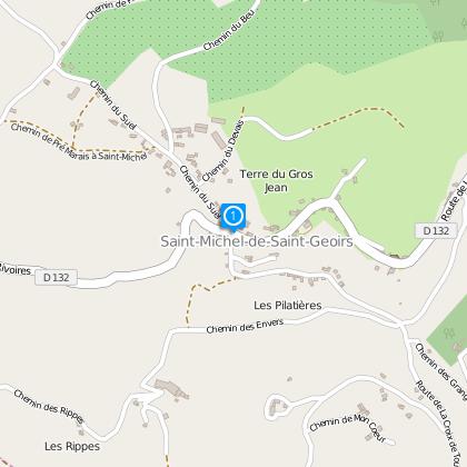
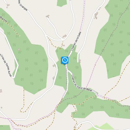
Map
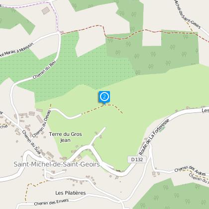
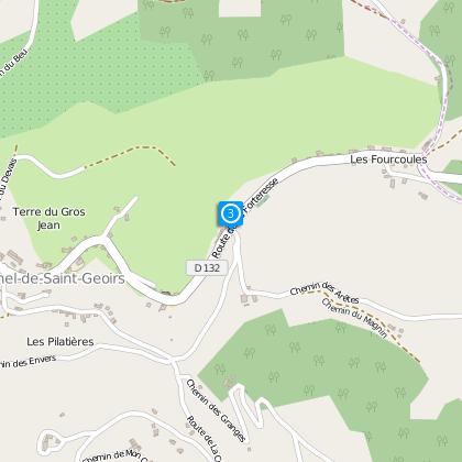
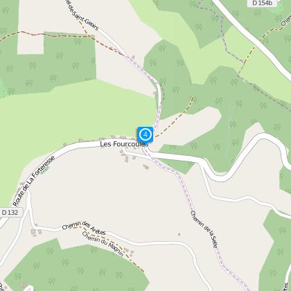
Steps
Cirkwi brief's
Ratings and reviews
See around
St Michel de St Geoirs
Description
Distance : 7,4 km
Duration : 2 h 50
Difference in height : + 306 m
Level : Easy
Technical Information
Walking
Difficulty
Very easy
Duration
2h50mn
(1d)
Dist.
8.3 km
Type of practice
Walking
Very easy
2h50mn
Mountainbiking
Very easy
Riding
Very easy
Show more
Altimetric profile
Starting point
38590
Saint-Michel-de-Saint-Geoirs
Lat : 45.30522Lng : 5.35435
Steps
Data author

proposed by
Office de Tourisme Terres de Berlioz
40 place du maquis de Chambaran 38940 ROYBON France
The Cirkwi brief
Escape to Saint-Michel-de-Saint-Geoirs: A Rambler's Dream
Nestled within the serene hills of the Chambaran, the trek across Saint-Michel-de-Saint-Geoirs is more than just a ramble through nature; it's an immersive journey offering expansive views of the Bièvre Valley and its quaint villages. This idyllic route, crafted by the Office de Tourisme Terres de Berlioz, unveils the rustic charm and tranquil spirit of France's lesser-known trails. Meandering through lush woodlands and rolling hills, each step promises a scenic tapestry that binds the soul to the simple pleasures of walking. It’s an invitation to discover the beauty of the French landscape, narrating tales of nature's silent whispers one stride at a time.
Key Specs of Your Next Adventure
Focusing on the nuts and bolts, the path stretches over 7.4 kilometers, taking approximately 2 hours and 50 minutes to complete, with a positive elevation change totaling between 397-355 meters. The journey begins at an altitude of 520 meters, climbing to its zenith at 721 meters above sea level. This makes the trail accessible for individuals of all fitness levels, classifying it as an easy hike. Such specifications signify an opportunity for both novice and experienced ramblers to engage with the terrain without the intimidation of strenuous climbs, still promising the rewarding vistas that every hiker seeks.
Seasonal Tips for Trail Enthusiasts
As your local guide, my advice for traversing these picturesque landscapes varies with the seasons. In spring, the freshly bloomed flora paints the trail in vibrant colors, though do be wary of slippery paths post-rain. Summers are splendid, yet hydration is key under the sun's embrace. Autumn brings a crispness to the air and a kaleidoscope of leaf colors, ideal for photographers. Winter, while chilly, offers clear views but demands warm apparel and caution on frosty trails. Regardless of when you visit, ensure proper footwear and notify someone of your itinerary for safety.
Riches of the Region: A Historical Overview
Located in the heart of France, Saint-Michel-de-Saint-Geoirs and its surroundings are steeped in a tapestry of history and culture. This area, pivotal during various periods, has been a witness to significant events that shaped the nation. From ancient Roman settlements to pivotal battles in French history, the trail offers more than scenic beauty; it's a journey through time. The land tells stories of past glories and hardships, making every step a tribute to the resilience and spirit of the French people. This region's significance is deeply ingrained not just in its natural beauty, but in the very soil that nourishes it.
Understanding Local Weather Patterns
The climate in Saint-Michel-de-Saint-Geoirs is characterized by its temperate features, with distinct seasonal changes that influence the best times for a visit. Spring presents a mild and often wet climate, blossoming into full splendor towards its end. Summers are pleasantly warm, not overly humid, making it a popular time for hikers. Autumn sees cooler temperatures and a picturesque transformation of the landscape, ideal for those seeking aesthetic beauty. Winter, though colder, generally remains accessible for the avid rambler equipped for the chill. For an optimum experience, late spring through early autumn is recommended, offering a balance of comfortable weather and natural beauty.
Automatically generated.
Ratings and reviews
To see around