Alert
Alerts
Sentier du château de Lagarde
Description
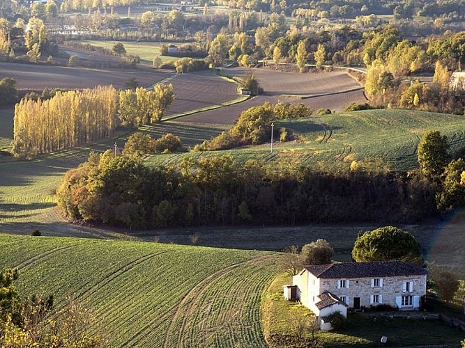
Following rivers, fields, and meadows, and crossing streams, the route will lead hikers from the village of Castelnau-de-Montmiral to the Vère-Grésigne leisure center.
At Pradel Parking, behind the community hall, follow the ramparts for 200m then descend left on a path. Cross the D964 (caution!) then turn left. Walk for 50m, then take the path on the right. Continue straight to a road intersection. Go left (view of Castelnau-de-Montmiral on the left).
Take the forest path on the right that climbs through an oak undergrowth. At the junctions, first with paths, then with a road, continue straight. At the D5, turn right and reach an intersection.
Go right towards Magarié, La Vernière, then immediately left on a path. Pass by agricultural buildings on the left. At a path intersection, turn right. At a fork, go right. In front of a house gate in Lagarde, descend right on the path marked by a white road sign with a red border (close the electric fence carefully) (viewpoint over the Vère valley). Walk along the edge of meadows.
At the trail intersection, leave GR® 46 (red and white marks) which goes left and take the right path. Follow the fences, then descend right in a hairpin turn. Ignore the first path on the left. Hairpin on the second path to the left. The trail becomes a path through a mixed forest of deciduous and coniferous trees.
At the road, turn left. At the intersection, turn right. Pass by Trifyl. Go past it and immediately turn left into the meadow. Enter the leisure center by a path that leads to the lake. Turn right, follow it along. Ignore a path to the left between the lakes. Continue straight along the second lake to reach a chicane. Exit, turn left on the road.
Cross the D964 (caution!) and continue straight on a path. At the road, turn left then immediately right on a path. At the next road, turn left again and immediately right on a path. At Lapeyre, follow a path to the left that becomes a road; arrive at an intersection.
Turn right (GR® 46). At the intersection with the D4, climb straight ahead on a grassy path, then turn right to return to Castelnau-de-Montmiral.
Technical Information
Altimetric profile
Starting point
Additional information
Is in the midst of the park
The national park is an unrestricted natural area but subjected to regulations which must be known by all visitors.
Labellisé FFRandonnée® Tarn
Cet itinéraire est labellisé FFRandonnée®. Il fait partie du réseau tarnais de chemins validé et reconnu par la Fédération Française de la Randonnée et les partenaires du Tarn comme de qualité supérieure.
Advised parking
Parking du Pradel, behind the Salle des Fêtes (at the top of the village of Castelnau)
Access
23 km south of Cordes sur Ciel via the D922, then from Cahuzac sur Vère continue on the D115A, and at the junction, take the D15.12 km north of Gaillac via the D964, then the D15.
Arrival
Same place as the start
Ambiance
The hiking trail begins at the foot of Castelnau-de-Montmiral, whose name derives from "Castelnou" meaning new castle and "mon mirailh" meaning a mount. The village stands on a promontory projecting from the chain of hills along the left bank of the Vère. This position, allowing surveillance of both the upstream and downstream parts of a large portion of the river basin, was perfectly suited for a castle and village in the Middle Ages. Following rivers, fields, and meadows, and crossing streams, the route will lead hikers to the Vère-Grésigne leisure center.
Departure
Pradel Parking, Castelnau de Montmiral
Data author
