Alert
Alerts
Chemin de Gradille
Description
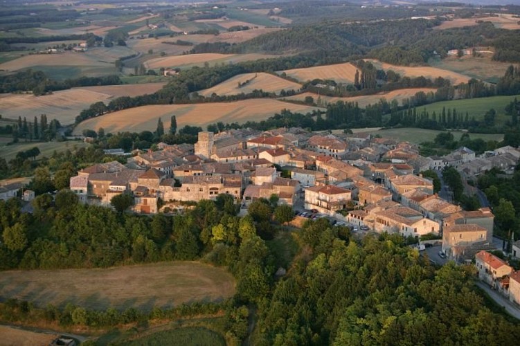
The Gradille Path passes through landscapes of woods (downy oaks and maples) and vineyard slopes. It offers superb panoramic views of the bastide of Castelnau-de-Montmiral: this hike showcases the beauty of the Gaillac region in a single itinerary.
Starting from the cross, take the road towards Saint-Jérôme, passing by the agricultural building. At the road junction, turn left and continue for 650 meters.
Turn right onto a path. Walk along the edge of the fields, then descend into a wooded area. Emerge onto a road; take it to the right. Pass by Labot and continue straight, skirting vineyards. At Mas de Journès, descend to the left for about 100 meters then, before a bend, take the grassy path to the right. Cross the Tescou stream.
Leave a path on the right and, about 15 meters further, take the earthen steps on the right. Climb along the left side of the field, then enter another wooded area. The path continues straight out of the woods and emerges onto a road.
Turn sharply and take a path through fields and vineyards (stay on the path near Palis). At a road, descend to the right. At the next intersection, ascend to the right on a road for about 500 meters. Turn left onto a gravel path towards Pommier-Long and reach a path intersection.
Leave Pommier-Long to the left and continue straight on a dirt path towards the woods of Gradille. Reach a crossroads. The Gradille Chapel is to the left.
Continue straight under the pine trees. Walk through the undergrowth and descend along a furrow. Cross a small bridge over the Tescou, then cross a road and continue straight ahead.
Turn right, crossing a ditch. Climb straight, skirting a field (beware of the beehives to the right of the path). At Marevaysse, circle around a house on the left, then go right and right again. At a road, under the trees, turn left until an intersection. Ascend with a sharp left turn.
In front of a house, take a gravel path to the right. Continue straight on this path to return to the starting point
Technical Information
Altimetric profile
Starting point
Additional information
Advice
In wet weather, the route can be muddy and rutted in the Bois de Gradille.
Is in the midst of the park
The national park is an unrestricted natural area but subjected to regulations which must be known by all visitors.
Labellisé FFRandonnée® Tarn
Cet itinéraire est labellisé FFRandonnée®. Il fait partie du réseau tarnais de chemins validé et reconnu par la Fédération Française de la Randonnée et les partenaires du Tarn comme de qualité supérieure.
Advised parking
At the St-Jérôme cross
Access
Access by car to the starting point: from the place called Colombier (southeast of Castelnau-de-Montmiral via the D964), take the D4 towards Gaillac for 400 meters, then the D5 towards Les Barrières for 1.5 km. The Croix de Saint-Jérôme is located on the left side of the road.
Arrival
Same place as the start
Ambiance
During your walk, you can admire the panoramic view of Castelnau-de-Montmiral, the Gradille Chapel dating back to the 11th century, and the small bridge that connects Saint-Jérôme to Gradille.
Departure
Parking at Croix de Saint-Jérôme, Castelnau de Montmiral
Data author
