L'Abbaye n°14
Description
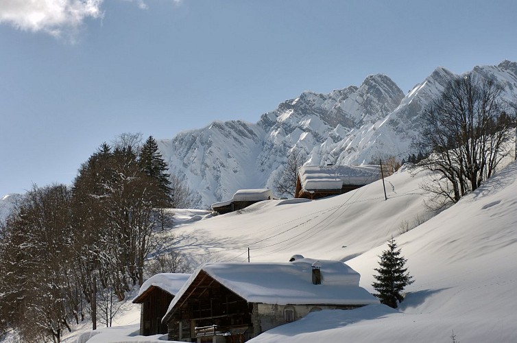
Short walk from La Giettaz to admire this beautiful village from above.
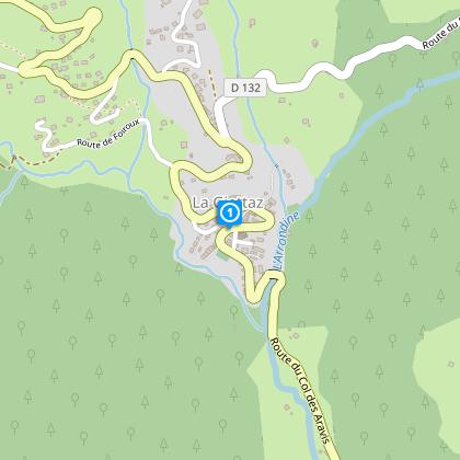
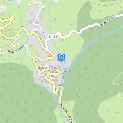
From the village square, go up the alley in front of the Tourist Office and cross the RD909. Continue towards the Abbey then climb to the Chapelle des Nants. After the Chapel, go up towards the RD132, cross it carefully and continue the route uphill towards Les Puginières. Des Puginières, descend to the village via the Pont Noir and the Chapelle des Nants.
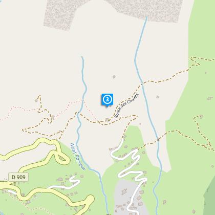
ALTERNATIVE: L'Oratoire des Clapières: From the Chapelle des Nants, go up towards the RD 132, cross it carefully and continue the route uphill on the right to join the Chemin du Fardellet. Arrived on this path, turn left towards Pétaz. From this crossroads, turn right towards the Bois de Fouestarle then turn left to cross the field and reach the Oratoire des Clapières. The return to the village of La Giettaz takes the same route to Pétaz. From this crossroads, descend by the Puginières, the Pont Noir and the Chapelle des Nants (duration: 1h45; distance: 4.1 km).
TO KNOW :
The Oratoire des Clapières is the oldest oratory in Val d'Arly. During the revolution, it was hidden under a heap of wood and branches in order to escape the order of destruction of the small oratories. Note that "Clapières" designates stony ground, which manifests itself in the construction material of the oratory.
Technical informations
2 km
|
max. 1402 m
min. 1090 m
140 m
140 m
| |||
Styles : MountainForest | ||||
Altimetric profile
Starting point
Steps
Points of interest
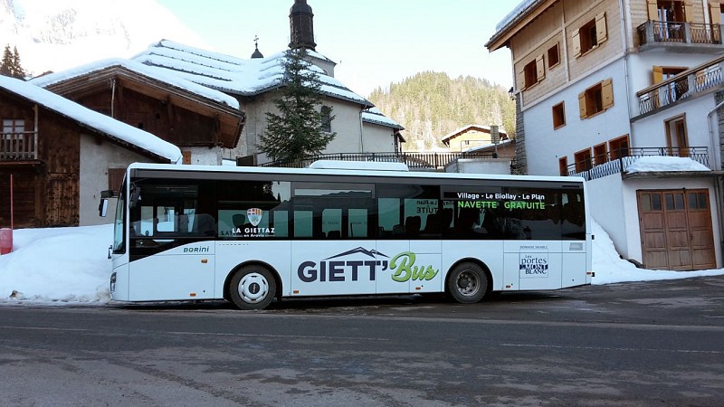
Shuttle Bus
The free shuttle service named Giett’Bus links your accomodation to the bottom of the ski slopes of the Portes du Mont-Blanc ski area. Let yourself be transported !
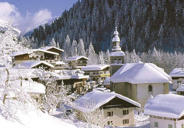
La Giettaz church
The church of La Giettaz, dedicated to Saint Pierre-aux-Liens, was rebuilt in the middle of the 19th century to replace the medieval building. Its bulbous bell tower and its furniture make it a fine example of late Savoyard Baroque.The first church in the village was built at the very end of the 14th century. Imagine, before this construction, the Giettois went to mass, risking their lives in winter, in Flumet for the inhabitants of the village, and in Megève for the inhabitants of the hamlet of Plan! If the exterior is admirable by the presence of the majestic onion bell tower with two lanterns, the interior of the vast building derives its originality from its Greek cross plan: this choice allowed the construction of a central dome, which was decorated with frescoes. in 1848. Raise your eyes to the sky: restored in the spring of 1999, their colors await your eyes! In 1732, a sculpted altarpiece was installed, paid for by the Giettois who had emigrated to Paris. The current major altarpiece, from 1849, partially reuses this old decor (the pale green part with the twisted columns), so it retains the vitality born of the Baroque spirit.
Museum - A la Rencontre du Passé
Display of traditional Savoie costumes, a woodwork workshop and a snow themed exhibition: skis, sledges, bob sleighs. Possibility of visit during village tour on Friday mornings.Located in an old house in the center of the village, this museum aims to safeguard and to make known all that constituted the life of our ancestors.
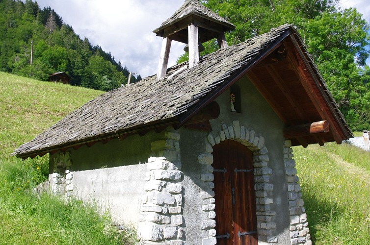
Chapelle des Nants
Little chapel located at the place known as L'Abbaye and which is part of the Oratory and Cross itinerary.The chapel was probably the first place of public worship in La Giettaz, at the beginning of the 11th century. The Benedictine monks came from Megève to the place known as L'Abbaye in the summer, which meant that they needed a chapel close by. It was rebuilt in the 17th century and given the name of the Annunciation. During the Revolution, it suffered much damage : its bell tower was destroyed and its bell requisitioned to make canons. Neither was it spared by the avalanches of 1843, 1847 and 1914. In 1927 it was restored but was again swept away by an avalanche of 1978 which came down from Les Verres and La Pare (at the summit of the Aravis mountains). It was rebuilt on a smaller scale in 1981 and 1982, further to the east, away from the risk of avalanches. The Virgin of the Anunciation was sculpted by a local from La Giettaz, with the inscription "Me Voici".
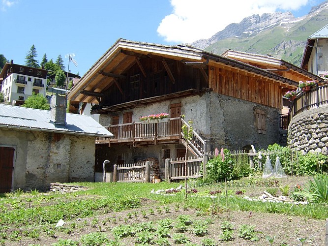
"La Gardette" Farm
On-site production and sale of Reblochon, Tomme and Raclette cheeses. Visits by reservation on winter from 5pm (milking). Credit card payment.
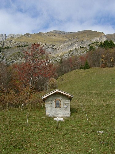
Oratoire des Clapières
The Oratoire des Clapières is the only wayside cross to have escaped the destruction of the Revolution : it is the oldest in Val d’Arly. Situated on the Route des Chalets, its name comes from “clapier” meaning pile of stone.
Date and time
- From 15/12/2024 to 15/04/2025
- From 15/12/2025 to 15/04/2026
Additional information
Location complements
Accessibility possible via the Giett'Bus (Le Village stop).
Opening hours at the Tourist Office.
Departure from the trail at the Tourist Office.
Topo guides and map references
Topo guides references :
Map of the SNOWSHOE - SKI HIKING routes in Val d'Arly on sale for €2.50 in the Val d'Arly tourist offices.
Map references :
Map of the SNOWSHOE - SKI HIKING routes in Val d'Arly on sale for €2.50 in the Val d'Arly tourist offices.
Type of land
Non-groomed itinerary
Contact
Phone : 04 79 32 91 90
Email : sentiers@valdarly-montblanc.com
Open period
From 15/12 to 15/04.
Subject to snow conditions.
Updated by
Office de Tourisme du Val d'Arly - 23/02/2024
www.valdarly-montblanc.com
Report a problem
