The Mont de Vorès FFC n ° 54
Description
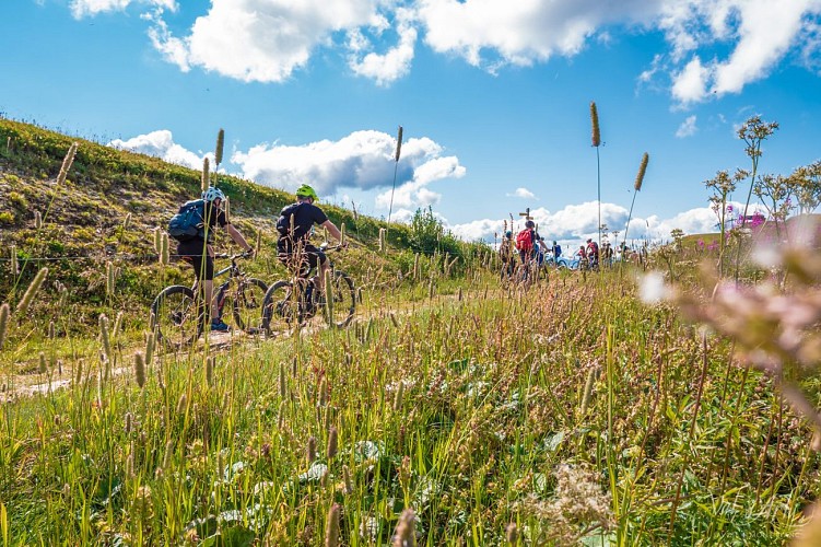
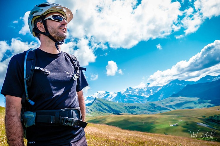
Course on the crests of Notre Dame de Bellecombe, where you can admire magnificent views.
Above 2000 meters above sea level and facing Mont-Blanc, welcome to the ridges of Vorès. From the Planay car park, briefly follow the departmental road and, at the ski lift garage, turn left towards Les Combes. Take the track to the right then the road departmental to reach the hamlet of Frasses. Turn left towards Lac du Guï. At the small lake, turn right onto the track that leads to Crête de Douce: steep climb. The ridge runs between Val d´Arly and Beaufortain and joins the Col de la Limace. Take the descent to Plan Désert on the left: steep passage and vigilance at the Bouza intersection. When you get to the lake, go around it on the left and take the "single" player to Stomu. Continue on the track towards Chardonnet then Planay.
Technical informations
17 km
|
max. 2060 m
min. 1308 m
750 m
750 m
| |||
Altimetric profile
Starting point
Points of interest
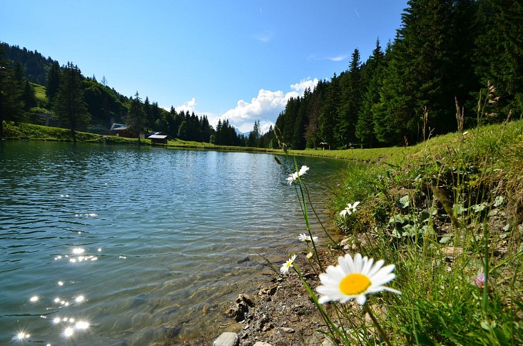
Plan Dessert Lake
The Plan Dessert lake is an isolated site, 4 km from the village centre, which is a favourite with anglers who enjoy fishing mountain lakes. 2 competitions are organised each summer. Several walking trails from hereThe Plan Dessert lake is accessible to pedestrians and vehicles from spring to autumn, only when the crossing gate is up.
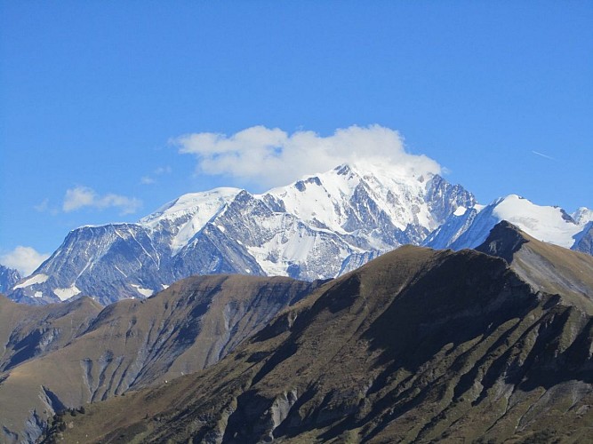
Mont Vorès
The Mont de Vorès is the highest point of the ridge stretching from the Col des Saisies to the Col de Very, located in the commune of Notre Dame de Bellecombe. A place for quiet hikes for all seasons, offering a magnificent view of Mont Blanc.
Date and time
- From 15/06/2024 to 15/10/2024
- From 15/06/2025 to 15/10/2025
Additional information
Topo guides and map references
Map references :
Sports VTT map on sale in the Uffizi at € 4 OR Espace Diamant MTB card on sale in the tourism office at € 2.50.
Contact
Phone : 04 79 31 61 40
Email :
sentiers@valdarly-montblanc.com
info@notredamedebellecombe.com
Website : www.notredamedebellecombe.com
Facebook : www.facebook.com/notredamedebellecombetourisme
Open period
From 15/06 to 15/10.
Updated by
Office de Tourisme du Val d'Arly - 05/02/2024
www.valdarly-montblanc.com
Report a problem
