Alert
Alerts
Sentier des Pigeonniers
Description
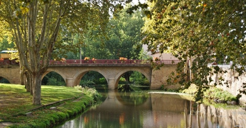
Between hillsides and valley, this star-shaped route takes you on a stroll around Soual and its river, the Sor. This tributary of the Agout contributes to feeding the famous Canal du Midi, listed as a World Heritage Site.
Download the hiking sheet in PDF
On the first slopes of Lauragais, the river has cut into a modest hill: the Pech du Roy, which dominates the valley. There is an interesting view of the surroundings which allows you to locate the Montagne Noire, where the Sor has its source.
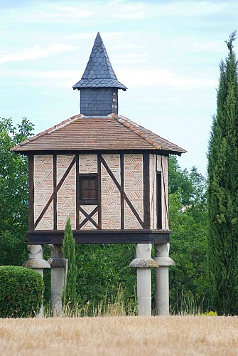
All along the route, you will come across several dovecotes,
outward signs of wealth for their owners in the Middle Ages and pretty amenities for the landscape. After this beautiful hike which will have allowed you to burn calories, stop at a pastry shop in Soual to taste the famous feuillat. This delicious cake is a variation of poumpet, made with eggs, flour, sugar, honey, lemon zest, and... goose fat!
Technical Information
Altimetric profile
Starting point
Additional information
Updated by
Tarn Attractivité - 03/06/2026
www.tourisme-tarn.com
Report a problem
Contact
Phone : 08 00 74 65 81
Website : http://www.lepaysdecocagne.fr
Location complements
Departure : Soual town hall parking lot.
Arrival : Same place as the starting point.
Road access : By the N126 coming from Castres or Lavaur. Take the exit towards the town centre of Soual at the roundabout.
Parking recommended : Parking near Soual town hall, on the river bank. .
Guidebook with maps/step-by-step
1. Cross the RD and go up opposite. In front of a cross, follow a grassy path on the left. Nice view of the valley and the Montagne Noire. By a hook on the right, get back on the path and go down to a tarmac road. Turn right then just before the RD, turn right and go around a warehouse. Turn left again, cross the RD. Go up the tarmac path.
2. Go down a dirt road, then follow a gravel track for 1 km. Continue on a road, cross the Sor then the D626.
3. Follow the Chemin de la Prade for 1 km. Cross the old railway line then on the left, follow a grassy path. See the dovecote on the right. Go along workshops, and follow a tarmac section. At the RD, turn right and right again towards l'Estap. Follow the track for 1.5 km.
4. After a slight hill, leave the road to take a path in the fields on the right. Follow the path along the hedge, then turn slightly left on the same path. Continue straight on until you reach the Estap farm, where you take the tarmac road on the left.
5. Continue straight ahead on the green path, cross the D621 and take a gravel path. At the crossroads with the Sainte-Gemme road, turn right.
6. Continue on the path for 1.5 km until you reach the D621. Cross the road and follow the tree-lined path (old railway line). After 50 m, turn left onto a path between hedges. Continue on a small road, then onto the “chemin de la Mouline”.
7. Cross the street and go along a stone house on a gravel path. Cross a market garden area, then follow the street on the right (rue du Valat viel). Cross the main street towards the MJC and turn right onto the rue des jardins. Turn left in front of the school, and left again on Rue des Vieux Logis to return to the starting point.
Data author
