Alert
Alerts
Oenorando® Vignes & clochers


Description
The starting point is at the foot of the Lislois hills, winding through the vineyards and highlighting the local heritage: you’ll encounter the Montaigut Chapel, which offers a beautiful panorama, the charming hamlet of Saint-Salvy de Coutens, and the Châ
The cultivation of vineyards, although not predominant in agricultural operations before the 19th century, has shaped the architecture of the Gaillac region: castels and mansions reflect the social status of wine producers and merchants. In hamlets and farms, you’ll find wine presses, fermentation vats (“tinal”), cellars, dovecotes, vine huts, sheds for vehicles and tools, and barns for draft animals. Additionally, infrastructure for transporting barrels (ports, quays, fords, roads) has shaped the landscape since Roman times.
Dovecotes have dotted the vineyards since the Renaissance. Their elegant architecture showcased the owner’s wealth. Pigeons were raised for their meat and their droppings (the precious "colombine"), the only fertilizer allowed to enrich the vines without altering the taste of the wine.
For modest farms, the dovecote was simply holes and a flight platform integrated into one of the farm buildings.
During the Revolution, many dovecotes, symbols of nobility, were destroyed. But in the 19th century, with the significant development of Gaillac wines, their characteristic silhouettes reappeared in the vineyards.
Land of bastides and vineyards, rugby and gastronomy, dynamic and warm, full of conviviality and joy of life, the Gaillac region is a must-visit tourist destination where wines play a prominent role.
Technical Information
Altimetric profile
Starting point
Additional information
Updated by
Tarn Attractivité - 03/06/2026
www.tourisme-tarn.com
Report a problem
Contact
Phone : 08 05 40 08 28
Website : https://www.la-toscane-occitane.com/
Location complements
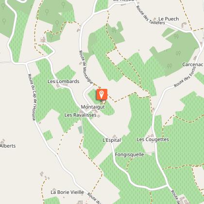
Departure : Domaine de Borie Vieille, Lisle sur Tarn.
Arrival : Same place as the start.
Road access : 10 km from Gaillac.
Take the scenic Chemin de Toulze (D18), passing close to various wineries.
Alternatively, from the D988 (Gaillac towards Lisle-sur-Tarn), at the Intermarché roundabout, turn right towards Domaine de la Borie Vieille via Chemin des Fortis.
4.5 km from the center of Lisle-sur-Tarn.
At the Intermarché roundabout, take the D988, go straight, and follow the signs to Domaine de la Borie Vieille via Chemin des Fortis..
Parking recommended : Hikers' car park at Domaine de la Borie-Vieille. .
Public transport : By bus: route 702 (Albi - Lisle sur Tarn - St Sulpice) - Les Robertes stop 3km from the starting point.
More information on liO (French only)
or line 1 and 2 of the Agglo Gailac -Graulhet interurban buses - Les Robertes stop 3km from the departure point.
More information on the Gaillac-Graulhet interurban bus routes (French only)
By train: SNCF TER Toulouse-Albi or Toulouse-Aurillac line - stop at Lisle sur Tarn station, 4km from the departure point.
More information on SNCF. .
Guidebook with maps/step-by-step
1. At the exit of the Domaine de Borie Vieille parking lot, cross the road and turn left along the vineyard. After 200m, turn onto the path that leads to the hamlet of Borie Vieille. Pass to the right of the buildings, cross the small road, and continue past the calvary, taking the path that climbs to Montégut. Follow the cemetery to the intersection of the GR® 46, the Toscane Lisloise, and the Coteaux de Lisle. Access Notre Dame-de-Montaigut Church (400m round trip) by crossing the hamlet and climbing the small path leading to the church.
2. Descend to the left via the path bordering the vineyards. At the small road, turn left. At the fork, take the right path and climb to Les Alberts. Go around the houses on the left and take the small path through the woods.
3. At the intersection, turn left, passing La Garenne and Belle Viste. Continue on the road. At the Croix de Mathieu, take the path on the right leading to the Tumulus de Saint-Salvy. Access the tumulus on the right. A little further, access Saint-Salvy de Coutens Church (400m round trip).
4. Continue to the left below the embankment. Follow the path. Pass along the fortified house of Cassagnols to rejoin Chemin Toulze (D18).
5. Follow the road to the left for 150m. At the first intersection, take the path on the left that climbs towards the pigeonnier des Cassagnols. At the end of the path, cross the small road via a right-left maneuver to take a path that you leave a bit further to the right to continue through the vineyards to the hamlet of Borie Vieille. Return to the starting point via the same path.
Data author
