Alert
Alerts
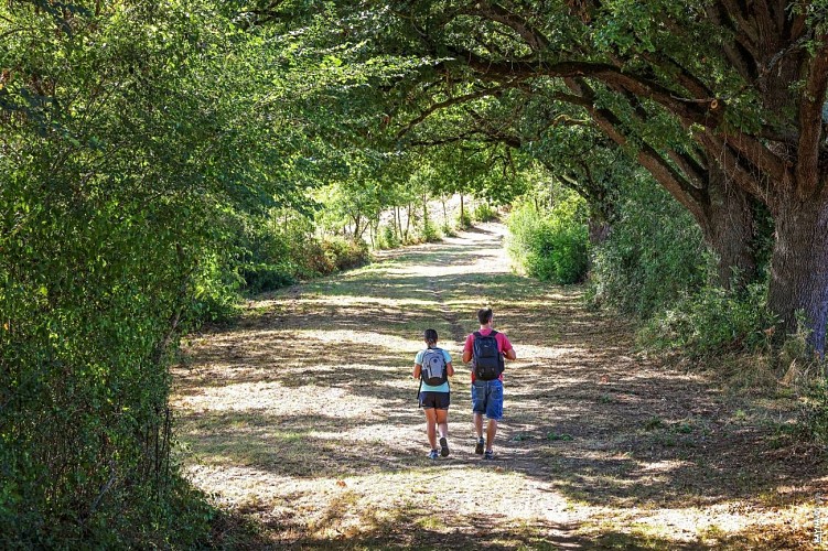
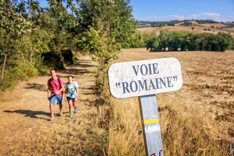
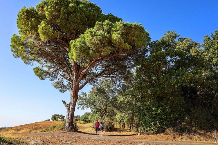
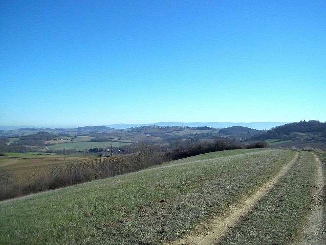
La voie romaine
Description
Between Lavaur and Puylaurens, the Roman road runs along the ridge of the hills, offering a scenic route through the land of 'Cocagne', the land of pastel.
Download the hiking guide in PDF format.
Cocagne: the blue gold of the Land of Cocagne
A yellow-flowered cruciferous plant, pastel owes its fame to a process used to produce a blue dye. This name is closely linked to that of 'cocagne', which, since Rabelais, has evoked dreams. The Land of Cocagne, a place of abundance, as the Académie Française says… In the Middle Ages, in the south of Tarn, pastel was cultivated, harvested, and transformed into 'cocagnes', then into 'agranats' solely for the purpose of dyeing. This patient and meticulous process, taking three weeks, involved shaping the drained, homogeneous pastel pulp into a roughly spherical ball, varying in size from an apple to a small melon. This ball is the 'coque' or cocagne. No miraculous dream here! Although… the cocagne became an 'agranat', the finished form of the dyeing material, which producers sold for a fortune. In 1560, the arrival of indigo from the East marked the end of this 'golden age of pastel', a true Cocagne for the vast Toulouse region.
In the Land of Cocagne
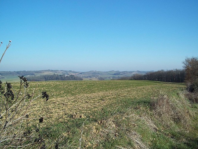
The ochre and beige hues of the plowed fields introduce a tapestry of corn, wheat, and sunflower fields. From hills to gentle valleys, the path rises, offering wide vistas of the rolling lines of the Montagne Noire or the pristine peaks of the Pyrenees. Nearby, characterful farms nestle against the hillsides—here, a dovecote or a chapel adorned with old cypress trees; there, a château crowned by ancient oaks. Along the clay paths dotted with orchids, clusters of broom, juniper, or a few holm oaks create a Mediterranean atmosphere. Sometimes, just a few steps away, a small limestone plateau with fragrant meadows basks in the sun...
Sturdy roads
The Roman road network of Gaul, begun under Agrippa and continued until the 1950s under Claudius, was meticulously maintained and periodically restored. Military mobility and economic development required these roads as much as the waterways and maritime routes. Third-century road documents provide a theoretical layout. Today, well-preserved sections of these routes, existing bridges, inscribed milestones, and more allow us to catalog much of what was once an extraordinary road network. These Roman roads continue to fascinate. Modern hikers follow in the footsteps of those who, over 2,000 years, have written history (and stories) along these paths. They're built tough! Not only do they spark the imagination, but they also demonstrate solid road construction: a meter-thick layer of pebbles, stones, and compacted earth beneath a domed paving designed to drain rainwater.
Technical Information
Altimetric profile
Starting point
Additional information
Updated by
Tarn Attractivité - 03/06/2026
www.tourisme-tarn.com
Report a problem
Location complements
Departure : Puylaurens : place du Ravelin.
Arrival : Lavaur pont Saint-Roch.
Road access : Puylaurens, 22 km west of Castres via the N 126; Lavaur, 40 km west of Castres via the D 112..
Parking recommended : • Puylaurens (starting point): Place du Ravelin, in the center of the village (at the intersection of the Revel road) • Parking .
Public transport : Start of the hike in Puylaurens:
By bus : liO Autocar, line 760.
From Castres or Toulouse.
More information on lio-occitanie.
Start of the hike in Lavaur:
By bus : liO Autocar:
Lines 705 and 709. From Albi.
Line 710. From Gaillac.
Line 765. From Saint-Sulpice-la-Pointe or Castres.
Line 376. From Toulouse.
More information on lio-occitanie.
By train: SNCF station in Lavaur.
From Toulouse, Castres, Mazamet.
More information on SNCF. .
Tips
Mountain Biking Route
Contact
Phone : 08 00 74 65 81
Website : http://www.lepaysdecocagne.fr
Guidebook with maps/step-by-step
1. From the main avenue, go up Porte-Neuve Street towards the town hall and the tourist office. At the top, turn left onto Foulimou Street, cross the D 84, and continue towards La Gravière. 200 meters after the water tower, go down the path on the right. At the bottom of the valley, before reaching the D 84, turn left. At the ruined cottage, make a right-left turn, then follow the stream straight ahead.
2. At the path crossing, turn right. Cross the stream. Climb the steep slope ahead, then turn left. Follow the edge of the field. Take the paved road to the left, then, 120 meters later, the path in front. At the end of the pond, turn right. At the crossroads at the top of the hill, go left. In front of Surinam, cross the road. When you reach the paved road, go right. Near the En Banquet farm, take the path down to the right. In front of La Peyre, continue straight.
3. At the crossroads, take the so-called Roman road to the left. Continue straight. Cross the road towards La Garenne.
4. Cross the road towards Bolo-Guiraud. Keep going straight. On the D 40, turn left; 100 meters later, turn right towards La Trivalle.
5. Cross the road. In front of La Métairie-Neuve, turn left onto the path. Cross the D 43, then the next road.
6. 50 meters before the reservoir, go down to the left between two fields (! > private property: be respectful!) towards a chapel at the edge of the woods. Continue to the left. Near Rial, make a left-right turn. In front of Oustalou, go right.
7. On the D 12, go right; 20 meters further, turn left towards Marzens. On the D 48, turn left, then right at the corner of the town hall towards the church. At the top of the hill, take the path to the right.
8. At the corner of two fields, turn right, then after a left turn, arrive at Preignan Castle (! > private property: be respectful!). In front of the castle, cross towards the path opposite. At Anglès-Haut, turn right onto the road. Continue straight.
9. 30 meters after the Fourestête junction, take the path on the right. Cross the D 112. In front of En-Genblanc, turn left. Continue straight. Go up Port Street. Continue along Dame-Guiraude and Villeneuve Streets. Leave Saint-Alain Cathedral to the right, follow the Bishop's Garden, then at its end, go down the alley. Climb up Mégisserie Street to Saint-Roch Bridge
Data author
