Alert
Alerts
Grand Avaris hiking trail
Description
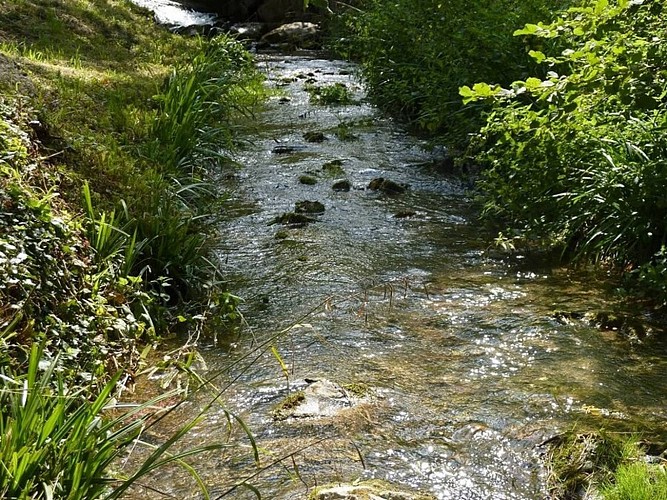
Discover the village of Saint-Amancet and the surrounding mountains of the Montagne Noire by walking this 12km trail through the forest. Avaris is the name of the stream flooding in the valley. Saint-Amancet is part of the Parc Naturel Régional du Haut-La
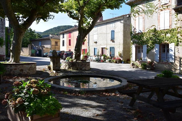
This route takes you around the Avaris, a small stream of the Sor which springs up on the Montagne Noire. The village of Saint-Amancet has a beautiful square with a fountain and huge plane trees. From here, the route takes you through the forest overlooking the Avaris valley and the Saint-Amancet quarry.
Technical Information
Altimetric profile
Starting point
Additional information
Updated by
Tarn Attractivité - 03/06/2026
www.tourisme-tarn.com
Report a problem
Location complements
Departure : Hiker car park - Saint-Amancet.
Arrival : Same as departure.
Road access : Saint-Amancet can be reached from Castres or Revel via D85, 4 km before Sorèze when coming from Castres..
Parking recommended : Hikers car park .
Public transport : Bus liO Tarn, line 761 Castres-Revel: stop Saint-Amancet. .
Tips
Respect the environment around the trail.
Do not pick flowers.
Do not disturb wildlife and herds.
Be careful on hunting days.
Contact
Phone : 05 63 74 16 28
Website : https://www.auxsourcesducanaldumidi.com
Guidebook with maps/step-by-step
1. Turn left. Look out for the former public oven on the right and walk past the church. Next, cross go through the two squares where you will find refreshing fountains (toilets in front of the town hall). After the second square, take ruelle de la Canèla Vièlha, then turn right. You will see a stone bridge over a diversion of the Avaris on your left.
2. Turn left up the tarred road.
3. At a bend leave the road for a path on the left, closed by a chain.
4. Next crossroad, turn completely right to continue along the track.
5. When you reach the plateau, turn right and enjoy the view over the Lauragais plain.
6. Turn right and follow the path that used to lead to a former farmhouse Métairie Haute, which no longer exists. Watch out for the markings.
7. After around 1,500 m, the final climb of the route awaits you, then head down towards the Avaris stream.
8. Cross the old stone bridge.
9. On your right, a narrow path leads to a panoramic view over Dourgne slate quarries.
10. Turn right at "des chasseurs" crossroads and follow the gravel path until you reach the tarmac road and then the car park.
Data author
