Alert
Alerts
Type of practice
Walking
Easy
2h30mn
Presentation
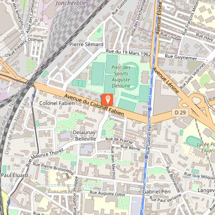
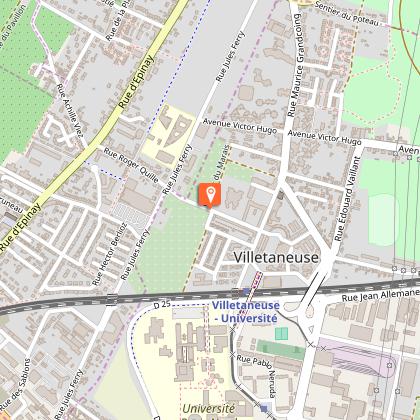
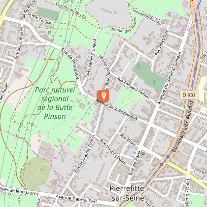
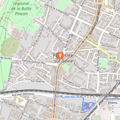
Map
Steps
Cirkwi brief's
Ratings and reviews
See around
PR 6 - The path of metamorphoses
The Cirkwi brief
Discover Urban Transformations on the PR 6 Path
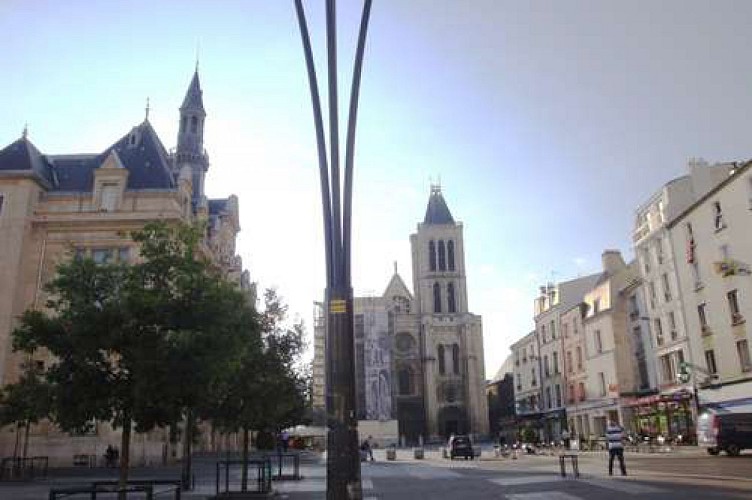
Embark on a journey through time and space with the PR 6 trail, curated by FFRandonnee Seine-Saint-Denis. This route invites you to witness the evolving urban landscape, marrying architectural heritage with a rich tapestry of green spaces. From quaint urban squares to sprawling regional parks and historic orchards, experience a unique blend of nature and city life. Feel the rhythm of transformation under your feet and let the path lead you through a narrative of past, present, and the hopeful future. It’s more than just a walk; it's an exploration of metamorphosis.
Brief Technical Overview of PR 6
The PR 6 pathway stretches for 9.5 km through changing altitudes, reaching a maximum of 79 meters and a minimum of 29 meters, with a total positive elevation change of 50 meters. This moderate hike is accessible to most, offering a blend of urban and natural terrains. The diverse altitudes and terrains featured in this route make for an engaging walking experience, showcasing both the urbanization and the preservation of green spaces amidst the cityscape. Overall, the technical aspects reflect a well-balanced pathway suitable for a broad range of walkers.
Seasonal Tips for PR 6 Explorers
To fully enjoy the PR 6 journey, consider the seasons. Spring brings blossoming gardens and temperate weather, perfect for witnessing the renewal of urban and natural landscapes. Summer offers extended daylight for leisurely exploration, though hydration is key under the sun. Autumn transforms the path with fiery hues and cooler temperatures, ideal for comfortable treks. Winter, while chillier, presents a stark beauty, albeit with shorter days - so start early. Regardless of the season, sturdy footwear and weather-appropriate clothing are essential for a safe and enjoyable experience.
Exploring the Heart of Seine-Saint-Denis
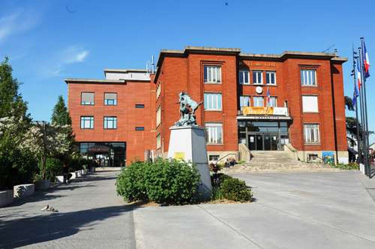
Seated in the vibrant Seine-Saint-Denis region, the PR 6 path explores a territory rich in cultural and historical significance. This area, often overshadowed by its proximity to Paris, boasts a unique identity shaped by diverse communities and industrial heritage. The evolution from agricultural lands to urban expanses tells a tale of resilience and adaptation. By walking the PR 6, one treads on centuries of history, witnessing the transformative power of human endeavor and nature’s enduring beauty. It’s a testament to the region's dynamic spirit and integral role in the greater Parisian tapestry.
Climate Insights for the Ideal Visit
Seine-Saint-Denis Climate Guide
Situated in the Île-de-France region, Seine-Saint-Denis experiences a temperate oceanic climate. This means mild temperatures prevail year-round, with occasional rain to sustain the lush greenery along the PR 6 path. The best times for exploration are late spring through early summer (May to July) and early autumn (September to October), offering balanced conditions for walking and enjoying the outdoors. Winter can be brisk and less accommodating for lengthy treks, while mid-summer, though pleasant, may require precaution against heat. Weather-wise, timing your visit during these recommended periods ensures a comfortable and picturesque experience.
Embark on a journey through time and space with the PR 6 trail, curated by FFRandonnee Seine-Saint-Denis. This route invites you to witness the evolving urban landscape, marrying architectural heritage with a rich tapestry of green spaces. From quaint urban squares to sprawling regional parks and historic orchards, experience a unique blend of nature and city life. Feel the rhythm of transformation under your feet and let the path lead you through a narrative of past, present, and the hopeful future. It’s more than just a walk; it's an exploration of metamorphosis.
Brief Technical Overview of PR 6
The PR 6 pathway stretches for 9.5 km through changing altitudes, reaching a maximum of 79 meters and a minimum of 29 meters, with a total positive elevation change of 50 meters. This moderate hike is accessible to most, offering a blend of urban and natural terrains. The diverse altitudes and terrains featured in this route make for an engaging walking experience, showcasing both the urbanization and the preservation of green spaces amidst the cityscape. Overall, the technical aspects reflect a well-balanced pathway suitable for a broad range of walkers.
Seasonal Tips for PR 6 Explorers
To fully enjoy the PR 6 journey, consider the seasons. Spring brings blossoming gardens and temperate weather, perfect for witnessing the renewal of urban and natural landscapes. Summer offers extended daylight for leisurely exploration, though hydration is key under the sun. Autumn transforms the path with fiery hues and cooler temperatures, ideal for comfortable treks. Winter, while chillier, presents a stark beauty, albeit with shorter days - so start early. Regardless of the season, sturdy footwear and weather-appropriate clothing are essential for a safe and enjoyable experience.
Exploring the Heart of Seine-Saint-Denis
Seated in the vibrant Seine-Saint-Denis region, the PR 6 path explores a territory rich in cultural and historical significance. This area, often overshadowed by its proximity to Paris, boasts a unique identity shaped by diverse communities and industrial heritage. The evolution from agricultural lands to urban expanses tells a tale of resilience and adaptation. By walking the PR 6, one treads on centuries of history, witnessing the transformative power of human endeavor and nature’s enduring beauty. It’s a testament to the region's dynamic spirit and integral role in the greater Parisian tapestry.
Climate Insights for the Ideal Visit
Seine-Saint-Denis Climate Guide
Situated in the Île-de-France region, Seine-Saint-Denis experiences a temperate oceanic climate. This means mild temperatures prevail year-round, with occasional rain to sustain the lush greenery along the PR 6 path. The best times for exploration are late spring through early summer (May to July) and early autumn (September to October), offering balanced conditions for walking and enjoying the outdoors. Winter can be brisk and less accommodating for lengthy treks, while mid-summer, though pleasant, may require precaution against heat. Weather-wise, timing your visit during these recommended periods ensures a comfortable and picturesque experience.
Automatically generated.
Technical Information
Walking
Difficulty
Easy
Duration
2h30mn
(1d)
Dist.
9.6 km
Type of practice
Walking
Easy
2h30mn
Show more
Altimetric profile
Starting point
Lat : 48.935816833923Lng : 2.3588774410215
Steps
Data author

proposed by
CDRP 93
1Ter Place des martyrs de la Résistance et de la Déportation 93110 Rosny-sous-Bois France
Ratings and reviews
To see around