Alert
Alerts
PIC DU BURAT PAR LA CABANE DE SALODE
Description
Loop / Patou present.
This well-known summit, which rises to 2154m, is a lovely lookout point over the high peaks of the Central Pyrenees.
Overall, there are no particular difficulties, apart from the length of the hike.
However, the path down the Mail de la Pique narrows on the ridge. As it is little used, it can be poorly marked in places.
Technical Information
Altimetric profile
Starting point
Additional information
Detailed stages
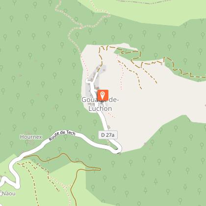
1 - Park at the entrance to the village of Gouaux-de-Luchon (940m).
At the last house, the track climbs up on your right. The twists and turns allow you to progress without too much difficulty.
2 - Go through a gate and then, a little further on, go up into the meadows on the left. Follow the track until you enter a pretty forest of beech and fir trees. The track levels out and you have a pleasant walk through the wood.
At the end of the wood, after a few minutes' walk, you will reach the Salode hut (1561m).
3 - Pass to the right of the hut and continue straight ahead, leaving the path leading up on the left.
Follow the track as it winds up to the pass. When you reach the pass (1860m), you can see the Mouscadé hut on the right.
4 - Continue eastwards on a good footpath with a rising gradient.
At the pastoral zone sign "Estive de Gouaux-de-Luchon. Etang de Dessous" (Dessous pond), continue straight up until you reach a flat area. There is an Orry (former summer pasture) on the right and the Etang de Dessus (2010m) on the left.
Pass to the left of the pond and continue straight on along a narrow path towards the Col d'Esclot d'Aou (2093m).
5 - Continue slightly right to reach the Cigalières ridge, and follow it without difficulty to the summit of Pic de Burat (2154m), marked by a small milestone.
6 - For the return journey, you have a choice of :
- go down the same route ;
- make a loop via the Mail de la Pique (a little-frequented route, the path may be less visible in places).
7 - Descend to the left along the ridge. Initially very wide, the ridge becomes thinner.
Continue to the small pass at the foot of the Pic de Maupas (1894m), either continuing to the summit or skirting it by taking the small path on the left.
8 - Once you reach a flat area at the foot of Mail de la Pique (1754m), either climb to the summit and then descend to the left, or go around to the left.
Continue downhill on the ridge near the Planet hut (1585m), on the edge of the forest.
The path continues to the Plagnette hut (1321m).
9 - Follow the path signposted "Baren - Chemin de Courraou".
At the next junction, take the path leading down to the left.
At the 1st flat spot, continue on the narrow path that descends to the left as far as a large cairn with a fork. Take the hairpin path to the right as far as the junction with the GR86.
10 - Follow it to reach Gouaux-de-Luchon.
Dates
From 2026-05-01T00:00:00 From 2026-11-30T00:00:00
Signage
Yellow
Elevation gain
1350 (High)
Contact
Tel : 05 61 79 21 21
Email : info@pyrenees31.com
Website : https://www.pyrenees31.com/
Start and end town
GOUAUX-DE-LUCHON
Data producer
Contact : HAUTE-GARONNE TOURISME / OFFICE DE TOURISME PYRÉNÉES 31
Phone : 05 61 79 21 21
This information comes from the Haute-Garonne Departmental Tourism Network and is synchronized as part of the partnership between Cirkwi and Haute-Garonne Tourisme.
Data author
