Alert
Alerts
LE COL DES PRADETS AU DÉPART DE LA GARE DE LUCHON

Description
Patou present.
All along the trail, and particularly at the Col des Pradets, there are fine views over the Luchon valley and surrounding peaks.
This route is great training ground for trail runners.
Departure from Luchon station. Most of the route climbs through woodland, with occasional gaps where you can admire the scenery.
Technical Information
Altimetric profile
Starting point
Additional information
Signage
Yellow
Detailed stages
1 - From the Luchon station car park, cross the road to the impasse de la Liberté.
2 - Steep at first, the path levels out slightly afterwards and you climb up into the open, with a beautiful view of Luchon.
3 - After a twenty-minute climb, path no. 61 leads off to your right.
It winds steadily upwards through the woods. On the way up, take advantage of a few gaps in the trees to admire the scenery.
4 - Higher up, you reach the Col de Pradets (1090m). Magnificent views of Luchon and the 3000 Luchonais. Continue along the path towards Cazarilh.
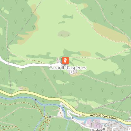
5 - You pass a pigeon farm and then the path descends to Cazarilh (971m).
There is a gate at the first houses. Remember to close it after you have passed through.
Turn left and go through the village.
6 - Before beginning the descent towards Luchon, the sculpture "Le randonneur" (The Hiker) by Françoise Lasvènes invites you to take a contemplative break.
7 - At the first junction, turn left. After a very short climb, the descent resumes into the woods.
8 - At the next junction, turn left following signposting 53 "Luchon Barcugnas".
9 - You're back where you started.
Elevation gain
689 (Medium)
Start and end town
BAGNERES-DE-LUCHON
Contact
Tel : 05 61 79 21 21
Email : info@pyrenees31.com
Website : www.pyrenees31.com
Data producer
Contact : HAUTE-GARONNE TOURISME / OFFICE DE TOURISME PYRÉNÉES 31
Phone : 05 61 79 21 21
This information comes from the Haute-Garonne Departmental Tourism Network and is synchronized as part of the partnership between Cirkwi and Haute-Garonne Tourisme.
Data author
