Alert
Alerts
Hike : Col de la Forclaz pass to Col de l'Aulp pass
Description
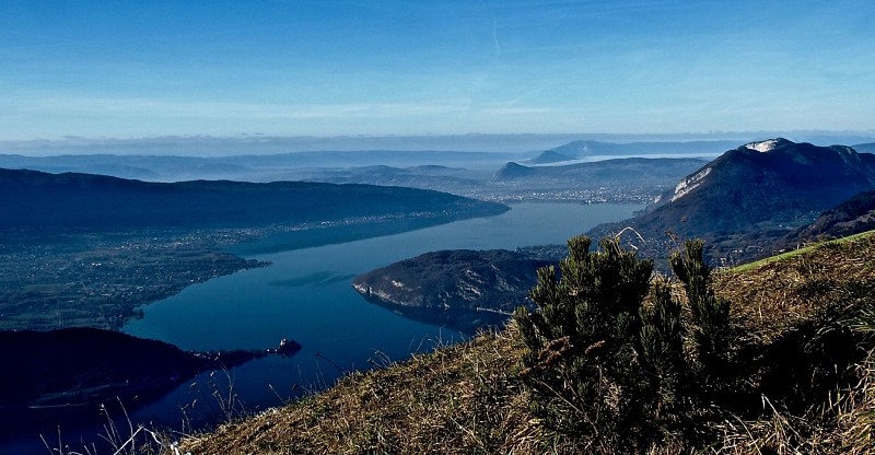
At col de la Forclaz pass, join the paragliding take-off to discover a gorgeous view of lake Annecy.
Technical Information
Altimetric profile
Starting point
Additional information
Updated by
Office de Tourisme des Sources du Lac d'Annecy - 09/06/2026
www.sources-lac-annecy.com
Report a problem
Environments
Lake view
Topo guides and map references
Map references :
IGN Map TOP25 Sources du lac d'Annecy available at the Tourist Office at 19,5€
Open period
All year round daily.
Type of land
Not suitable for strollers
Contact
Phone : 04 50 44 60 24
Email : accueil@sources-lac-annecy.com
Website : http://www.sources-lac-annecy.com
Facebook : https://www.facebook.com/sources.lac.annecy.tourisme/
Guidebook with maps/step-by-step
0/ Carpark Col de la Forclaz
1/ Continue on the path going up behind the take-off area until you reach the Chalet de l'Aulp. Enjoy the view of la Tournette !
2/ Get down via the pass cutting through the road towards the Pré Vérel refuge.
3/ At the carpark, take a right on the path along the ruisseau de Montmin stream, cross RD42 and keep going ont the pass leading you back up to Col de la Forclaz pass.
Animals
Yes
