Alert
Alerts
D - LE PIC DU CÉCIRÉ


Description
Return trip.
The highest point in the Superbagnères area, the Pic de Céciré offers one of the most beautiful panoramas accessible by hike from the resort.
The climb offers spectacular views of the peaks of the border chain, including the Maladeta massif and Aneto.
A not-to-be-missed hike for lovers of great landscapes!
The path winds along a balcony, offering sweeping views over the Luchon valley, the border ridge and the massif's iconic peaks: Aneto, Maladeta, Perdiguère.
The arrival at the summit of the Pic de Céciré rewards the effort with a 360° viewpoint, a veritable belvedere over the central Pyrenees, on both the French and Spanish sides!
Technical Information
Altimetric profile
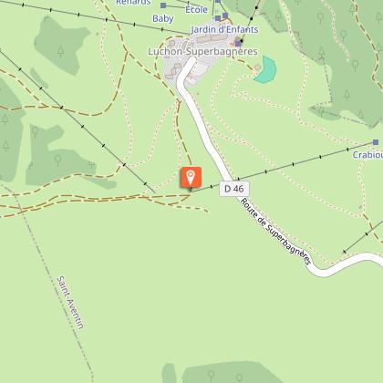
Starting point
Additional information
Detailed stages
1 - - Starting from the Superbagnères plateau, follow the GR10 signs towards the crests. Near the Arbesquens ski lift, follow the red and white markings on the GR10, which has recently been redesigned to provide a safer route.
2 - - The well-marked path runs along the grassy ridge overlooking Superbagnères. It alternates between rising false flats and gentle, more sustained climbs. Below, the Lys valley comes into view.
After around 1? hours' walking, you reach the Col de la Coume de Bourg (2,240m).
3 - - At the pass, leave the GR10 and turn right onto a well-marked path that follows the ridge. This is a panoramic route with no major technical difficulties.
You arrive at the summit on an unobstructed rocky platform overlooking the whole of the Luchonnais basin and the great peaks of the border.
The return journey takes the same route.
Dates
From 2026-04-30T00:00:00 From 2026-10-31T00:00:00
Signage
GR 10 + Yellow
Elevation gain
954 (High)
Contact
Tel : 05 61 79 21 21
Email : info@pyrenees31.com
Website : www.pyrenees31.com
Start and end town
SUPERBAGNÈRES
Data producer
Contact : HAUTE-GARONNE TOURISME
Phone : 05 61 79 21 21
This information comes from the Haute-Garonne Departmental Tourism Network and is synchronized as part of the partnership between Cirkwi and Haute-Garonne Tourisme.
Data author
