Alert
Alerts
PL 10 - TOUR DU PLATEAU DE SUPERBAGNÈRES
Description
X Country - Altitude: max. 1850m/mini 1435m.
With beautiful panoramic views, this itinerary offers a complete loop to discover the Superbagnères plateau, on wide tracks through the ski area.
It offers breathtaking 360° views of the Luchonnais peaks along the way.
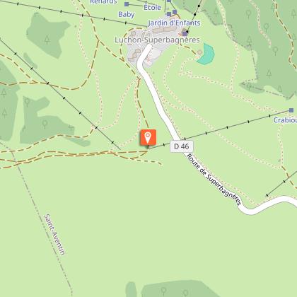
This route starts from the Superbagnères plateau.
This itinerary is more physical than technical, and you'll be skiing almost exclusively on gravel tracks.
Leaving from Superbagnères, the route forms an accessible loop, alternating wide tracks, rolling paths and open country.
The gradient remains moderate and the climbs are gradual, allowing you to manage your effort comfortably. The route has no major technical difficulties and remains easy to follow throughout.
Technical Information
Altimetric profile
Starting point
Additional information
Detailed stages
1 - From Superbagnères (alt. 1800m), take the Chemin des Crêtes
the Chemin des Crêtes (alt.1831m), down to the start of the Hount Estrète chairlift.
2 - Continue along a wide forest track to reach the Fontaine de Cubère junction.
Turn right towards Lac d'Arbesquens (alt.1450m).
3 - Follow the piste below the lake to the start of the Record ski lift. It then twists upwards towards the Téchous car park.
4 - At the car park, turn right along the road back to the starting point.
Dates
From 2026-05-01T00:00:00 From 2026-11-29T00:00:00
Signage
MOUNTAIN BIKE
Elevation gain
534 (Medium)
Contact
Tel : 05 61 79 21 21
Website : www.pyrenees31.com
Email : info@pyrenees31.com
Start and end town
SUPERBAGNÈRES
Data producer
Contact : HAUTE-GARONNE TOURISME
Phone : 05 61 79 21 21
This information comes from the Haute-Garonne Departmental Tourism Network and is synchronized as part of the partnership between Cirkwi and Haute-Garonne Tourisme.
Data author
