Alert
Alerts
Type of practice
Walking
Very easy
3h
Presentation
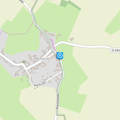
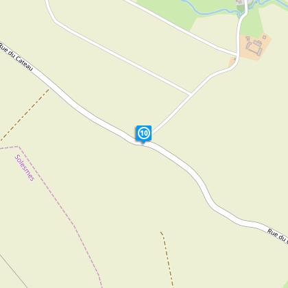
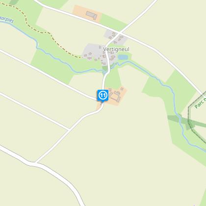
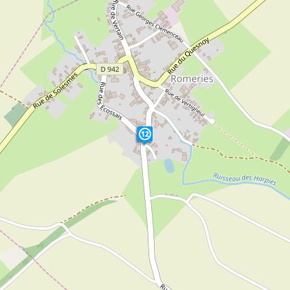
Map
Steps
Cirkwi brief's
Ratings and reviews
See around
Harpies at the feudal mound
The Cirkwi brief
Explore Mystical Trails: Harpies River to Feudal Mound Journey
Nestled at the crossroads of the Cambrésis plateaus and the bucolic landscapes of Avesnois, the journey from Place Irénée Cartier leads you through a tapestry of heritage and natural splendor. Crafted by Nord Tourisme, this path not only promises adventure but also a connection to the serene beauty of the countryside. Wander along the Harpies river, where each turn reveals a story, and each vista awakens the wanderlust in you. It’s an invitation to immerse yourself in a world where history and nature dance together in harmony.
Technical Insights for Enthusiasts
Spanning approximately 15.99 km, the elevation fluctuates between 82 to 131 meters, resulting in a modest cumulative positive elevation gain of about 49 meters. Marked with yellow signs, this route demands attention to detail for navigation. While it's accessible to those of average fitness, the variances in altitude and distance make it a rewarding challenge for those seeking to test their endurance. Ensuring proper preparation and understanding the technical nuances of this journey can significantly enhance the experience.
Seasonal Tips for Hikers
Regardless of the season, gearing up appropriately is crucial. During the warmer months, lightweight, breathable clothing will enhance comfort, while the colder periods necessitate layers to retain warmth. Reliable footwear is a must to navigate the diverse terrain confidently. Don't forget to carry water, especially in summer, to stay hydrated. Winter explorers should be wary of slippery paths. Always check weather forecasts before embarking to ensure a safe and enjoyable trek.
Heart of History: Vertain's Rich Past
Vertain, the starting point of this grand journey, lies within a territory steeped in history. Bridging the Cambrésis and Avesnois regions, it serves as a gateway to exploring a landscape that has seen centuries of evolution. From feudal mounds that whisper tales of yore to the serene flow of the Harpies river, which has been both lifeline and boundary through ages, this area offers a profound insight into the cultural tapestry of northern France. Understanding this context enriches the traversal of this route, turning each step into a journey through time.
Climate Guide and Best Visit Times
The region generally enjoys a temperate climate, characterized by mild summers and cool winters. Precipitation is fairly distributed throughout the year, with no extreme dry or wet seasons, making this journey viable in most months. However, the ideal time for this expedition would be late spring through early autumn, where the weather is most favorable, balancing warmth and the beauty of blooming nature. During these seasons, the days are longer, providing ample daylight for exploration and the full appreciation of the terrain's diverse features.
Automatically generated.
Technical Information
Walking
Difficulty
Very easy
Duration
3h
Dist.
16 km
Type of practice
Walking
Very easy
3h
Show more
Altimetric profile
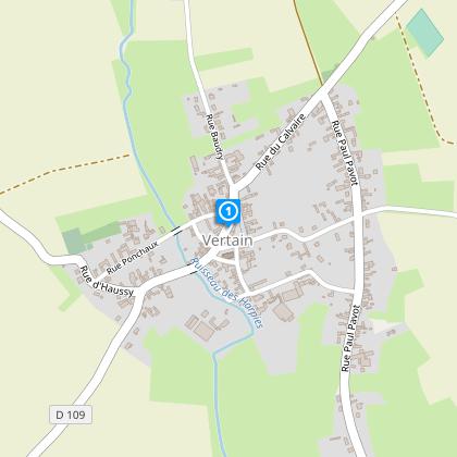
Starting point
Place Irénée Cartier, mairie
,
59730
VERTAIN
Lat : 50.1813395359Lng : 3.55537815907
Steps
Data author

Ratings and reviews
To see around