Alert
Alerts
Chalet d'la Croë - Chalet du Perron


Description
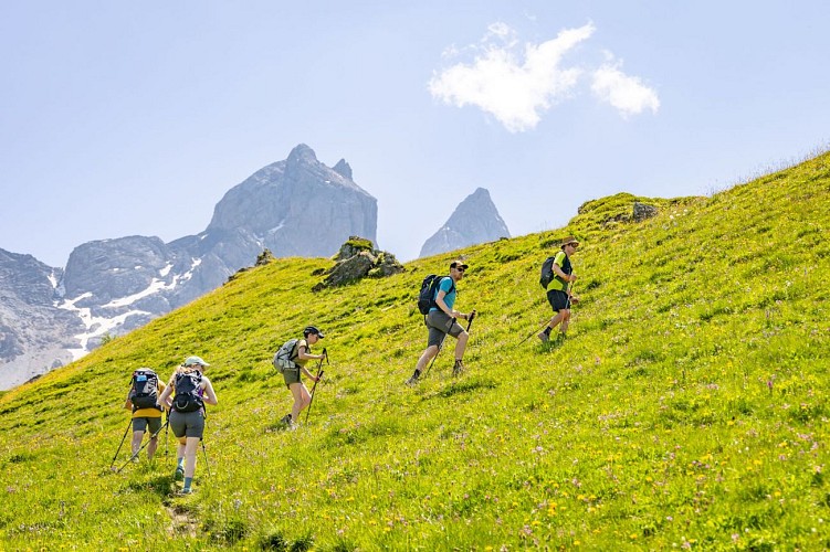
In the heart of the mountain pastures, this traverse links Chalet d'la Croë to Chalet du Perron. The route passes under the tête de chat and crosses the Basse du Gerbier, offering a beautiful immersion at the foot of the Aiguilles d'Arves.
From Chalet d'la Croë, the route crosses vast mountain pastures, in a pastoral atmosphere typical of the Aiguilles d'Arves. The relief remains gentle, and the route takes in wide open spaces where herds graze in fine weather.
The route leads gradually below the Tête de Chat, in a setting where meadows rub shoulders with a more mineral world. Passage of the Basse du Gerbier marks the start of the descent to the Chalet du Perron. From here, panoramic views open up in the heart of a wild landscape.
The descent then continues quietly through the mountain pastures, in a peaceful, high-mountain atmosphere. The arrival at Chalet du Perron offers a simple, warm welcome, ideal for a stopover in the heart of the high-altitude pastures.
Technical Information
Altimetric profile
Starting point

Date and time
- From 20/06/2026 to 22/09/2026
- From 20/06/2027 to 22/09/2027
Additional information
Contact
Phone : 04 79 59 30 48
Open period
From 20/06 to 22/09 daily.
Subject to favorable weather.
Updated by
Office de tourisme Intercommunal Cœur de Maurienne - 17/09/2026
www.explore-maurienne.com/
Report a problem
Type of land
Stone
Ground
Hard coating (tar, cement, flooring)
Grit
Not suitable for strollers
Topo guides and map references
Map references :
Tour des Aiguilles d'Arves IGN map available from Tourist Offices.
Map IGN 3435ET VALLOIRE - Aiguilles d'Arves / Col du Galibier
Tips
It is advisable to book accommodation well in advance, given its small capacity. Map-reading skills are essential.
Recommended equipment :
- Mountain boots suitable for walking on varied terrain
- Rain gear
- Pair of telescopic poles
-IGN map of Tour des Aiguilles d'Arves
- Sufficient water and food.
- Cheques or cash (bank terminals not always available in refuges).
Reception complements
This is a mountain itinerary. You need to be well equipped and experienced in the mountains before embarking on this tour.
Guidebook with maps/step-by-step
1/ Take the path south of the chalet to join the track at Bassin level.
2/ Turn left on the track, then at La Motte take the track on the left, leaving a chalet on your right, cross the stream and follow the ridge to Plan Pradin.
3/ From here, turn slightly right onto a path that crosses several streams.
4/ Under the cat's head, turn right and follow the ridge to Basse du Gerbier.
5/ Turn left to descend along a ridge to the La Crête sign.
6/ Continue downhill to the Col, then turn right to go back down into the mountain pastures to the Chalet du Perron.
Data author
