Alert
Alerts
De la Redonne à Sausset-les-Pins
Description
Stage of the great loop of the Côte Bleue. Hiking from La Redonne to Sausset-les-Pins
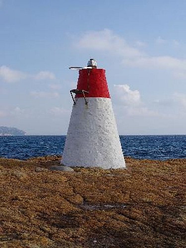
A very beautiful modern coastal itinerary where calanques and beaches, architectural houses and bastides, railway and customs path are mixed together... it is a circuit which can be modified as desired because the departures can be made from the 3 stations: Sausset-les-Pins, Carry-le-Rouet or Ensues-la-Redonne. This itinerary is located in the Côte Bleue marine park, crosses the Carry marine reserve and offers exceptional views over the harbour of Marseille, the Bonne Mère, the archipelago of Frioul, Maïre... the ocean horizon. The Calanques from Redonne to Sausset are south-facing, with a beach for the most part, and are easily accessible compared to their neighbours in the Calanques massif between Marseille and Cassis. Some panoramas from the Pointe de Rouveau, the Pain de Sucre fire ... are breathtaking.
Technical Information
Altimetric profile
Starting point
Additional information
Open period
All year round.
Updated by
Provence Tourisme - 12/06/2025
www.myprovence.fr/
Report a problem
Guidebook with maps/step-by-step
1. From the railway station of La Redonne, turn right onto the very steep road that passes under the impressive viaduct. Before arriving at the port (option), take the Pébraïre path on the right, you are on the customs path (PR: yellow). Just before the tunnel, take the stairs on the left (GR: red and white) and climb the old path of Redonne in the pine forest (nice view on the creeks and the harbour of Marseille but also on the "madrague" of Gignac). Follow the signs to the Eaux Salées cove via the path to the Puits cove.
2. Leave the beach by the steep stairs that go up to the left of the viaduct, along the railway. At the next crossroads, go straight on to the Notre Dame du Rouet chapel (option), on the right the GR continues towards the Calanque du Rouet. Cross the beach of Tamaris, take on the right the lane which goes down on the port, in 150m go up the stairs of the bridge and follow on the left the Blue street (D5) on 300m. Leave the road, the path goes behind the villas on the left, to get back to the allée des Marines. At the next crossroads, go straight ahead along the Barqueroute path (250m from the Carry marine reserve option) until you reach the Cap Rousset cove.
3. Continue on the GR which follows the avenue Gerard Montus, take on the left a small part of the D5 and on the left the rue Jérôme Chapuis. On the port of Carry (option towards the station of Carry by Av Aristide Briand, yellow line). Continue by the quay of Malleville (beginning of the path of the lizard) until the light Pain de sucre. Follow the seaside path to the Tuilière cove. The route is marked out with descriptive boards on the natural environment...
4. The Tuilière cove collects a maximum of posidonia residue (aquatic plant), which forms whole banks of this plant on the beach, which protects the coastline. Continue along the seafront to the beach of Les Baumettes, cross the beach, continue on the D5 to the road "promenade de la Corniche" (Optionally, you can go from the beach of Les Baumettes along the seafront and join the D5 250m further by stairs on the right). Next point: the Pointe Rouveau, viewpoint on the open sea.
5. From this magnificent viewpoint, the walk follows the seafront along the road known as the "promenade de la corniche". Pass in front of the numerous beaches of Sausset. The shortest way to the station of Sausset: before the port, turn right on the Bvd Armand Audibert then on the Bvd Charles Roux, the station is on the top left. Otherwise through the village (30 min extra), continue on the quays of the port, before the wooden footbridge, turn right. Pass in front of the tourist office, go up in the middle of the traverse des Pêcheurs then continue straight on Av de la Gare. Go past the Mairie and the Salle des Arts et de la Culture, a little further up is the station.
