Alert
Alerts
Tour des Bauges by bike
Description
The Tour des Bauges by bike winds its way through the foothills of the PNR of the Bauges massif. A beautiful escape into the heart of varied landscapes, punctuated by the rich heritage of towns and villages to discover during a stopover or a stage.
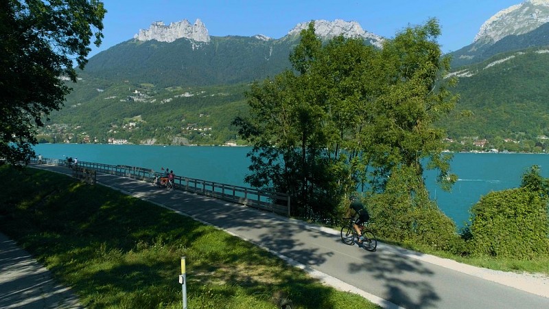
The Tour des Bauges à vélo covers 130 km of the foothills of the Parc Naturel Régional - Géopark du massif des Bauges. A beautiful escape between lakes and mountains in the background, in the heart of an incredible diversity of atmospheres and landscapes punctuated by the rich heritage of towns and villages to discover, according to your tastes, at the mercy of a stopover or a stage.
Departing from Aix-les-Bains station, the route reaches the shores and beaches of Lac du Bourget, France's largest natural lake, before arriving in Chambéry, Ville d'Art et d'Histoire. The route continues to Montmélian and Saint-Pierre-d'Albigny, through the vineyards of Cœur de Savoie. It then reaches the Pays d'Albertville, with the Belledonne range in the background, then Ugine, Doussard and the Sources du lac d'Annecy, before reaching Annecy and its old town via Duingt, Saint-Jorioz and Sevrier. Return by train from Annecy station to Aix-les-Bains.
(Cycling to Aix-les-Bains is possible by taking the cycle-discovery route n°51 out of Annecy).
Nb: You can plan your itinerary with a different starting point, accessing the route via the SNCF stations at Chambéry, Montmélian or Albertville, and shaping it as you wish with your choice of stops, visits, stages and overnight stays. You can also discover it over half a day, a day or several days.
Technical Information
Altimetric profile
Starting point
Points of interest


Additional information
Updated by
Conseil Départemental de la Haute-Savoie - 16/09/2025
www.hautesavoiexperience.fr
Report a problem
Environments
In the country
Lakeside or by stretch of water
Lake view
Mountain view
Station district
Close to a public transportation
Lake 5 km away
Waterside
View over the vineyards
Panoramic view
Open period
All year round.
Subject to favorable weather.
Contact
Phone : 04 79 85 12 45
Email : info@agencesmb.com
Topo guides and map references
Map references :
TOP IGN 924 - Greenways and Bicycle Routes of France
Type of land
Hard coating (tar, cement, flooring)
Location complements
Access to the route is possible and signposted from SNCF stations.
Animals
No
Data author
