Alert
Alerts
Type of practice
Walking
Very easy
2h
Presentation
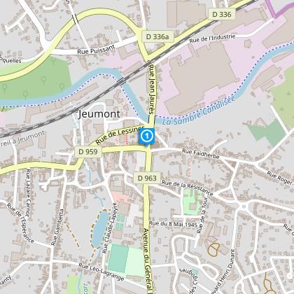
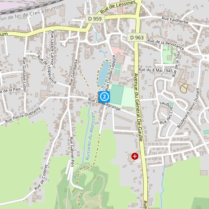
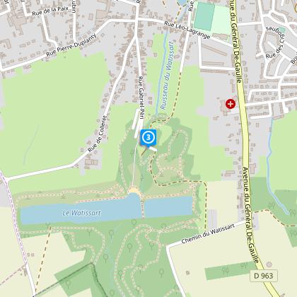
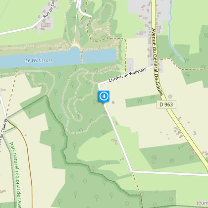
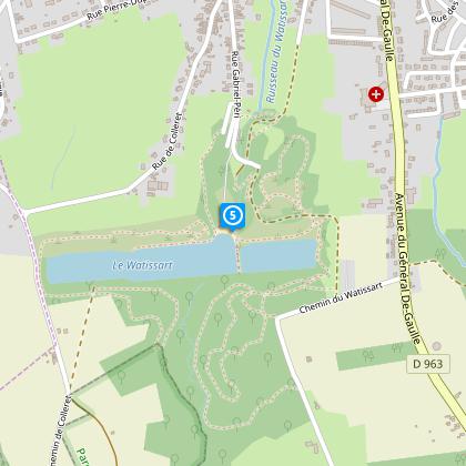
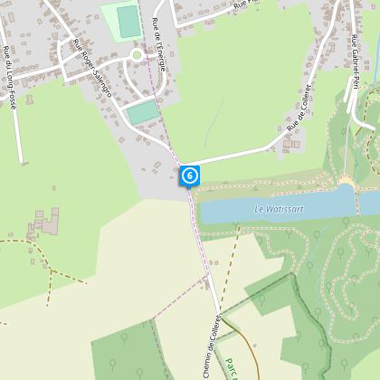
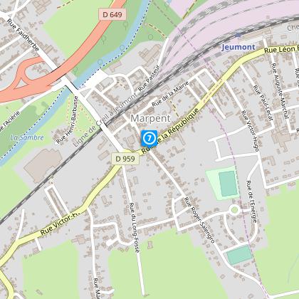
Map
Steps
Cirkwi brief's
Ratings and reviews
See around
Jovis Mont Circuit


Credit : OT Sambre Avesnois
The Cirkwi brief
Explore the Charming Jovis Mont Footpath in Jeumont
Nestled in the majestic valley of the Sambre, Jeumont's Jovis Mont circuit offers a unique glimpse into the rural charm of northern France. With paths meandering through scenic routes, this journey robustly connects one with the untouched beauty of countryside vistas. Experience the allure of ancient marble and sandstone quarries, integral to the region's illustrious history of paving craftsmanship. Brought to you by Nord Tourisme, this family-friendly trail promises an invigorating walk amidst a serene landscape, beckoning travelers seeking tranquility and a touch of adventure.
Technical Overview of the Route
Embarking on the Jovis Mont circuit unveils a 7.58 km journey with negligible difficulties, making it accessible for most. The altitude fluctuates between 123 meters at its lowest and 175 meters at its peak, offering a total positive elevation change of 82 meters. Such gentle elevation variances ensure a pleasant experience throughout. When translated into laymen's terms, this path is neither strenuous nor demanding, thereby accommodating family outings perfectly. The well-marked trails eliminate navigation concerns, allowing focus solely on the adventure at hand.
Seasonal Tips for Trail Trekkers
Regardless of the season, the Jovis Mont circuit presents its unique charm. In spring, the trail bursts into life with vibrant flora; therefore, allergy sufferers should come prepared. Summer offers lush, shaded paths, yet wearing sun protection is advisable. Autumn paints the landscape in stunning hues, making it a photographer's paradise, albeit with slippery leaves underfoot. Winter, though stark, holds a quiet beauty; however, it is essential to wear appropriate footwear for potentially icy paths. Always carry water, and check weather forecasts ahead.
Jeumont: A Cultural Beacon
Jeumont, a quaint town in the Nord department, serves as the starting point of the Jovis Mont circuit. This area, rich in history and tradition, stands testament to the resilience and craftsmanship of its people. The region's exploitation of marble and sandstone not only highlights the industry's historical significance but also showcases the intricate connection between nature and the local culture. The resulting pavements symbolize the meticulous artistry and enduring legacy of Northern France's architectural prowess, making this trail a journey through history as much as nature.
Understanding Jeumont's Climate
Jeumont experiences a temperate oceanic climate, characteristic of the Nord region. Winters are generally mild, yet preparing for occasional icy conditions is advisable. Summers, on the other hand, are pleasantly warm but seldom overly hot, creating ideal conditions for exploring. The best times to visit this captivating trail are late spring through early autumn when the weather beautifully complements the scenic landscape. Rainfall is fairly distributed throughout the year, so carrying waterproof gear is always a prudent decision.
Automatically generated.
Technical Information
Walking
Difficulty
Very easy
Duration
2h
Dist.
7.6 km
Type of practice
Walking
Very easy
2h
Show more
Altimetric profile
Starting point
Parking de l'Eglise
,
59460
JEUMONT
Lat : 50.2967111213Lng : 4.10199754252
Steps
Data author

Ratings and reviews
To see around