Alert
Alerts
Le puy du Sapt
Description
A walk through the tall forests of the Haut-Livradois, ideal habitat for Tengmalm's owl and black woodpecker. The paths lined with crosses around Fournols priory offer views of the Forestier ponds, Croix des Sucs and Colombière.
Technical Information
Altimetric profile
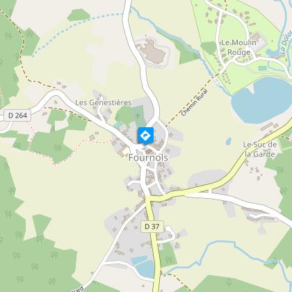
Starting point
Steps
Additional information
Tips
- View of the Sancy and Puys ranges
Updated by
Conseil départemental du Puy-de-Dôme - 02/06/2026
www.puydedome-tourisme.com/
Report a problem
Environments
In the country
Forest location
Presence of livestock and guard dogs
Distinctions
Listed PDIPR
Open period
From 01/01 to 31/12 daily.
Subject to favorable weather.
Location complements
From the village of Saint-Germain-l'Herm, take the D37 for 9km towards Fournols.
Contact
Phone : 04 73 72 05 95
Email : contact.saint-germain-lherm@vacances-livradois-forez.fr
Website : https://www.auvergne-livradois-forez.com/
Reception complements
For your own safety, always take a bottle of water, a hat, warm clothing and footwear suitable for walking.
Depending on weather conditions, certain itineraries are not recommended in bad weather (fog) or are not practicable, or even forbidden, during the winter season.
Some sites are fragile, so stay on the marked trails. Avoid picking wild flowers and disturbing wildlife. Pick up your garbage.
Animals are not allowed on some routes.
Guidebook with maps/step-by-step
1/ Place de la Mairie. Opposite the town hall, take the D264 towards Echandelys, passing a bakery. Turn right in front of the school, then left 100 m further on, in front of a fountain. The path joins a road, follow it to the left and leave it for the first road on the left that leads to Les Andes.
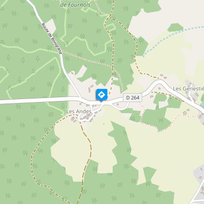
2/ At the entrance to Les Andes (view of the Sancy and Puys ranges), take the road on the left. Go straight through the hamlet. Take the path that follows the road, and continue straight on for over a kilometer until you reach the asphalt road at the Sucs cross. Turn right. At the left-hand bend in the road, take the path opposite, which climbs immediately to the left. Follow the main path to the village of Viallard. Turn left and follow the road downhill.
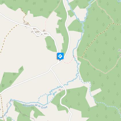
3/ Cross the road, go down a track to the stream and cross it. After the footbridge, at the crow's-foot, take the right-hand path and, 300 m further on, turn left to reach Puy du Sapt. Go through the village, continuing straight ahead on a track. Bend left between a house and a ruin; 200 m further on, turn right onto a track.
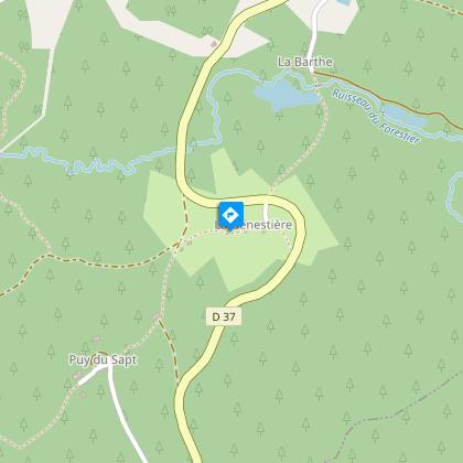
4/ Go through the hamlet of La Genestière, exit to the left onto the D37 road. Cross the road and descend to the village of Le Forestier. Follow the tarmac track that joins the D37, follow it to the right, then turn left in front of the pond. Opposite the stadium, turn right to return to the starting point.
Proposed and managed by the Conseil départemental du Puy-de-Dôme - PDIPR.
Animals
Yes. Dogs must be kept on a leash due to the presence of herds.
Data author
