Alert
Alerts
Col d'Emy
IGN cards


Description
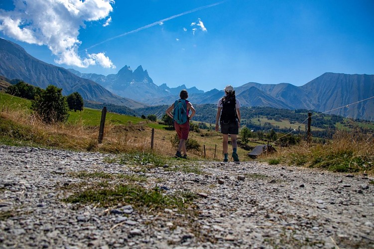
Set off on an ascent reserved for experienced hikers towards the Col d'Emy. The demanding, technical route crosses alpine meadows before reaching the final scree slope. Your efforts will be rewarded by a magnificent view.
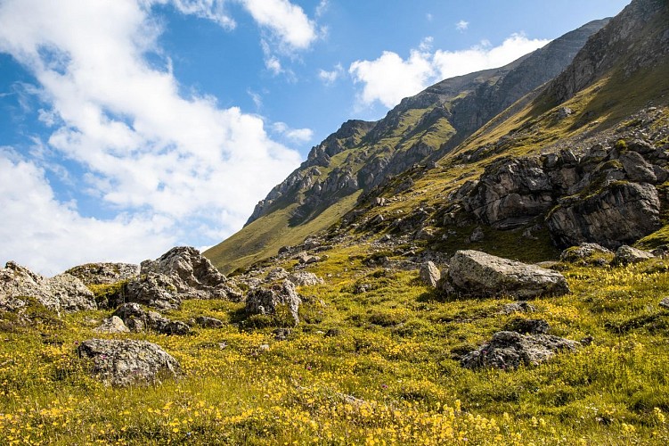
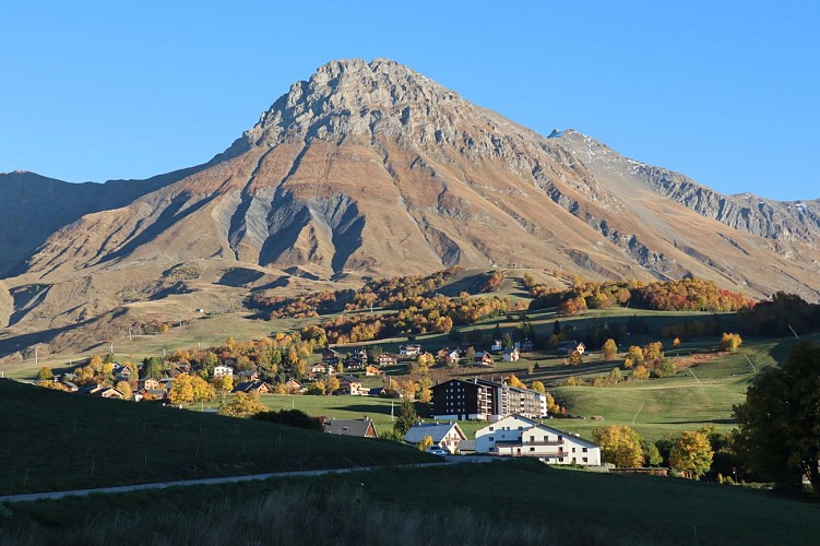
This hike has to be earned, with a steady climb from the very first meters. Wild and authentic, it offers a unique experience in the heart of the mountain. Along the way, marmots and cows accompany you, before giving way to a 100% mineral landscape. The view from the Col d'Emy is breathtaking: on the Albiez side, a breathtaking view of the hamlets, the Maurienne valley, the Pic de l'Étendard and the Belledonne range; on the Karellis and Valloire sides, the Péclet glacier, the Fort du Télégraphe and, on a clear day, Mont Blanc.
A demanding hike, ideal for those who love vertical drops and exceptional panoramas.
Technical Information
Altimetric profile
Starting point
Additional information
Updated by
Office de tourisme Intercommunal Cœur de Maurienne - 17/11/2025
drone-de-regard.fr/vr/mcm-2/saint-jean/
Report a problem
Topo guides and map references
Map references :
TOP 25 IGN 3435
Open period
Open every day.
Subject to favorable weather.
Contact
Phone : 04 79 59 30 48
Guidebook with maps/step-by-step
Start: Col du Mollard.
1/ Continue on the RD80 towards Le Mollard for 100 m.
2/ Turn slightly left onto Rue du Ravarin.
3/ At the Pierre aux Fées vacation center, turn left onto Route de la Praz (road then forest track).
4/ Follow this track to the "Pierre Noire" chalets, where you'll find a small caravan with dogs, donkeys and other animals.
5/ Climb up a mountain pasture track, following the red/pink paint dots on the rocks.
6/ After about 3 hours' walking, you'll come to the foot of a scree where the path is lightly marked (observe carefully) and the markings are always present.
7/ At the Col d'Emy, you'll find vegetation again and can take a break on a wide platform.
8/ Return by the same route.
Animals
Yes. Pets allowed on leash only.
Data author
