Warnung
Warnungen
LÈGE CAP-FERRET / AUDENGE (15.4 KM – FAMILY FRIENDLY)
Beschreibung
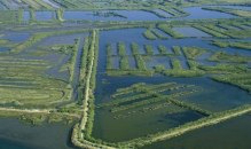
The forests of Gironde give way to the urban on this stage of the Vélodyssée around the Bassin d’Arcachon. Shortly after Lanton, we enter the territory of the Landes de Gascogne regional nature park, full of sweet scents and authentic sea salts. Carry on until a junction, where you go straight ahead towards Andernos-Arès. On the right, the network of tracks that runs through the Cap Ferret peninsula begins. You may opt to take these paths if you wish to follow the EuroVelo 1 route to get to the Bélisaire jetty, on the way to the tip of Cap Ferret, where a ferry can take you to Arcachon so that you can enjoy the tracks that lie to the south of Arcachon Bay. If you have chosen to continue straight on, you’ll arrive at another intersection. Follow the signs to Claouey and join up with the ‘Tour du Bassin d’Arcachon’ track. At any time of the year, you can safely go the whole way around Arcachon Bay on bike. Follow the signposts for ‘Piste cyclable départementale Lège-Biganos’. You are now on the old railway that is of local interest, transformed into a cycle track by the regional council (‘le Conseil Départemental’), taking you past the old train stations in Arès, Andernos (km 25.5), Taussat, Cassy, Lanton and Audenge. Just before Audenge, on your right you’ll find a signpost for Domaine de Certes, a vast natural space owned by le Conservatoire du Littoral (“Coastal Conservatory”) and managed by the regional council. Its former fish ponds have become a paradise for migratory birds. In season, naturalist guides are on hand to help you discover its charms. Your trip has taken you through the stations and villages that you’ve come across, but don’t forget that you can rejoin the centres and beaches in order to enjoy their various activities at any moment.
Technische Informationen
Höhenprofil
Datenautor
