Wenn Sie sich ein paar Kilometer von Pau entfernt wie am Ende der Welt fühlen wollen, sollten Sie diesen Start wagen.
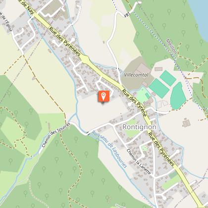
Start: Parkplatz des Stadions - 1, rue des écoles - Rontignon
Gelbe Markierung Wanderer (Nr. 8)
10 km
|
max. 374 m
min. 196 m
370 m
370 m
| |||||||||
Stile : WandernSpaziergangEntdeckungAuf dem Land Öffentlich : Familie Thema : Erbe |
Pass under the car park entrance porch and turn right on the footbridge. Continue on the road until the traffic light, cross at the pedestrian crossing and go straight on rue du Vieux Bourg. At the cross, turn left. At the end of the street, turn right onto rue de l'Eglise towards Hameau de Rontignon. When the road begins to rise, take the chemin de Lasbouries in the bend, in the direction of “La ronceraie”. Continue on this road for 1km. At this level the road forms 2 bends, the first on the left and the second on the right. After 300m the road forms a fork, keep to the left. Continue to a second fork, at the end of the asphalted road. Go left on the track that goes up (block of stone). The track becomes paved, continue to its highest point. Then the road descends to the sign "Cédez le Passage". Turn right.
At the level of the stele, take the path which goes down to the left. Before the shed, turn right on the path. Reach the paved road and continue down. Just before the house, cross the stream and turn immediately right onto the path. Arrive at the level of the road and turn right. Continue on the road to the last houses, then turn left on Chemin de la Glandée (Dead-end). After a very slight slope, turn right on Chemin Passabet. Come to the Hameau road and turn left.
At the cross, the road splits in two. Turn left (dead end). Follow the road which becomes a path. Pass between the two fields and enter the forest (chemin de Castagnou). Further on the path splits in two, turn left and go down. At the intersection of the four paths continue straight. Stay on the main path until you come out of the forest. At the road, turn right and follow it until you find the starting route. At the cross, turn left and join the car park.
Rontignon, un de ces villages au passé fondu dans celui de la vallée, dispose d’un territoire communal s’étendant à la fois dans la plaine et sur les coteaux, assez réduit dans le premier secteur mais débordant assez largement sur le second. Il est une des 31 de l'agglomération Pau Béarn Pyrénées. Il est bordé par la voie verte le long du gave de Pau et à proximité des équipements sportifs de la commune.
Le passé de Rontignon est peu connu ; néanmoins, l’analyse toponymique ne laisse pas de doute sur l’origine du nom de la commune. Celui-ci apparaît sous différentes orthographes dès le XIVe siècle et jusqu’au XVIIIe où la carte de Cassini révèle le nom actuel. Rontignon dérive du nom latin d’une personne nommée Frontinius auquel on a ajouté le suffixe -onem (domaine de). Cette dénomination signifie donc domaine de Frontinius. Enfin, la terminaison en -on est considérée comme le reste d’une déclinaison du bas-latin. D’après ces données, l’hypothèse d’une origine ancienne peut être émise : vers le haut Moyen-Âge.
Kabeltelefon : +33 5 59 27 27 08
Pau Pyrénées Tourisme
Website (URL) : www.rando-pau.com
E-Mail : contactrandos@tourismepau.fr
Gelb
pédestre
Schleife
Naturnah
In der Nähe einer Nationalstraße
Picknickplatz