Warnung
Warnungen
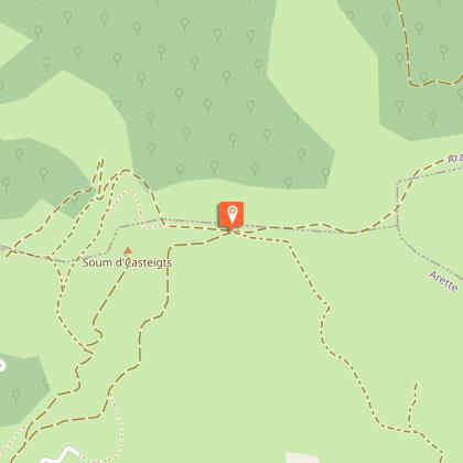
N°10 Barétous - Crêtes d'Issor

Beschreibung
Auf dieser Wanderung können Sie ein sehr leicht zugängliches Panorama genießen: im Norden auf die Gipfel des Piemonts und das Massif de l'Anie und im Süden auf die Ebene, soweit das Auge reicht! Das Wandern auf bequemen Pisten versüßt diesen Ausflug. Als Land der Schäferei ist die Begegnung mit Pferden und Kühen üblich, nicht zu vergessen die Gänsegeier, die über den Köpfen kreisen!
Technische Informationen
Höhenprofil
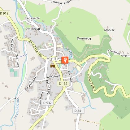
Ausgangspunkt
Schritte

Zusätzliche Informationen
Balisage
Gelb
Trait
Typologie de l'itinéraire
Schleife
Thèmes
Naturnah
Durée moyenne de l'expérience
2 bis 3 Stunden
Equipements
Picknickplatz
Datenautor
