In der Umgebung sehen
Mehr sehen
Öffnen
Schließen
Anzeigen
Anzeigen
Anzeigen
Anzeigen
Anzeigen
Anzeigen
Anzeigen
Anzeigen
Anzeigen
Anzeigen
Anzeigen

Oups... Es scheint, dass Cirkwi keine Berechtigung hat, Ihren Standort zu verwenden.

Beschreibung
Karte
Schritte
Sehenswürdigkeiten
Bewertungen und Rezensionen
In der Umgebung sehen

Le Pic du Merdanson

Le sommet 1540 m web (Copier)
Amazonie bearnaise web (Copier)
Brebis sur pentes sommitales web (Copier)
Cote Bigorre, le brouillard monte web (Copier)
Hetraie dans le brouillard web (Copier)
Hetres brouillard web (Copier)
Montee Bois Merdenson web (Copier)
Vue sur col de Pan et cabane Louscuts web (Copier)
Vue sur le Gabizos web (Copier)

Beschreibung

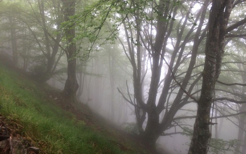
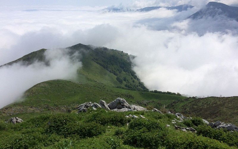
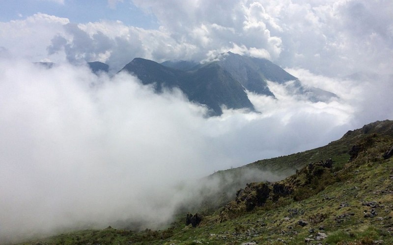
Wenn Sie Wanderungen mit einem Hauch von Abenteuer, wilde Berge mit guten Höhenunterschieden für jedes Gelände mögen, ist diese Route genau das Richtige für Sie. Nach einem Anstieg durch Wälder, Farnwälder und Lichtungen erreichen Sie die hochgelegenen Weiden, die zum Gipfel des Merdanson führen, einem Aussichtspunkt fernab der klassischen Wanderrouten
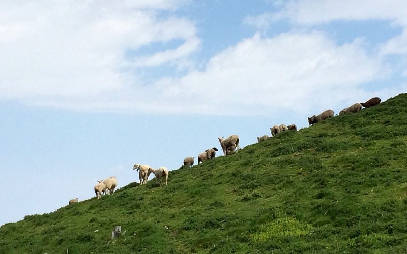
In den Bergen, von den Hügeln bis zu den Gipfeln, durchquert man verschiedene Vegetationsstufen, die je nach Bergmassiv und Hanglage unterschiedlichen Höhenlagen entsprechen. In den Pyrenäen befindet sich auf der Nordseite bis zu einer Höhe von 900 m die kollineale Stufe mit Wiesen und Laubwäldern. Von 900 bis 1700 m entwickelt sich auf der montanen Stufe der Tannen-Buchenwald. Oberhalb dieses Waldes beginnt die subalpine und alpine Stufe mit Heidelandschaften und Sommerweiden. Weiter oben, in der nivalen Stufe um 2300 m, gibt es nur noch

Technische Informationen

Dieser Rundweg wurde aktualisiert am: 06/05/2024
19 km
1380 m

Höhenprofil

Ausgangspunkt

64800 ARTHEZ-D'ASSON
Lat : 43.08744325Lng : -0.2523952

Schritte

image du object
1

Towards the Col d’Isou

Leave to the left of the town hall. Go up the steps. In front of the school, turn left. Take the second to the right, a path that goes up between low walls. Turn right in front of the cemetery, turn left in front of the church. At the crossroads turn left. Stay on the road. Turn right on the road D126. 50m ( 164.04ft.) further, turn right, go up towards Rocher Ecole. Turn left after a house. Go through a barrier, follow under box trees. To the right go up. At the bottom of the ferny area, go up to the right. We reach a path to the left. At the bottom of the small valley and go up veering to the left. After a ferny area follow the path under hazel trees. To the left, cross the stream and go up. Go up to the left. Exit the forest and go towards the col. To the left of the Col d’Isou, follow the clearly marked path that goes up into a beech wood.

- Office de Tourisme Communautaire du Pays de Nay -
Consulter
image du object
2

Towards the cabin of Louscuts

Turn left to leave the path. Pass by the Col of Nabails, continue on the other slope (East). Pass by a park and a stone cabin. 50m ( 164.04ft.) further, turn right, come back on the West slope. Follow the big path to the left. At the Col de Pan, turn right in front of the park. Go towards a rocky area. Go up towards the Merdanson by the East slope, passing above the cabin of Louscuts.

- Office de Tourisme Communautaire du Pays de Nay -
Consulter
image du object
3

Towards the Tachouete cabin

Go up towards two large rocks below the summit. Pass above them and follow the path over a limestone pavement. To the right go up on the side towards a great col. Pass above a cabin and ancient parks. To the right, towards the summit. From the summit (1540m) go down on the opposite ridge, following the weaker slope. Reach a path that goes down towards the two rocks seen on the way in. Turn left. Back at the park, to the left, go on the path you took on the way in. Back at the Col d’Isou go up ahead, North-East. Pass by groves and under the Tachuete cabin.

- Office de Tourisme Communautaire du Pays de Nay -
Consulter
image du object
4

Towards the Col of Tisné and return to Arthez-d’Asson

Pass by the Col of Arriulé and go down. Turn right at the source (water spring) des chiens. Follow the clearing. To the right, enter the forest. Cross the barrier, continue into the forest. At the Col of Tisné, turn right on the road then on the track. Turn left at the drinking trough then once again to the left on the road to go back to Arthez-d’Asson.

- Office de Tourisme Communautaire du Pays de Nay -
Consulter

Zusätzliche Informationen

Contact

Kabeltelefon : +33 5 59 13 94 99
Office de Tourisme Communautaire du Pays de Nay
Website (URL) : www.tourisme-bearn-paysdenay.com
Office de Tourisme Communautaire du Pays de Nay

Balisage

Gelb

Typologie de l'itinéraire

Schleife

Animaux bienvenus ?

Oui

Thèmes

Naturnah

Bewertungen und Rezensionen

In der Umgebung sehen
Mehr sehen
Öffnen
Schließen
Anzeigen
Anzeigen
Anzeigen
Anzeigen
Anzeigen
Anzeigen
Anzeigen
Anzeigen
Anzeigen
Anzeigen
Anzeigen