In der Umgebung sehen
Mehr sehen
Öffnen
Schließen
Anzeigen
Anzeigen
Anzeigen
Anzeigen
Anzeigen
Anzeigen
Anzeigen
Anzeigen
Anzeigen
Anzeigen
Anzeigen

Oups... Es scheint, dass Cirkwi keine Berechtigung hat, Ihren Standort zu verwenden.

Beschreibung
Karte
Schritte
Sehenswürdigkeiten
Bewertungen und Rezensionen
In der Umgebung sehen

VTC 3 Tour du Pays de Nay

Design sans titre - 8
Design sans titre - 9
Petite route BD
Canal BD
Le Gave de Pau à Coarraze BD
rec Colverts

Beschreibung

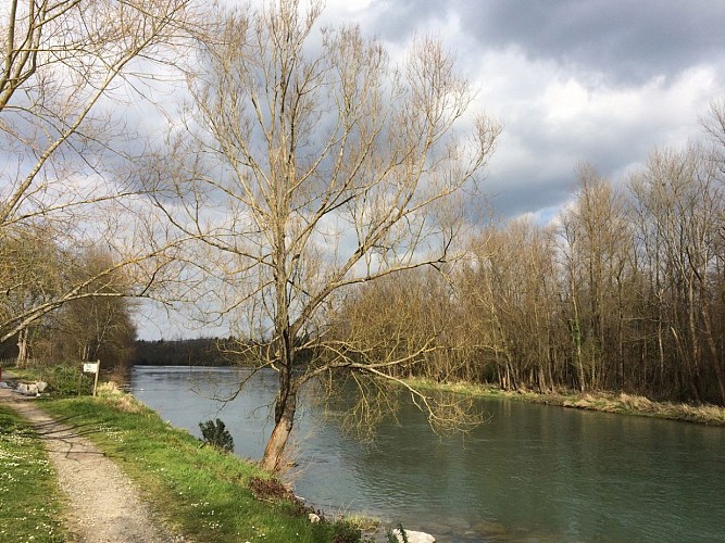
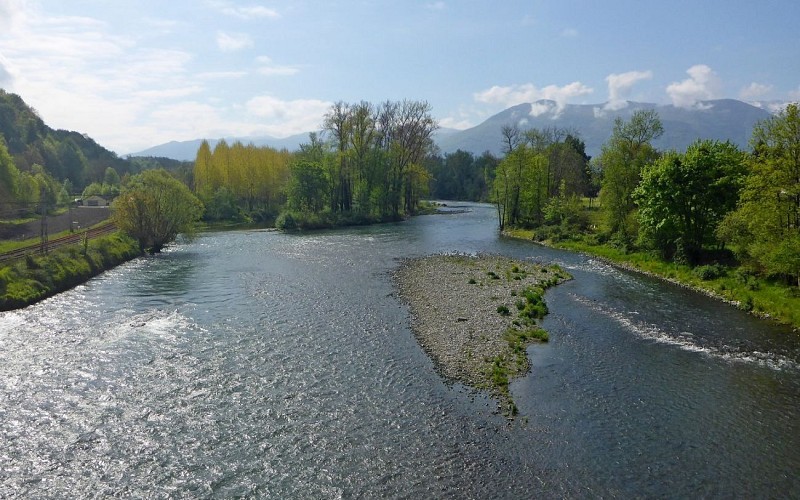
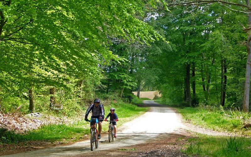
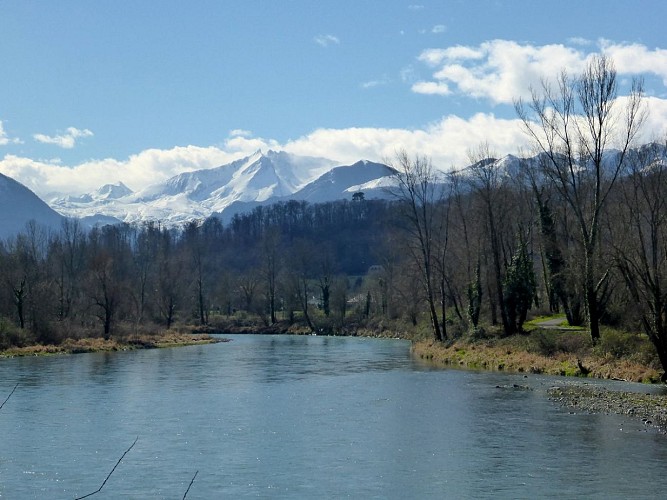
Was gibt es Schöneres als mit dem Fahrrad zu fahren, um mit der Nase im Wind eine Region zu entdecken? Auf dieser kompletten Rundtour durch das Pays de Nay können Sie von den Hügeln des Piemonts bis zur Ebene, durch Felder, Wälder und bis zum Ufer des Gave eine abwechslungsreiche Landschaft entdecken, in der sich vor dem Hintergrund der Pyrenäenkette schöne Dörfer aneinanderreihen.
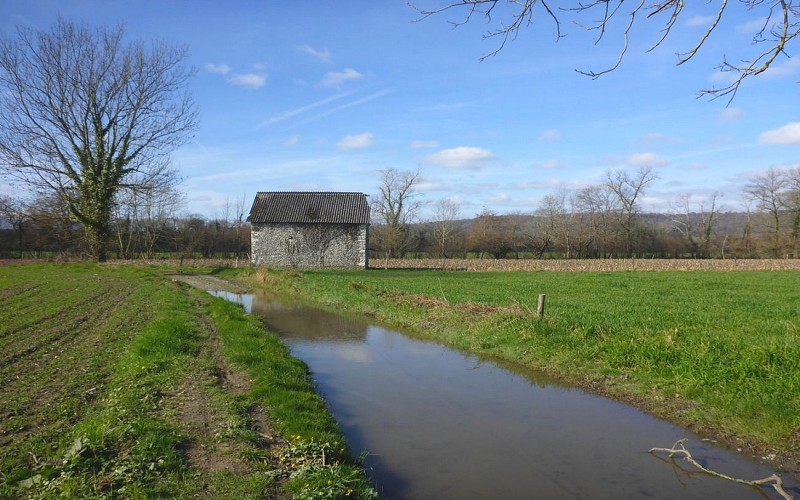
Kanäle sind ein wesentlicher Bestandteil der Landschaft in der Ebene von Nay und existieren seit dem Mittelalter. Sie dienten der Bewässerung und dem Antrieb von Mühlen und Hämmern. Ihre Rolle war für den Aufbau der Industrie in Nay im 19. Jahrhundert von entscheidender Bedeutung. Die Wasserfassung von Coarraze am rechten Ufer führt zum Lagoin-Kanal, der den gleichnamigen Bach und den Kanal der Ebene speist. Am linken Ufer oberhalb der Brücke von Claracq mündet der Grau-Kanal in den Escourre und ergibt den Ga

Technische Informationen

Dieser Rundweg wurde aktualisiert am: 06/05/2024
707 m
6 h 30 mn
6 h 30 mn
400 m

Höhenprofil

Ausgangspunkt

64800 NAY
Lat : 43.203938838Lng : -0.296195414

Schritte

image du object
1

From Nay to Lestelle-Bétharram

From Nay fire station, cross the Claracq bridge. Take the first right, reach the riverbank of the Gave. Turn left in front of the former flour mill, then turn right. Go straight ahead in the no-through road (dead end). Turn left towards Coarraze then turn right. After 200m ( 656ft) turn left then right in front of the secondary school. At the stop sign, turn right then left. Cross the railway bridge and turn right. At the roundabout (rotary), go straight on. Pass by the church of Coarraze and cross the bridge to the right and the street Rue de la textile. Turn left on the road Rue des Pyrénées. At the stop sign, turn right on the street Rue de l’Hermitage. Turn left on the street Rue du Martinet. At the sports hall, turn left then turn right twice. Turn left on the cycle path towards Lestelle-Bétharram. Cross the road D35 and ride for 3km ( 1.86mi).

- Office de Tourisme Communautaire du Pays de Nay -
Consulter
image du object
2

From Lestelle-Bétharram to Bénéjacq

Turn left, a crossroads with a Cross in Lestelle-Bétharram, then turn right then left, go down on a path. Turn right at the riverbank of the Gave and go along it for 1km ( 0.6mi). Go up the steps to the road, cross the bridge of the sanctuaries and turn left straight away. Follow a path bordering a field. Cross a small bridge and go up to the left on the street Rue Blanquine. Turn right then left in front of the church of Montaut. Cross the road and the railway. Turn left at the fountain. Turn right at the stop sign, then left. Go up and turn left towards a farm. Continue straight ahead on the road that goes down. At the bottom, turn right on a path that goes up. At the end of the way, turn left. At the crossroads go down to the left. Turn left. At a house built in the Basque tradition turn left. At the crossroads, go straight on. Before the town hall and the church of Coarraze turn right. At the stop sign, go straight ahead on the street Rue Léo Lagrange. Leave the village and turn right on the road Chemin du Lanot. Turn left on a track. Ride for 2.5km ( 1,55mi). At the stop sign, go straight ahead into Bénéjacq. At the next stop sign, turn left on the road D936.

- Office de Tourisme Communautaire du Pays de Nay -
Consulter
image du object
3

From Bénéjacq to Beuste

. At the crossroads with a crucifix, turn right. Pass by the school and the town hall, then turn left on the street Rue Emile Zola and then right on the road Chemin de Barcanou. At the stop sign in Bordères, go straight ahead and then turn right. At a bridge and a washhouse turn left. After 200m ( 656ft) turn right then left. Turn right on the road D212. Entering in Lagos, turn right. Turn left then right. To the left, go along the stream. At the second bridge turn right. Cross a footbridge, go along the rugby field and turn left on a track. Back on the asphalt, turn left at the entrance of Beuste.

- Office de Tourisme Communautaire du Pays de Nay -
Consulter
image du object
4

From Beuste to Bordes

At the bridge turn left then twice to the right in the village. At the end, turn left and at the stop sign turn left. After 100m ( 328ft), turn right on the road Rue des cerisiers. At the crossroads go to the track straight ahead. At the entrance of Angaïs turn right then turn left twice. At the stop sign, turn right on the road Rue des Pyrénées then turn left before the church on the road Rue porte neuve. At the entrance of Boeil-Bezing, turn right towards Bordes (to the left towards the centre of the village we can reach the leisure centre of Baudreix then Nay to do a smaller loop). Ride 1km ( 0,6mi) going along the railway. At the stop sign, turn left. Cross the railway and turn right on the road Rue de l’Ossau. At the end turn right then left. At the roundabout (rotary) of the town hall of Bordes turn left. At the stop sign turn left in front of the church then turn right at a public garden. Continue on the main road that passes by the factories. At a sewage treatment plant turn left on a track.

- Office de Tourisme Communautaire du Pays de Nay -
Consulter
image du object
5

From Bordes to Saint-Abit

At the sewage treatment plant of Bordes turn left on the road. At the roundabout turn left. Cross the bridge of Assat and turn left. Follow the road D37 up to Baliros. Turn left at a double bend after the bridge across the Luz. Go up to the castle of Baliros to the left. 100m ( 328ft) further turn right on the road Rue Saint-Vincent. Go straight ahead along the church on the road Chemin de Larroundade. In Pardies-Piétat turn right then left. Turn right on the road Rue de l’église then left on the road Rue de La Roundade. At the crossroads of Saint-Abit, go straight ahead.

- Office de Tourisme Communautaire du Pays de Nay -
Consulter
image du object
6

From Saint-Abit to Nay

At the crossroads, Rue de Cardède, turn right towards the church and the castle crossing the road D37. In front of the castle of Arros turn left. Cross the road and go straight ahead. Turn left at the “scale” (weighing machine). Before the stop sign, turn right then left, cross the road D936 and follow the road Chemin du Cayrou. Turn left at a washhouse. Turn right in front of the church of Bourdettes. Cross the footbridge of Baudreix and turn right. At the end of the lake, turn right. At the stop sign go straight ahead along the canal, go up and continue straight ahead. At the roundabout of Claracq bridge in Nay, turn right to go back to the start.

- Office de Tourisme Communautaire du Pays de Nay -
Consulter

Zusätzliche Informationen

Contact

Kabeltelefon : +33 5 59 13 94 99
Office de Tourisme Communautaire du Pays de Nay
Website (URL) : www.tourisme-bearn-paysdenay.com
Office de Tourisme Communautaire du Pays de Nay

Balisage

Grün
panneaux

Typologie de l'itinéraire

Schleife

Animaux bienvenus ?

Oui

Thèmes

Naturnah

Bewertungen und Rezensionen

In der Umgebung sehen
Mehr sehen
Öffnen
Schließen
Anzeigen
Anzeigen
Anzeigen
Anzeigen
Anzeigen
Anzeigen
Anzeigen
Anzeigen
Anzeigen
Anzeigen
Anzeigen