Warnung

Warnungen

In der Umgebung sehen
Mehr sehen
Öffnen
Schließen
Anzeigen
Anzeigen
Anzeigen
Anzeigen
Anzeigen
Anzeigen
Anzeigen
Anzeigen
Anzeigen
Anzeigen
Anzeigen

Oups... Es scheint, dass Cirkwi keine Berechtigung hat, Ihren Standort zu verwenden.

Präsentation
Beschreibung
Karte
Sehenswürdigkeiten
Bewertungen und Rezensionen
In der Umgebung sehen

Wanderroute: Entdeckung von La Plagne mit Übernachtung in der Berghütte von Mont Jovet

Wanderroute: Entdeckung von La Plagne mit Übernachtung in der Berghütte von Mont Jovet

Beschreibung

Entdecken Sie die wunderbare Landschaft von La Plagne zwischen Bergrücken, Pass und kleinen Seen.

Verbringen Sie eine Nacht in einer Berghütte, für ein einzigartiges und unvergessliches Erlebnis!

Technische Informationen

Wandern
Schwierigkeit
Einfach
Entfernung
14 km
Mehr anzeigen

Höhenprofil

Ausgangspunkt

Départ de Plagne Aime 2000 La Plagne , 73210   La Plagne Tarentaise
Lat : 45.509593Lng : 6.669215

Sehenswürdigkeiten

image du object

Mont Jovet

The panorama offers a view of the Ecrins as well as the Cervin, with the Mont Blanc and the Vanoise domes in the foreground. Enjoy the autentic characteristic of the Mont Jovet hut, one of the first refuge inaugurated in 1890: a wooden construction almost untouched.Summit: the Mount Jovet is situated in 2 558 m of height, where we can, in clear weather, admire a panorama of 360°, with the Mont Blanc on the horizon. It's name could be a derived of the god Jupiter. Geology: The hillside of Bonrieu consists of a basis of schists of the coal bearing (layers of sedimentary rocks) on which a tablecloth of gypsum triasique covered by the glossy schists (glossy aspect due to the presence of white mica). Below 1600 m of height, the torrent dug its bed in schists of the coal bearing. On both sides, the slopes are covered by former moraines. Downstream the torrent flows on more stable conglomerates. In left bank the ground is constituted by glacial resides. Refuge: In August 24th, 1889, the mayor of Bozel, Mr GARCON Victor-Marie-Ernest presented the project to the municipal council for the construction of a chalet-refuge on the Petits-Reys mountain for the benefit of the Tarentaise section of the CAF. It was completed on August 24, 1890 and served as a cottage or hotel for tourists on an excursion to Mount Jovet. A diligent system allowed to go from Albertville to Moutiers, then from Moutiers to Brides. Then we went up on the back of mules to the shelter. In 1893, a train replaced the hitch on the first section. Then it became disinterested for almost 15 years after the war, and the refuge became less and less profitable. Then the CAF decided to sell it in 2004 and the municipality of Bozel acquired it and obtained the right to exploit it in the summer of 2004. Since 12 January 2005, the municipality of Bozel has been the owner of the sanctuary and various contractors manage it during the summer. Impluvium des Sources de Brides: The history of Brides-les-Bains is inseparable from the thermal waters consomation there for their healing virtues, from the 17th century. But the springs are silted between 1653 and 1774, and it is necessary to wait 1818 founding date for the station, with the gushing of the thermal spring. A benefit that we owe to a natural disaster upstream from the valley... It is the Doctor Hybord who makes the first analysis of these waters and the following year, the first treatment cabins are built. At the beginning of the twentieth century, the clientele of the spa of Brides les Bains climbed on the back of a mule to contemplate the sunrise and sunset at the summit of Mont Jovet. By the Perrières woods, the trail climbs towards the Grand Rey. Climb in alp towards the refuge, then Mont Jovet. Alpine: The term refers to a mountain pasture where herds of cattle, sheep or goats are brought mainly in summer to enjoy fresh and abundant grass. It also designates the period of the year when the flocks grazein this pasture (we also speak, more precisely, of "estive "). The Chapel of the Bozelet or Chapel of Our Lady of the Alps: It is the smallest of the chapels, the furthest and most isolated of the commune. This private building was built in the middle of an alpine pasture and on top of a mountain at 2,271 m above sea level. It is accessible, for example, after the beautiful hiking route of the crests of Mont Jovet (PDIPR).

- Vallée de Bozel Tourisme -
Consulter

Datum und Uhrzeit

  • Von 18/06/2026 bis 18/09/2026

Zusätzliche Informationen

Updated by

Office de Tourisme de la Grande Plagne - 05/11/2025
www.la-plagne.com
Report a problem

Environments

Bergsicht
In den Bergen

Tipps

Das Tourismusbüro von La Plagne Vallée schlägt Ihnen einige Routen mit Übernachtung(en) in Berghütten vor, die unterschiedliche Schwierigkeitsgrade aufweisen. Sie gehen diese Strecken auf eigene Verantwortung. Zögern Sie nicht, sich an einen Begleiter zu wenden, um sicher geführt zu werden.

Open period

Vom 01/07 bis 20/09.

Type of land

Rock
Kieselsteine
Boden
Splitter

Location complements

Parken auf Aime 2000
Pendelbushaltestelle in Aime 2000

Topo/Schritt für Schritt

TAG 1 :
1/ Steigen Sie in Richtung Roc de Becoin über den Col du Martinet auf, von dort aus gehen Sie entlang des Kamms der Etroits. Die luftigen Passagen sind wunderschön.
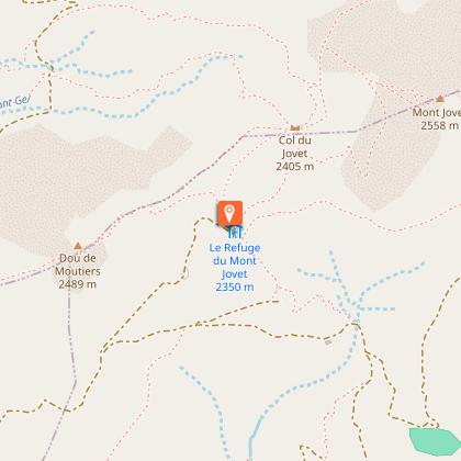
2/ Kommen Sie am Pas des Brebis an, folgen Sie dem Mont Jovet und der Mont Jovet-Hütte, wo Sie die Nacht verbringen werden.

1. Tag: 6,7km und 625mD+

TAG 2 :
3/ Nachdem Sie Ihre Nacht in der Hütte verbracht haben, gehen Sie in Richtung des Col de Jovet und dann in Richtung des Col du Lac, wobei Sie den Lac Bovet links liegen lassen.
4/ Gehen Sie wieder hinunter bis zum Chalet de Prajourdan und biegen Sie dann rechts zum Chalet des Envers ab.
5/ Nehmen Sie den Weg, der bis zur Spitze des Sessellifts La Roche in Plagne Aime 2000 hinauf führt.

2. Tag: 7,5km 320mD+/600mD-

Tiere

Ja. Hunde müssen aufgrund der Anwesenheit von Herden zwingend an der Leine gehalten werden.

Datenautor

Les Provagnes 73210 Aime La Plagne France

Bewertungen und Rezensionen

In der Umgebung sehen
Mehr sehen
Öffnen
Schließen
Anzeigen
Anzeigen
Anzeigen
Anzeigen
Anzeigen
Anzeigen
Anzeigen
Anzeigen
Anzeigen
Anzeigen
Anzeigen
Vorsicht!
Wir haben keine Informationen zur Schwierigkeit dieser Strecke. Es könnte sein, dass Sie unterwegs einige Überraschungen erleben. Bevor Sie loslegen, informieren Sie sich bitte etwas genauer und treffen Sie alle erforderlichen Vorsichtsmaßnahmen. Gute Fahrt! 🌳🥾