In der Umgebung sehen
Mehr sehen
Öffnen
Schließen
Anzeigen
Anzeigen
Anzeigen
Anzeigen
Anzeigen
Anzeigen
Anzeigen
Anzeigen
Anzeigen
Anzeigen
Anzeigen

Oups... Es scheint, dass Cirkwi keine Berechtigung hat, Ihren Standort zu verwenden.

Beschreibung
Karte
Schritte
Bewertungen und Rezensionen
In der Umgebung sehen

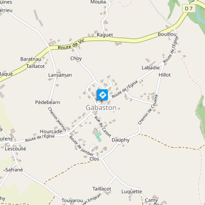
Gabaston : Balade jacquaire

5 gabaston randonnée balade jacquaire 2 © peio Gaillard Montamigo
balade jacquaire, Gabaston

Beschreibung

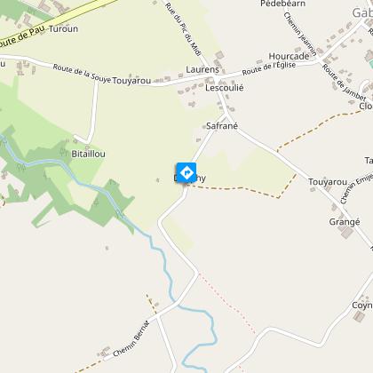
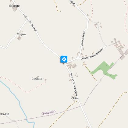
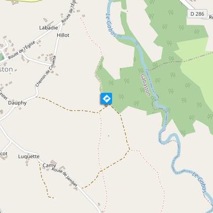
Von Gabaston aus führt dieser reizvolle Rundweg zunächst am Fluss Souye entlang und folgt dann einem Teil des Jakobswegs im Schatten von Stechpalmen und Eichen. Er ist ideal für einen Familienausflug und kann das ganze Jahr über zur Freude aller begangen werden.

Technische Informationen

Wandern
Schwierigkeit
Sehr einfach
Dauer
1h30mn
Entfernung
7.4 km
Mehr anzeigen

Höhenprofil

Ausgangspunkt

64160 GABASTON
Lat : 43.3607155737Lng : -0.2071977127

Schritte

image du object
1

Etape 1

From the town hall car park, opposite the church, the walk starts off to the left. Take the first turning on the left into rue du Castet and leave the village. Continue along this road until you cross the Route de Jambet. Go straight ahead, and a shady path begins alongside a farm. When you reach the Pic du Midi road, turn left, then right along a grassy path. Arrive at the farm (Dauphy) and turn left.

- TOURISME ET LOISIRS - COTEAUX BEARN MADIRAN -
Consulter
image du object
2

Etape 2

Continue along this road, and at the first bend to the right, between two plots of land, take the grassy, covered path directly opposite. At the end of the path, turn right onto the small road, then left onto a shady lane. Continue as far as the Mousquetaire district.

- TOURISME ET LOISIRS - COTEAUX BEARN MADIRAN -
Consulter
image du object
3

Etape 3

At the crossroads, go straight ahead between the two farms. Watch out for vehicles. At the crow's feet, turn left onto Chemin Hiale. At the next junction, turn right and then left between a stream and a fence. When you reach the track, keep right. Stay on this path, and just after a sharp bend to the left, take a grassy path to the right.

- TOURISME ET LOISIRS - COTEAUX BEARN MADIRAN -
Consulter
image du object
4

Etape 4

Walk along this track until you reach the tarmac. Once on the road (be careful of traffic!), head towards Gabaston and take the first turning on the left (chemin de Couette). Continue along this road until you come to Rue du Castet. Turn right into the car park on the left-hand side of Rue de l'Eglise.

- TOURISME ET LOISIRS - COTEAUX BEARN MADIRAN -
Consulter

Zusätzliche Informationen

Contact

Kabeltelefon : +33 5 59 33 62 25
Syndicat tourisme Coteaux Béarn Madiran (antenne Morlaàs)
Website (URL) : www.bearnmadiran-tourisme.fr/
E-Mail : contact@bearnmadiran-tourisme.fr

Balisage

Gelb

Typologie de l'itinéraire

Schleife

Thèmes

Compostela
Historisch
Naturnah

Durée moyenne de l'expérience

1 bis 2 Stunden

Animaux bienvenus ?

Oui

Bewertungen und Rezensionen

In der Umgebung sehen
Mehr sehen
Öffnen
Schließen
Anzeigen
Anzeigen
Anzeigen
Anzeigen
Anzeigen
Anzeigen
Anzeigen
Anzeigen
Anzeigen
Anzeigen
Anzeigen
Vorsicht!
Wir haben keine Informationen zur Schwierigkeit dieser Strecke. Es könnte sein, dass Sie unterwegs einige Überraschungen erleben. Bevor Sie loslegen, informieren Sie sich bitte etwas genauer und treffen Sie alle erforderlichen Vorsichtsmaßnahmen. Gute Fahrt! 🌳🥾