St-Izaire - Bois Noir
Description
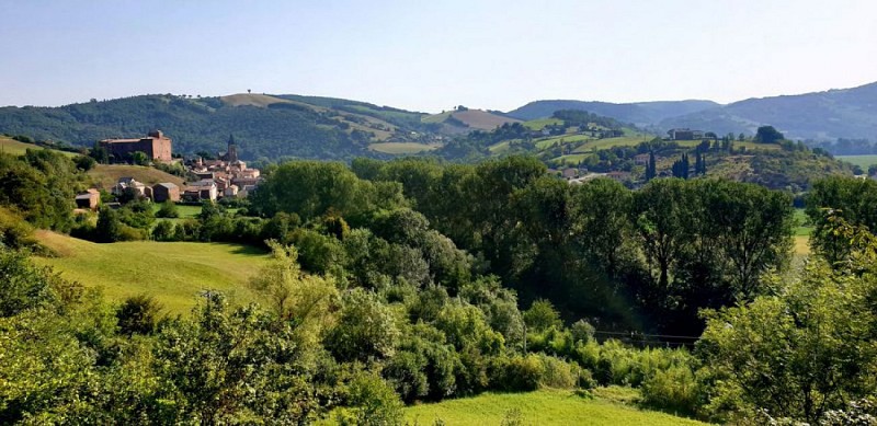
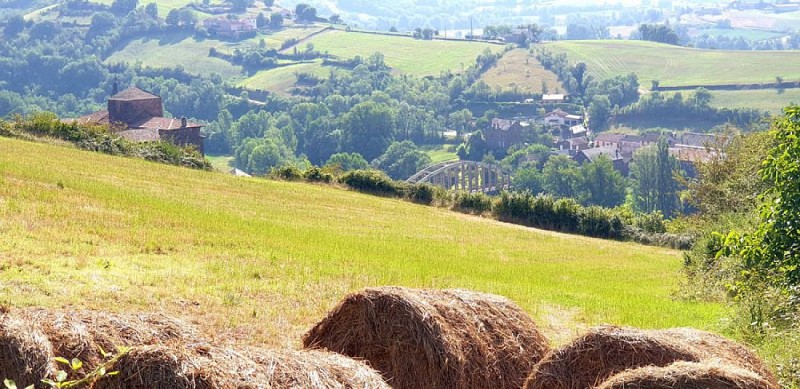
You will best enjoy the numerous scenic views by a bright and sunny day From the car park, walk up towards the bridge to cross the Dourdou river and turn left. Follow the D 25 for 875 m, then take a right turn and follow a small road towards Donacoste, and straight after take right a grassy path which runs alongside the road. Pass under a bridge, then cross a footbridge over a stream and further on you will find the entrance to a 500 m long unlit tunnel (old railway tunnel).Enter this tunnel, it is easier if you keep to the left hand side on the passageway. At the end of the tunnel you re-join the grassy path first running the D25, then deviating towards the hamlet les Roques. At the intersection between the D25 and the path, carry on straight leaving the hamlet to your left. Walk alongside the pond, leave on your right the entrance of another tunnel, walk over this tunnel to reach the hamlet of les Canacs.Enter the hamlet and just before you leave, walk to your left in a wide curve and follow a path rising progressively up, leaving 3 trails to the right one after the other. Walk into the woodland, and at the next fork, close by a barn, take the left most path and keep ascending towards NE. As you get near the crest, pay attention to the trail signs and leave the numerous trails going left and right to carry straight on. At the top, enjoy the beautiful views of the surrounding landscape. Walk down the slope and cross over to the other side of the hill.When you reach a fork on the path, take the left track and start walking down through the woodland. You are now walking on the “bishop’s trail”, which makes a wide curve north. After approximately 20mn, follow the path around two hair pin bends and join a little tarmacked road.Stop and take time to look at the carved standing stone beside the road. Follow that road to the left walking downhill until you reach a fork. At the fork, turn right the road which leads to Riols (equestrian farm) for approximately 150 m, then take almost opposite, a path that rises to the left. Follow a ridge line between the fields and enjoy the beautiful landscape which stretches on either side. The path runs down towards Belle-vue from where the entire village of Saint-Izaire can be seen.6- Follow the small road which leads to Notre-Dame de Grâce chapel. Close to the chapel, you will see a wide path to the right side which runs down towards Saint-Izaire. Walk around the chapel and follow the path which joins the D 25. Turn left, then right to pass under the bridge and get back to the car park.
Technical informations
10 km
|
max. 478 m
min. 256 m
| |||
Altimetric profile
Starting point
Steps
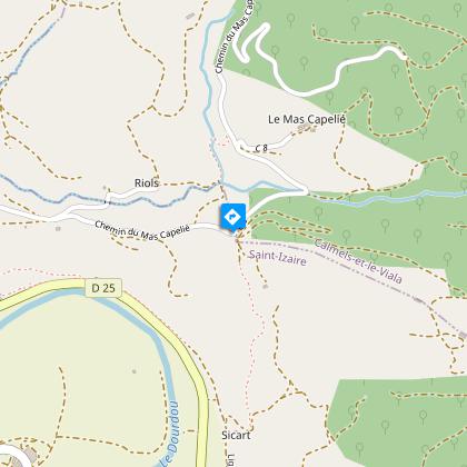
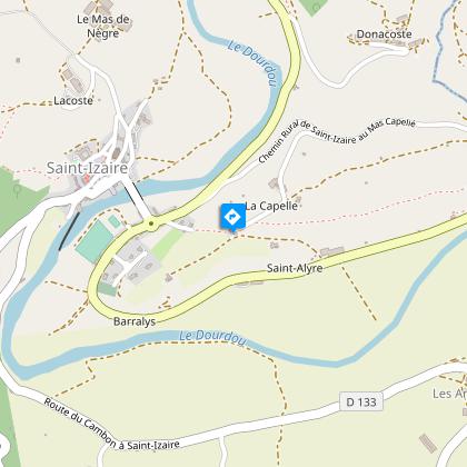
Village de Saint-Izaire
L'histoire de ce village se confond avec celle du vieux château épiscopal, résidence d'été des évêques de Vabres.Il est fait mention du nom de ce village pour la première fois dans un acte de 862.Au XIIème siècle, invasions, brigandages et luttes entre féodaux font régner une terrible insécurité et il est vraisemblable que le village s’enferme peu à peu dans des remparts qui deviennent le refuge des habitants des environs lors des désordres. Le château et le bourg fortifié datent des évêques de Vabres qui font de Saint-Izaire leur résidence d’été ainsi qu’un solide refuge.A la fin des guerres de religions, avec le retour de la paix, cette enceinte a perdu son rôle de fortification, elle a été percée de fenêtres, les portes fortifiées ont été démolies pour le passage des charrettes ou pour agrandir les maisons voisines. Le tracé des rues, ruelles et maisons est inchangé depuis le Moyen-âge, et dans certaines rues on peut encore voir de très belles façades et fenêtres du XVème siècle.
Le pont de Saint-Izaire
Jusqu’en 1859, la traversée du Dourdou se faisait par un bac ou à pied par le gué ou par une passerelle (la Planqua en occitan, qui reste le nom du quartier rive droite). Le premier pont construit tout en grés rouge en 1859 fut emporté par une crue en 1930 et remplacé par l’actuel pont suspendu en béton.
Statue menhir du Mas Capelier
Cette statue possède tous les attributs féminins : seins adjacents à la pendeloque en forme de Y, jambes disjointes, chevelure représentée dans le dos par une bande du sommet de la tête jusqu'à la ceinture. Les yeux ronds, à la hauteur du nez, surmontent les tatouages des joues faits de quatre traits parallèles.
Chapelle Notre Dame de Grâce
Sanctuaire fondé par Alix de Castelnau.Cette chapelle existe depuis au moins le XVème siècle, où elle portait le nom d’Ouradou (oratoire).Elle a été restaurée en 1730 et au XIXème siècle; on y a remployé alors la porte de l’escalier du château.
Points of interest
Village of Saint-Izaire
The history of this village is intertwined with that of the old Episcopalian castle, which was formerly the Bishop of Vabres summer palace. The name of the village was first made mention of in an official document dating back to 862 AD.During the 12th century, continual invasions, acts of banditry and battles between feudal lords created a tremendous insecurity. This led to the building of battlements to improve the defensive system and providea safe haven to the neighbouring people during periods of turmoil. The castle and the fortified village date back to the time of the Vabres bishops who made the village their summer residence and a safe refuge.When the religious wars were over and peace restored, the protective wall lost its primary function and so today the façade of the castle has windows inserted along its length. The fortified gates were also demolished to allow the passage of carts or to expand the neighbouring houses. The villagestreet, footpath and house pattern has remained unchanged since the Middle Ages, and the beautiful 15th century facades and windowscan still be seen in some streets today. The old church part of the battlements had its vault lowered in 1635 to provide housing to the schoolmaster and guards. In 1650 repair works were started by the Consuls.
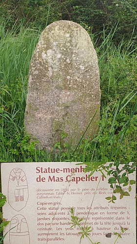
Carved standing stone of the Mas Capelier (B) This statue displays all of the feminine feature
This statue displays all of the feminine features: breasts are depicted either side of the Y shaped pendant,legs are set apart and the hair is tied back and depicted by a stripe down the back from the top of the head to the belt. The eyes are wide open set either side of the nose above tattooed cheeks represented by four lines.
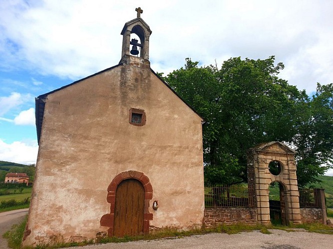
Notre Dame de Grâce chapel
This sanctuary which was founded by Alix de Castelnau has existed since at least the 15th century, when it was called Ouradou (oratory). This chapel was refurbished in 1730 and during the 19th century, the stairway door of the castle was then brought back into use.
Additional information
Public transport
Travel by bus or train: lio.laregion.fr/carpooling : BlaBlaCar, Rézo Pouce, Mobicoop, Idvroom, LaRoueVerte, Roulez malin
Advice
Take a light with you.Box tree moths are active from May to October. During the caterpillar phase, they feed on the leaves of box trees. They crawl down trees and move on long silken threads, although these threads are annoying when hiking they do not pose any health risk
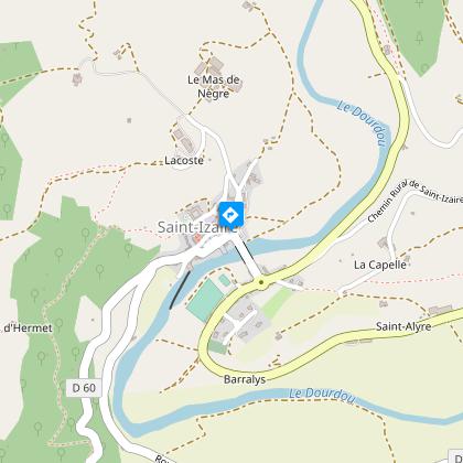
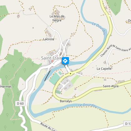
Advised parking
Next the river after the bridge
Access
From St-Affrique head towards Albi, then at the roundabout before Vabres l’Abbaye turn right the D25 up to St-Izaire
Arrival
Saint-Izaire
Ambiance
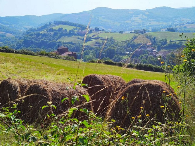
De hameau en tunnel, de chapelle en statue-menhir et de ruisseau en étang, le long d’une passerelle ou du “chemin de l’évêque“, le paysage de la vallée du Dourdou et des crêtes avoisinantes se révèle peu à peu. La traversée du Bois Noir et la vue insoupçonnée sur Saint-Izaire sont les temps forts de cette rando à effectuer par temps clair, panoramas obligent !
Departure
Saint-Izaire
Data author
