Corniches du Rajol

Description
Discovery of the flora on the causses, the ruiniformed rocks of Rajol and the imposant rocky chaos of Roquesaltes.From the parking, foward on the D991 that passes in the village. Right after the restaurant and the road to Montpellier-le-vieux, go up the cobblestone street towards the old oven and the church.The path joins the GR62. Turn right to discover the hamlet of Montméjean passing infront of the washbasin.Turn back until the intersection and follow the GR62 going up on the Causse Noir (limestone plateau), (on the leftside the ruiniformed chaos of Rajol with surprising shapes).Follow up until Roquesaltes to discover the ruiniformed chaos and a typical farmhouse "caussenarde".Take on the left side, the path that goes around the Chaos on the West side and cross below on the right, an arch naturally pierced into the rock. The path goes down winding throughout the woods until the road.At the bridge, go down on the road about 200 m and following the landslide continue on the road until the village. (Don't turn right on the path plunging into the ravine to join La Roque-Sainte Marguerite).
Technical informations
11 km
|
max. 856 m
min. 401 m
| |||
Altimetric profile
Starting point
Steps
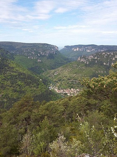
La Roque-Sainte Marguerite
Gardienne des Gorges de la Dourbie, elle s'étire entre Causse du Larzac et Causse Noir. Suivez la calade et accédez à l'église (XIè), profitez du panorama exceptionnel et approchez le château et son donjon (XIIIè). Côté Causse Noir, le chaos rocheux de Montpellier-le-Vieux, côté Larzac les hameaux typiques de Pierrefiche et de Montredon : 2 causses aux paysages et habitats façonnés par les bergers et leurs troupeaux. Le Moulin de Corp et son pont en dos d'âne (XVè) peaufinent le paysage.
Sentier botanique de Montméjean
Dans sa mission de sauvegarde du patrimoine, le travail de l'Association Vivre Montméjean s'est orienté essentiellement vers les sentiers, autrefois artères de communications vitales pour le hameau. Aujourd'hui, le débrousaillement qu'elle a effectué afin d'ouvrir ces sentiers aux randonneurs a révélé une flore particulièrement variée. Après en avoir fait l'inventaire, l'Association a décidé de créer la Boucle du Sentier Botanique - de Montméjean à Montméjean - afin d'enrichir la balade des promeneurs.
Points of interest
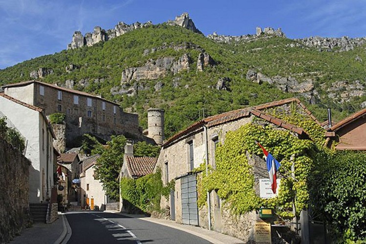
La Roque-Sainte Marguerite
Guard of the Dourbie valley, it is stretched between the Causse du Larzac and the Causse Noir. Go up the cobblestone street and access an 11th century church and enjoy an exceptional panorama approaching the 13th century castle. On one side (Causse Noir side) the rocky chaos of Montpellier-le-vieux, on the other side (Larzac) the typical hamlet of Pierrefiche and montredon: 2 limestones plateau with landscapes and habitats built by shepherds and their herds. The Mill du Corp and its humpback bridge (from the 15th century) refines the landscape.
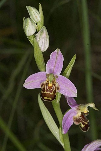
Botanical path in Montméjean
the Association Vivre Montméjean focused on the paths, that was once roads of vital communications for the hamlet. Today the clearness done, in order to open paths to the hikers, revealed a particulary varied flora. After the inventory, the Association decided to create a loop of the botanical path of Montméjean to enrich the walkers stroll.

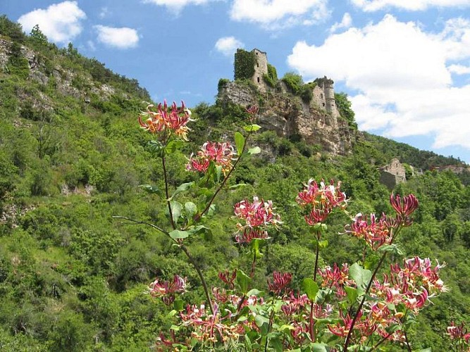
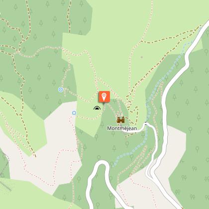
Montméjean
The castle belonged to a family of the same name. It was taken by Charles d'Amagnac, Viscount of Creissels in 1471 and reformed in 17th century.In the 18th Century, we counted 200 sheep heads, 30 pairs of oxen and 150 porks for a population of 93 inhabitants. Cereal and walnuts was taken to the Moulin-de-Corp (the Mill) for the flour and the oil. The Moulin de Corp (stemming from the occitan gorg the abyss) belonged to the Lord of Montméjean. The village runned a coal mine until the 19th century.
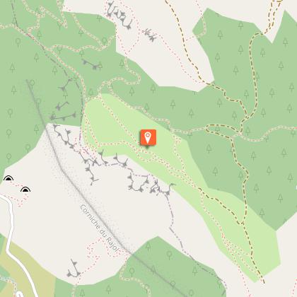
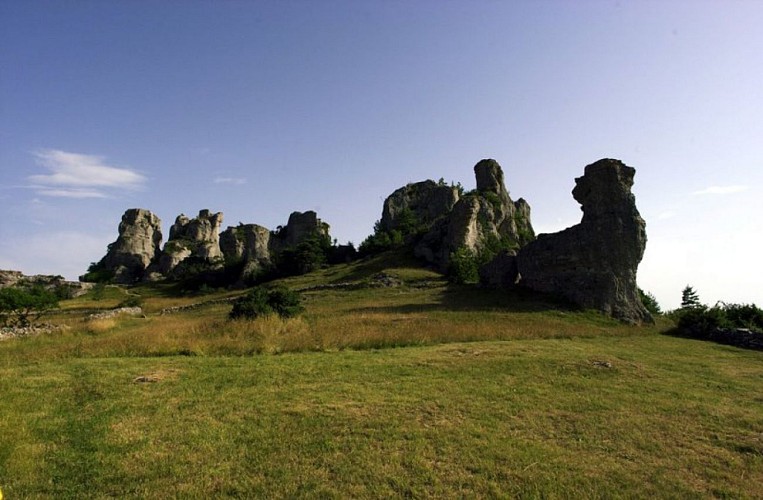
Ruiniform chaos of Rajol
About 240 years, the Causses (limestone plateau*) were formed by the accumulation of marine sediments. The errection of the Pyrenees and the Alps provoked an uprising of the region and formed numerous cracks on the surface area. The streaming infiltrates there, sculping rocks by dissolution of limestone. The erosion is more or less active according to the resistance of rocks, that's why we observe ruiniform sculptures today.
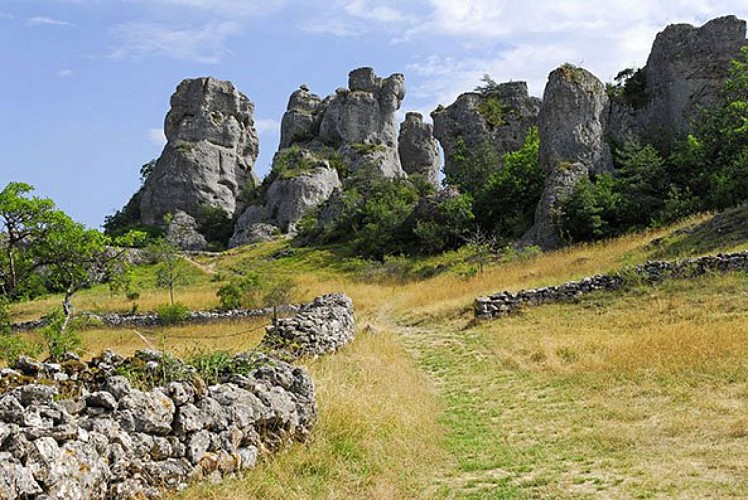
Ruiniform rocks of Roquesaltes
It is one of the most important ruiniform chaos on the Causses (limestone plateau). It constitutes a natural donjon which overhangs,and on the other side of the ravine du Riou Sec, that of Montpellier-le-vieux. Rocks with fantastic shapes among which 4 towers of 40 meters high, in which one is called l'Arc du Triomphe!Some of these sites were once coronate of an amazing image, feeding the imagination of the population which avoided them.
Additional information
Public transport
Pensez au covoiturage et à l'autostop Rezopouce ; Aires de covoiturage
Advice
Following a landslide, the end of the route is recommended by the road. Thanks for your understanding.
Is in the midst of the park
This itinerary is located in the World Heritage zone Causses and Cévennes, mediterranean agropastoral cultural landscape.
Advised parking
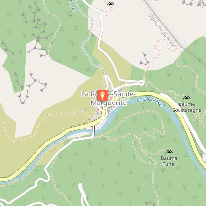
A l'entrée du village, parking sur la droite, avant le pont sur la Dourbie
Access
On the D991 towards Nant in La Roque-Sainte Marguerite, 13 km from Millau.
Arrival
La Roque Sainte-Marguerite
Ambiance
Discover the flora on the Causses, the castle and the fountain of Montméjean and strange landscapes of rocks like the ruiniformed chaos of Roquesaltes. Enjoy a beautiful panoramic view on the Dourbie valley and the Causse du Larzac.
Departure
La Roque Sainte-Marguerite
Data author
