In the regional forest of Ferrières
Description
Discovery of the regional forest of Ferrières, the Moulin de Belle Assise and the geodesic tower.
Technical informations
15 km
|
max. 124 m
min. 99 m
188 m
| |||
Altimetric profile
Starting point
Steps
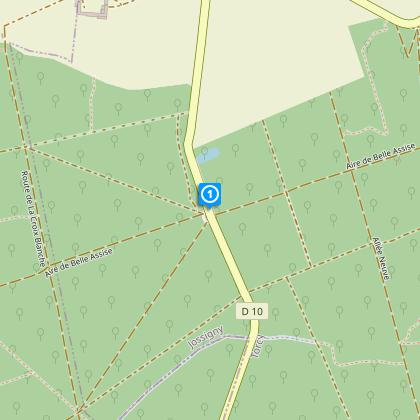
Départ
Du parking, emprunter l’allée centrale au cœur du bois de Maulny. Au carrefour, tourner àgauche route de la Croix Blanche.
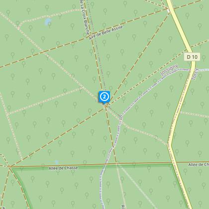
Etape 2
Au carrefour suivant, direction le bois de Belle-Assise : suivre le balisage rouge et blancdu GR14 sur 3 km, emprunter le chemin le Pas de l’Âne légèrement sur la gauche. 100 m après,tourner à gauche dans un chemin, traverser la route et continuer en face. Au carrefour, prendreà droite puis à gauche. Après un fossé, bifurquer à droite, au carrefour suivant à gauche (allée de la Chasse). Après 300 m,prendre le chemin à droite puis le suivant à gauche.
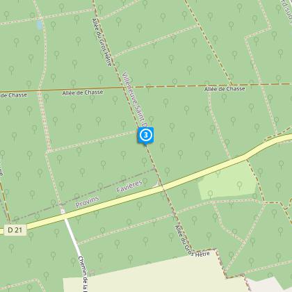
Etape 3
Au bout du chemin, quitter le GR en prenant à gauche. Traverser l’allée de la Chasse pour suivreen face l’allée du Gros Hêtre et, 400 m plus loin, tourner à gauche. Au carrefour suivant, bifurquerà droite puis à gauche environ 250 m plus loin. Au carrefour, prendre à droite à 180° une sente en sous-bois puis longer la mare par la gauche.
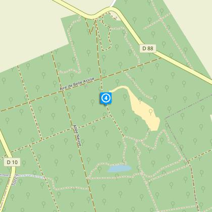
Etape 4
Tout au bout, emprunter l’ancienne route sur la gauche, en direction du moulin de BelleAssise.Environ 400 m plus loin, après une butte de terre, tourner dans un chemin à droite quicontourne le moulin. A la barrière, suivre le chemin de droite pour atteindre le moulin de Belle-Assise et la cheminée géodésique.
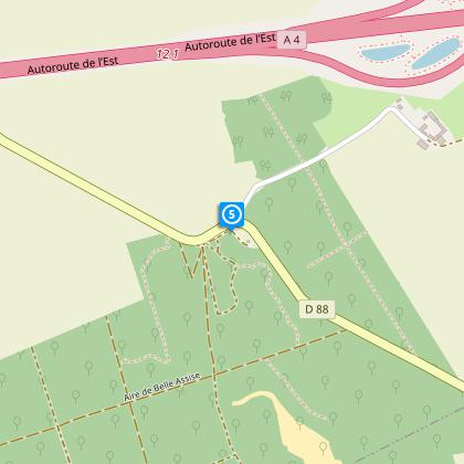
Arrivée
Faire demi-tour et revenir par le chemin sinueux, le moulin sur la gauche. Prendre àgauche au bout et, après la butte de terre, emprunter le chemin à droite, toujours tout droit pour rejoindre le parking.
Points of interest
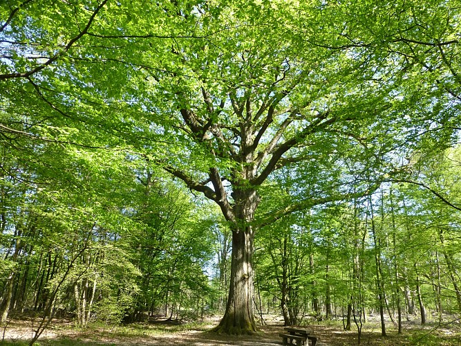
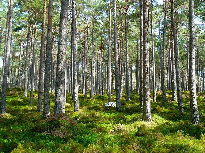
Ferrières forest
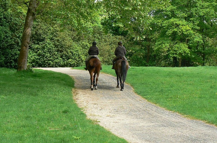
The ancient domain of the Rothschild family has become for its forest parts a regional forest.Majestic trees and ponds as well as alleys created for hunting in geometrical schemes form a nice setting for walkers. Deer and wildlife is preserved and forest settings around Ferrières are a nice leisure area for inhabitants and tourists. The Ile de France commission for nature areas and parks is in charge of this forest and locally points out some nice walking paths to discover this environment.
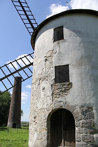
Moulin de Belle-Assise
Au détour d’une balade en forêt régionale de Ferrières, faites une halte pour admirer ce joli moulin à vent. Ce dernier cessa d’écraser du grain vers 1858. Il est actuellement au cœur d'un projet de rénovation.Les historiens, qui attestent de son existence depuis 1537, affirment que le moulin est passé de propriétaire en propriétaire, de Nicolas Fouquet à James de Rothschild. Il est aujourd’hui propriété de la commune grâce à laquelle il a retrouvé ses ailes et son mécanisme intérieur en 1998. A noter que ce moulin était présent sur la toute première carte de Cassini et fut utilisé par Jean-Baptiste Delambre entre 1792 et 1793 pour la conception du mètre étalon.
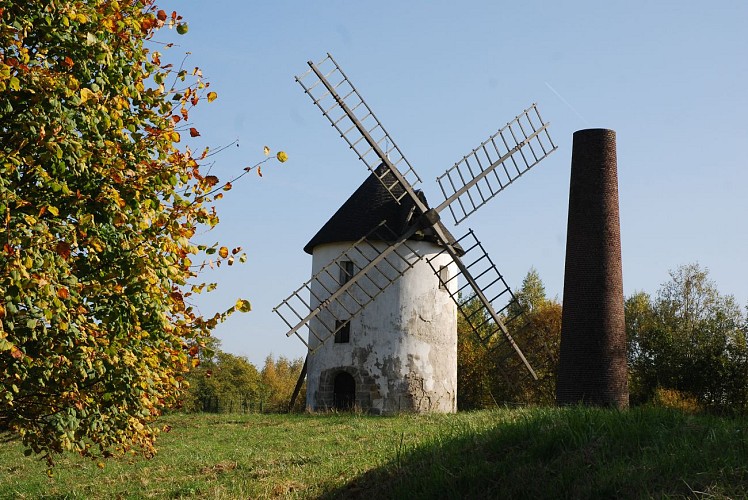
Tour géodésique
Cette cheminée géodésique qui se dresse à côté du moulin de Belle-Assise a été érigée à la fin du 19ème siècle par l’Institut Géographique National comme repère dans les travaux de mesure de l’arc du méridien de Paris.
Additional information
Contact
Phone : 01 64 02 15 15
Email : officedetourisme@marneetgondoire.fr
Website : www.marneetgondoire-tourisme.fr/
Open period
All year round.
Updated by
Office de Tourisme de Marne et Gondoire - 18/03/2024
www.marneetgondoire-tourisme.fr/
Report a problem
Data author

The Cirkwi brief
Embark on a journey through the enchanting landscapes of the Ferrières forest, a treasure trove of natural and historical marvels, brought to you by the Office of Tourism of Marne and Gondoire. This meticulously crafted itinerary invites you to explore the serene paths lined with towering oak trees, uncover the secrets of the ancient Moulin de Belle Assise, and marvel at the architectural prowess of the geodetic tower. Designed to immerse you in the tranquility of nature while connecting you with the rich tapestry of the region's past, this adventure promises an unforgettable escape into the heart of Ile-de-France's most cherished woodland sanctuary.
Technical Insights and Pathway Guide
This 15.38km route commences at the Taffarette parking area, boasting a minimum and maximum elevation of 99m and 124m respectively, exemplifying a moderate elevation fluctuation. Throughout the journey, participants will encounter a positive elevation change of approximately 185m. Pivotal to this experience is navigating through diverse terrains including tranquil forest pathways, historical sites, and crossing major roads attentively. The route’s signage, predominantly GR® and yellow markers, ensures a guided experience. It's an expedition that requires preparation, particularly in terms of physical readiness and navigation skills.
Seasonal Tips for A Smooth Journey
As a local guide, my advice for travellers traversing the Ferrières forest spans all seasons. Spring brings lush greenery and blooming flora - perfect for photographers. Summers are ideal for longer day explorations, but do carry water and sun protection. Autumn showcases a brilliant palette of leaf colors but prepare for muddy paths. Winters, while serene, demand caution for slippery routes and early sunsets. Regardless of the season, sturdy footwear and weather-appropriate clothing are essential. Always prioritize safety at road crossings and keep to marked paths to preserve this splendid environment.
Cultural and Historical Significance Unveiled
Nestled within the Ile-de-France region, the Ferrières forest and its surrounds are not just a natural haven but a repository of centuries-old history. Originally owned by religious communities and later the Rothschild family, its name echoes the iron forges that dotted the landscape in the Middle Ages. The presence of such historical landmarks as the Moulin de Belle Assise and the geodetic tower adds layers of cultural depth to the scenic beauty. This area's historical significance, intertwined with natural beauty, offers a unique glimpse into the region's past and present melding seamlessly.
Weather Patterns and Optimal Visit Seasons
Understanding the region’s climate is key to planning an enjoyable visit. The Ile-de-France enjoys a temperate climate, with mild winters and warm summers. Rainfall is distributed throughout the year with the possibility of snow in winter months. The best times for forest exploration are late spring through early autumn, offering the most favorable weather conditions. However, each season lends its unique charm to the forest. Remember, weather can be unpredictable, so always check forecasts ahead of your journey and dress accordingly for a memorable experience.