Forest
Description
Time: 1h45
Pedestrian
Road signs: Green signs, White markings
Difficulty: * (easy)
Distance: 6.7 kms
Map IGN 1339 and TOP 25
Directions
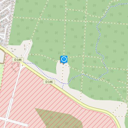
Start at D1, from the roundabout of Maguide (landmark on the map D4,) on the Arcachon road .Follow the direction “Biscarrosse plage” or “Biscarrosse beach” until the landmark 1. Take on your right and follow the road signs to reach the landmark 2, then turn immediately right until 3. At 3, turn left, cross the bike path and continue onto the perpendicular trail #4, turn right and proceed straight on the path until you reach the way of Cugnes passing by the reservoir 4.
Option: when you pass by the landmark 4, leave the circuit, turn left and follow the direction of the Reservoir. Admire the point of view of the Ocean and lakes (Biscarrosse / Cazaux / Sanguinet). Make a 180° turn and return on the circuit. At #5, take a right and go down until #2. Cross the bike path. At D2, take the trail on your right, continue straight to reach #6, turn left following the signs and finally take first trail on your right and return to your point of departure.
The numbers 1 through 6 are markers on the path map
Technical informations
6.6 km
|
max. 80 m
min. 18 m
134 m
| |||
Styles : HikingBaladeDiscoveryForest Public : FamilyOccasional hikers Theme : Couples | ||||
Altimetric profile
Starting point
Points of interest
Data author
