Hiking path throughout the Tiergues and Soulsou Causses
Description
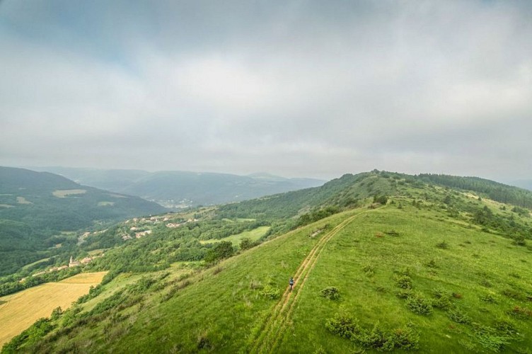
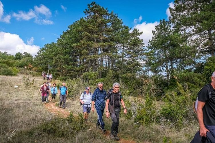
This circuit that leads you in the frontal causses across small valleys and ridges, displays a whole rich heritage and offers a getaway through time and space, with some superb views over Saint-Affrique.From the Maréchal Foch square in Saint-Affrique, take the road towards Rodez (route de Tiergues). 100 m after the Painlevé square, pass under the porch to your left. Carry on the path and reach the junction with the road which you take to the right up to a sharp bend. Walk straight on a track until an intersection with a larger path. Take this rising path up to the road.Take right the stone track, then follow the path that ascends progressively and overhangs the road to Tiergues.When you reach the junction, take the track of the dale which runs parallel to the D50. Follow the ravine and the brook towards Tiergues.At the signposted intersection, take to the left a rising wooded path which leads to the plateau where the Tiergues dolmen is located.After your visit to the dolmen, walk to the right along the D250 and reach the hamlet of Tiergues. To get through the village, walk around the graveyard and walk past the church (notice the sundial on the façade of a house).As you get to the intersection with the cross, fork to the left and follow the trail that slopes gently down towards the D993. Take this road for 70 m and leave it to join a footpath on the right, then reach the tarred road which leads to Canissac and go further up to the left.Walk past the buildings up to the junction and head towards Soulsou. Walk around the farm to the South-East and take a wide trail which runs parallel to the ravine. Carry on in the middle of pine plantations until you reach an intersection.Leave the main trail and take right a path that goes across the undergrowth and follow it to the junction with a tarmac road that you take to the left. Leave consecutively two roads going to the left, then 100 m after a bend and a place called "Julhac", take right a track up to a junction with a tarmac road that reaches the town centre.
Technical informations
17 km
|
max. 633 m
min. 318 m
| |||
Altimetric profile
Starting point
Steps
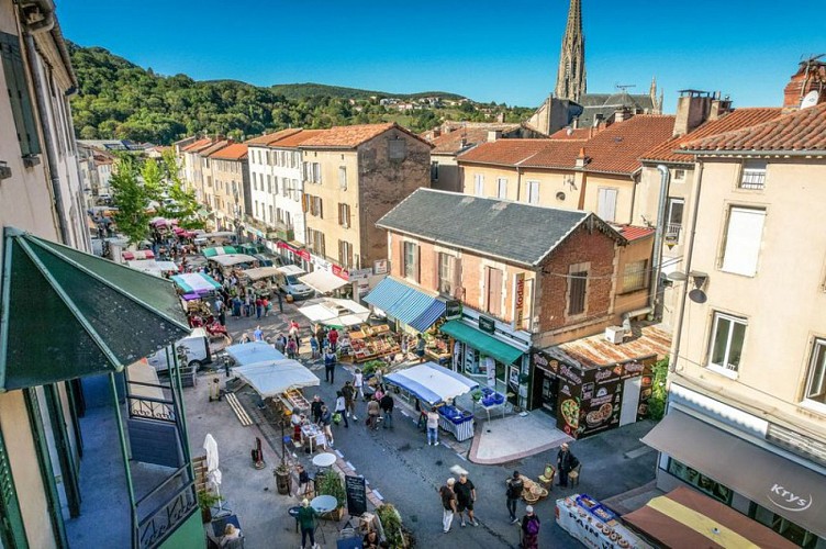
Ville de St-Affrique
Pourquoi Saint-Affrique avec deux F ?Au Vème siècle, les Wisigoths Ariens persécutaient les communautés catholiques et interdisaient l’accès aux églises. Africanus, évêque, fut chassé du Comminges.La légende raconte qu’Africanus aurait terminé son exil dans un hameau au bord de la Sorgues et qu’il en aurait profité pour évangéliser les habitants. Il y aurait aussi accompli de nombreux miracles (voir les vitraux du Chœur de l’église Notre Dame de la Miséricorde).Le nom de cet évêque trouverait son origine dans la langue parlée par les Wisigoths et plus précisément dans la racine Affric ou Effric, signifiant « puissant et affreux ».Le nom de Saint-Affrique fut attesté en 942 dans le cartulaire (recueil des droits et des titres d’un monastère ou d’un évêché) de Vabres l’Abbaye. Une anecdote : Saint-Affrique n’a pas toujours conservé ce nom là. Pendant la Révolution Française on appela la ville Montagne sur Sorgues. En effet, à cette période il était de coutume de modifier les noms à consonance ecclésiastique.
Le Pont Vieux de Saint-Affrique
Classé monument historique, il est reconnu comme l'un des plus beaux ponts médiévaux de France. Il existait déjà en 1368, il est attesté en 1408 grâce à une crue qui emporta l'arche rive gauche avec le moulin, reconstruite en plein cintre en 1418 (les arches d'origine sont en arcs brisés). Depuis le Pont n'a subi aucun réaménagement. La construction est tout à la fois hardie et légère. Une grand arche encadrée par deux plus petites, des piles minces, un profil en fort dos d'âne (pente de 14%). La grande arche atteint 21,40 m d'ouverture. Les piles, remarquablement minces, n'ont que 3,40 m d'épaisseur et sont terminée par des becs triangulaires effilés qui se poursuivent jusqu'au parapet pour former refuge.Conséquence du classement du Pont Vieux comme monument historique, seuls les toits en tuiles romanes sont autorisés dans un rayon de 500 mètres autour de lui.
Château des comtes de Caylus
Ce rocher servit d'appui à la construction du château des comtes de Caylus au XIème siècle, dont il ne reste aucune trace aujourd'hui.Au pied du Rocher, à l'intérieur de l'enceinte fortifiée, étaient regroupé les maisons des serviteurs du château, formant de l'est à l'ouest une rue traversante.Les habitants de Saint-Affrique s'étant plaints du seigneur de Caylus auprès de Raimond VII, le château fut détruit à la suite d'une rebellion en 1238 du comte de Caylus contre son suzerain Raymond VII, comte de Toulouse, marquis de Provence et de Gothie.Le mur d'enceinte a subsisté jusqu'au début du XIXème siècle : en 1808, le Conseil Municipal de Saint-Affrique le fit abattre pour empierrer la route de Tiergues, alors route impériale 99.Le rocher culmine à 519 mètres.
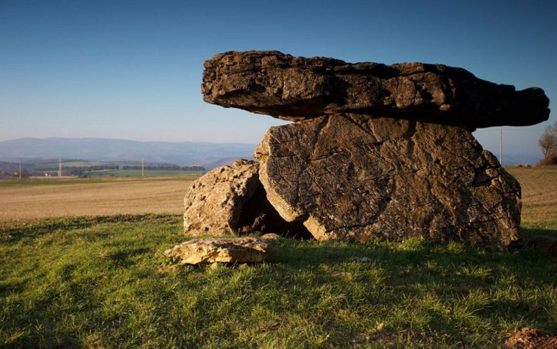
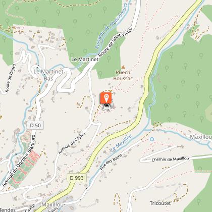
Dolmen de Tiergues
Dolmen classé monument historique.Il fait parti de la vingtaine de dolmens recensés, pas tous bien conservés. Ces dolmens ont été fouillés au XXème siècle par Emile Cartailhac. le mobilier découvert lors de ces fouilles se trouve éparpillé à Rodez, à Toulouse....
Points of interest
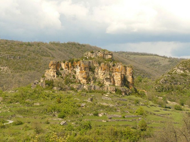
Counts of Caylus’ Castle
This rock was used as the bedrock for the building of the Counts of Caylus’ Castle of which nothing remains todayThe castle was destroyed in retaliation of Count of Caylus’ rebellion against his overlord Raymond VII, count of Toulouse, marquis of Provence and of Gothie.
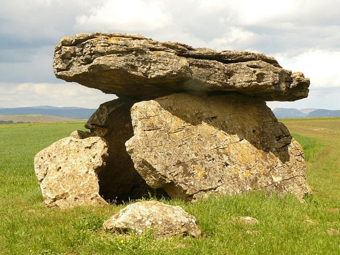
Tiergues dolmen
Listed as a historical monument, the Tiergues dolmen is part of the 20 or so dolmens which have been recorded in the area, some of them being poorly-preserved. The excavations of these megaliths were carried out by Emile Cartailhac during the 20th century and today their artefacts are scattered throughout Midi- Pyrennées (Rodez, Toulouse…)
Additional information
Public transport
Travel by bus or train: www.mobimipy.fr/carpooling : BlaBlaCar, Rézo Pouce, Covoiturage-libre, Idvroom, LaRoueVerte, Roulez malin
Advice
Box tree months are active from May to October. During the caterpillar phase, they feed on the leaves of box trees. They crawl down trees and move on long silken threads, although these threads are annoying when hiking they do not pose any health risk
Advised parking
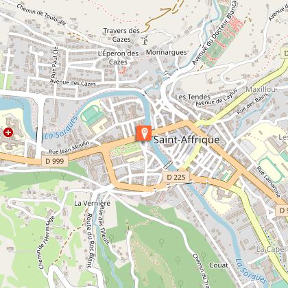
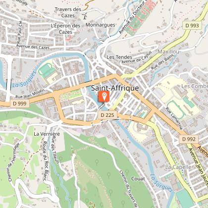
Parking place Maréchal Foch à Saint-Affrique
Access
Saint-Affrique is situated 31 km southwest of Millau via the D 992 and D 999
Arrival
Parking Maréchal Foch à Saint-Affrique
Ambiance
Throughout stone tracks, low stone walls, a buissière and a pine plantation, this hike unveils some treasures of the local heritage: the Caylus rock, a former Seigneurial castle, the Tiergues dolmen, an outstanding megalith and the Soulsou farm. To get more info, a stop at the Maison de la Mémoire in Saint-Affrique is imperative!
Departure
Parking Maréchal Foch à Saint-Affrique
Data author
