Around La Couvertoirade


Description
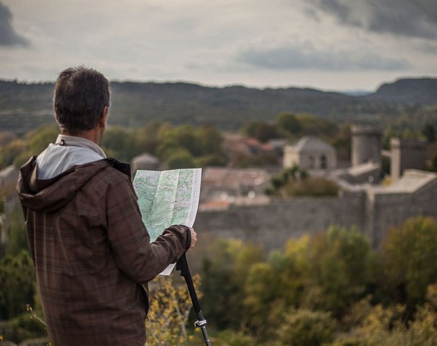
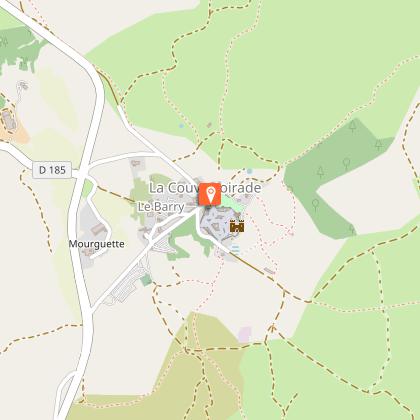
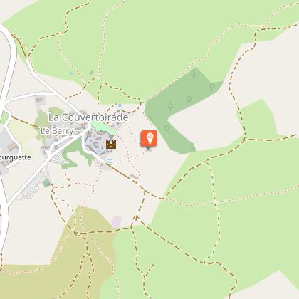
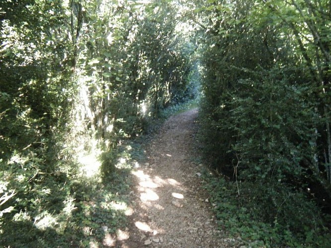
A trip outside La Couvertoirade, in an agropastoral landscape: ideal for understanding the daily life of inhabitants of this fortified village at the time of Templars and Hospitallers.Through the parking, you have to get the ramparts of the village at the north gate and go through the village on the left to join the church.You can leave the village by the small door of access located between the church and the castle. Walking up and down till Moulin de Redounel, you have to take down on the way back to the left along the ramparts to lavogne.Follow the road in left approximately for 250 m and to pass beyond a disused barn. To veer right on the track that rises smoothly on the tray. After a wide turn, it turns towards south and reaches 1 km, at a fork.To leave GR de Pays to go down in right through the pasture of 100 m, then to appear on a dirt track. To follow it towards west for 900 m and reach an intersection with the GR 71.To turn right on the stony path. Being narrow, it then widens and passes through a small oak wood. You have to go through the Boussière, then in a small meadow and continue through the hollow road that leads to the foot of the wall, facing the south gate.To enter the village through the south door and to the car park via the north door.
Technical informations
6 km
|
max. 827 m
min. 765 m
| |||
Altimetric profile
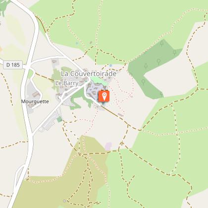
Starting point
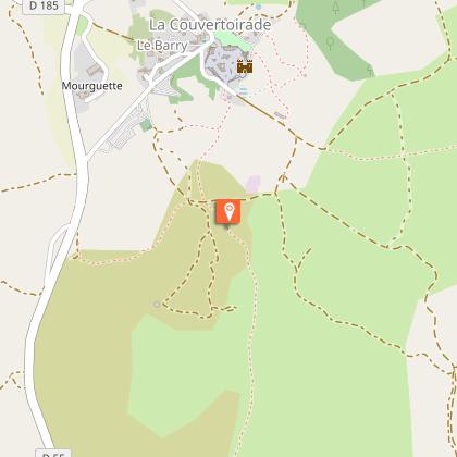
Steps
Les remparts
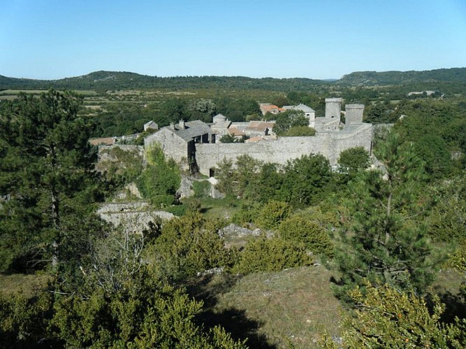
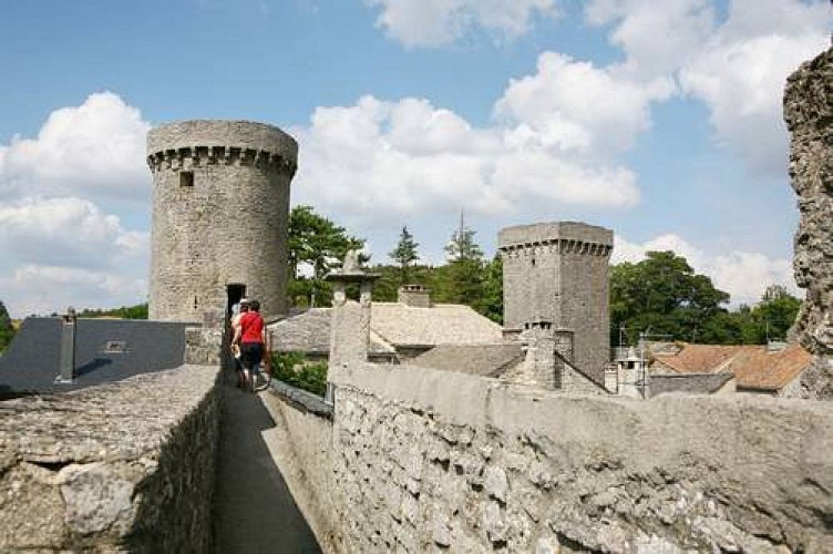
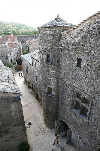
La Couvertoirade conserve l'intégralité de ses remparts, édifiés au milieu du XVe siècle. Dès 1346, des "routiers" pillent le Larzac. C'est par crainte de ces bandes armées que les villageois demandent en 1439 l'autorisation de fortifier le village. La construction se poursuit jusqu'en 1445, sous la direction du maître maçon Déodat d'Alaus.Cette muraille, de 420m de long et d'1.30m d'épaisseur, est percée par des archères-canonnières et est surmontée d'un chemin de ronde.Sources : Point Accueil Tourisme La Couvertoirade
La Maison de la Scipione
Cette maison de la fin du XVe siècle présente une superbe fenêtre à meneau et une tourelle, rajoutée au XVIIe siècle, qui laissent deviner la richesse des propriétaires. Cette maison, qui doit son nom à l’une de ses propriétaires (la veuve de Monsieur Scipion Sabde, surnommée la Scipione), abrite aujourd’hui le Point accueil du village. A l’intérieur, une superbe salle voûtée servait de bergerie. Les étages de la maison se visitent, et l’escalier à vis qui y mène donne également accès au chemin de ronde.Source : Point Accueil de La Couvertoirade
Le four banal
Ce four doit son nom à l’impôt que l’on devait payer pour pouvoir l’utiliser : la banalité. Construit au XVe siècle par les hospitaliers et restauré dans les années 2000. Il est aujourd’hui en état de marche et des fournées y sont régulièrement faites par le boulanger du village.Source : Point Accueil de La Couvertoirade
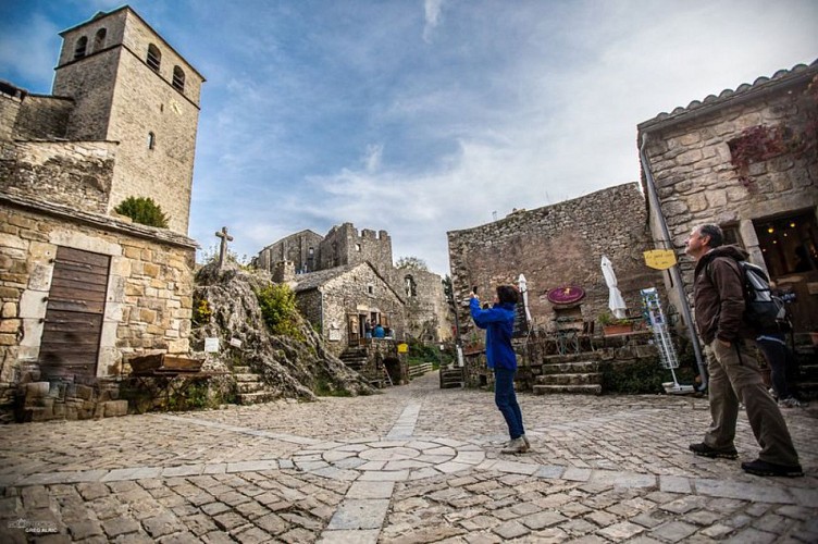
L'église Saint-Christophe
L'église actuelle a remplacé l'ancienne église paroissiale du XIe siècle, située à l'extérieur du village. Ce nouvel édifice, en partie creusée dans le rocher au XIVe siècle, participera à la constitution définitive d'un village. Lors de l'édification des remparts, au XVe siècle, le chevet plat de l'église fera partie entière du rempart. Une tour de défense sera également rajoutée au dessus du chœur, mais devra malheureusement être détruite au XVIIIe siècle représentant un poids trop important pour l'édifice primitif.Sources : Point Accueil Tourisme La Couvertoirade
Le Château
Le château templier a été édifié vers la fin du XIIe siècle sur un piton rocheux. Sa fonction, jusqu'à l'édification des remparts au XVe siècle, a été de protéger les villageois en cas d'attaque, en témoigne sa barbacane, cette enceinte primitive, ainsi que les vestiges d'une bretèche, situés au dessus de sa porte d'entrée. Cet édifice possède trois parties: une basse cour, un corps de logis et un donjon. Sources : Point Accueil Tourisme La Couvertoirade
Le moulin de Redounel
Les premières mentions de moulins à vent apparaissent en Angleterre et en France à la fin du XIIème siècle. Ils se sont beaucoup développés au début du XIIIème siècle et ont cessé de tourner à la fin du XIXème siècle, sauf exception.A La Couvertoirade, il y avait deux moulins à vent : l’un a disparu mais a été mentionné au XVIIème siècle au lieu-dit « La Croix du vent », l’autre domine encore la cité au Redounel ».Le Moulin de Redounel : altitude : 808 m, diamètre extérieur : 5,56 m, hauteur : 6,60 m, épaisseur des murs : 1,08 m. Il constitue l’un des seuls vestiges de moulins à vent du Sud-Aveyron, parmi les 60 moulins à vent connus en Aveyron. Les moulins servaient à moudre le blé (farine), presser les noix (huile) ou écraser les pommes (cidre).Sources : PNRGC_DA
La Lavogne
La lavogne et la citerne remplissent une double fonction, vitale sur les causses. La lavogne est une mare aménagée sur des fonds argileux, imperméables à l’eau. Elle est souvent dallée de pierres pour éviter le ravinement que provoquerait le piétinement des troupeaux de brebis venant y boire. La citerne recueille les eaux de pluie et la stocke. Elle alimente également la lavogne, qui reçoit de son côté les eaux de ruissellement provenant du Puech de la lavogne.Sources : PNRGC_DA
Le chêne pubescent
Le chêne pubescent (Quercus pubescens) est largement répandu dans les zones calcaires du sud de la France. Ses feuilles sont pubescentes à leur face inférieure, ce qui constitue une adaptation à la sécheresse (les poils limitent l’évaporation et retiennent l’humidité). Autrefois, les glands étaient ramassés pour les animaux ou bien mangés sur place par les troupeaux.Sources : PNRGC_LJ
La buissière
Cheminements à l'intérieur de haies denses de buis arborescents centenaires, elles étaient destinées à protéger et à canaliser les troupeaux.Sources : PNRGC_DA
Points of interest
The ramparts
La Couvertoirade preserves all its walls, built in the mid-fifteenth century. As early as 1346, robbers called "routiers" plunder the Larzac. Because of fear of the armed gangs, villagers were asking in 1439 the permission to fortify the village. The construction continued until 1445 under the direction of master mason Déodat d'Alaus.This wall of 420 m long and 1.30 m of thickness is pierced by arrow slits and is surmounted by a walkway.Sources: Information Office of La Couvertoirade.
The Scipione House
This house built in the end of 15th century has a superb mullion window and a turret added in the 17th century, which suggest the wealth of the owners. The Information Office of the village is located in this house, which owes its name from one of its owners (Sir Scipion Sabde’s widow, nicknamed “La Scipione”. Inside, a superb vaulted room served as a sheepfold. It‘s possible to visit the floors and the spiral staircase leading to it also gives access to the walkway.
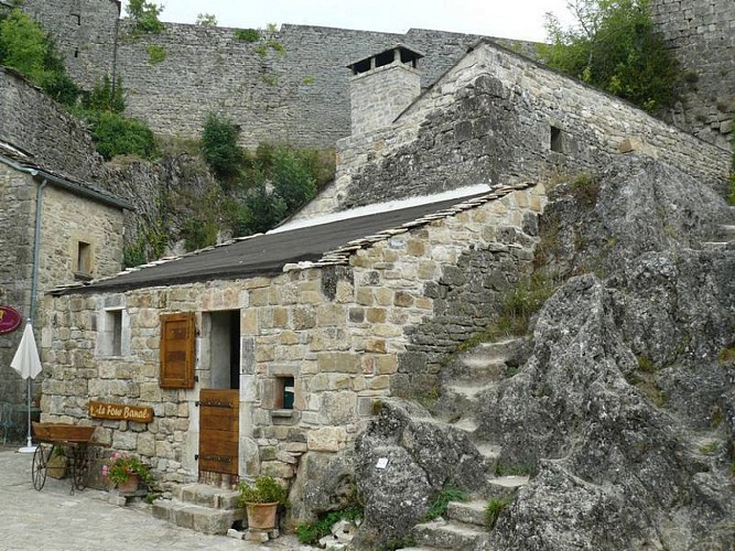
The oven
This oven owes its name to the tax people had to pay for using it: this tax was called “la banalité”. Built in the 15th century by the Hospitallers and restored in 2000s. Today, it works and batches are regularly made by the village baker.
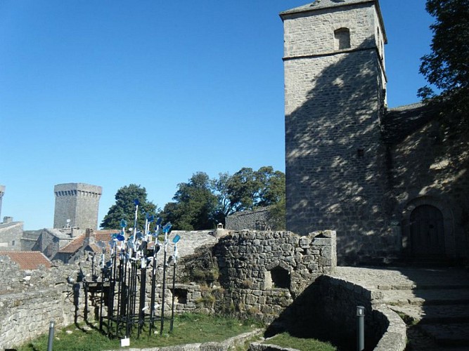
The church Saint-Christophe
The present church has replaced the old parish church of the 11th century, situated outside the village. This new building, partly carved into the rock in the 14th century will attend the final constitution of a village.During construction of the walls in the 15th century, the church flat chevet will be a complete portion of the wall. A defense tower will also be added to the above the choir, but will unfortunately be destroyed in the 18th century representing too much weight to the original building.Sources: Infirmation Office of La Couvertoirade.
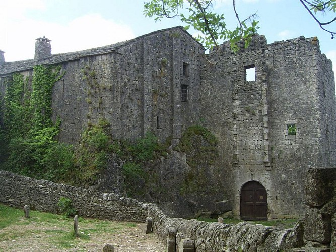
The Castle
The Templar castle was built in the late twelfth century on the rocky outcrop of the village. Until the construction of the walls in the fifteenth century, its mission was to protect the villagers in case of attack, evidenced by its barbican, this primitive enclosure, as well as the remains of a gatehouse, located above the front door. This building has three parts : a farmyard, a main building and a dungeon.Sources: point Home Tourism Couvertoirade
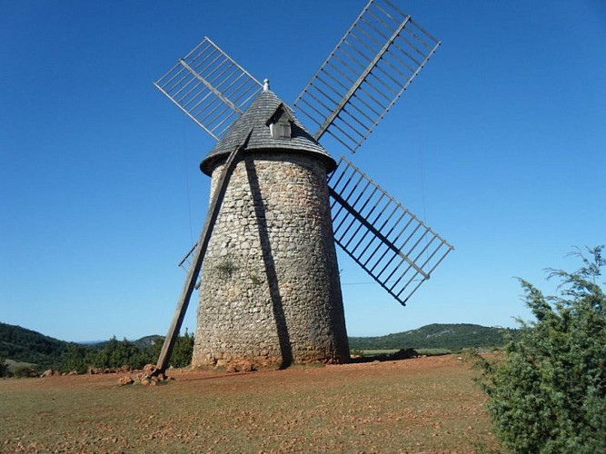
The mill of Redounel
The first notes about windmills appear in England and France at the end of the 12th century. They were much developed in the early 13th century and stopped turning at the end of the 19th century without any exception. In La Couvertoirade, there were two windmills, one disappeared but was mentioned in the 17th century in a place called “the Cross of wind”, the other still dominates the city at Redounel. “Le Moulin de Redounel”: altitude: 808 m, outer diameter: 5.56 m, height 6.60 m, thickness of walls: 1.08 m. It is made up of one of the only remains of windmills in South Aveyron, among the 60 windmills known in Aveyron. The windmills were used to grind wheat (flour), to press nuts (oil) or crush apples (cider).Sources: PNRGC_DA
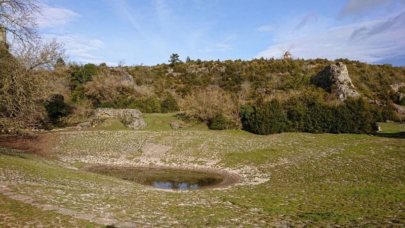
The "lavogne" (cobbled watering place)
The lavogne and the tank have a dual function, vital to the plateau. The lavogne is a pond developed on the clay funds, impervious to water. It is often paved with stones to prevent gully erosion that cause trampling of sheep flocs came to drink it. The cistern collects rainwater and stores. It also feeds the lavogne, which, in its side receives runoff from Puech of Lavogne.Sources: PNRGC_DA
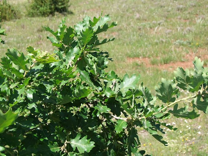
The pubescent oak
The pubescent oak (Quercus pubescens) is widespread in the areas of the south of France. Its leaves are hairy on their underside, which is an adaptation to drought (the hairs limit evaporation and retain moisture). Formerly, the acorns were collected for animals or eaten by the herds on site.Sources: PNRGC_DA
The buissière.
The slow progression inside dense hedges of boxwood trees arboreal, they were intended to protect and channeling herds. Sources: PNRGC_DA
Additional information
Public transport
To find a means of transport go to Hérault transportThink about carpooling and hitchhiking: Rezopouce ; Aires de covoiturage
Advice
You cross sometimes classified areas, presenting protected species. Close the gate in the grazing area, don’t near the sheep, keep the animals on a leash. Stay on marked trails, respect private property and nature. Don’t pick flowers. Bring back your waste, take care of the risk of fires. Put on good shoes and take enough water. Check the weather forecast before leaving.
Is in the midst of the park
This itinerary is located in the World Heritage zone Causses and Cévennes, mediterranean agropastoral cultural landscape.
Advised parking
Parking at the entrance of the village
Access
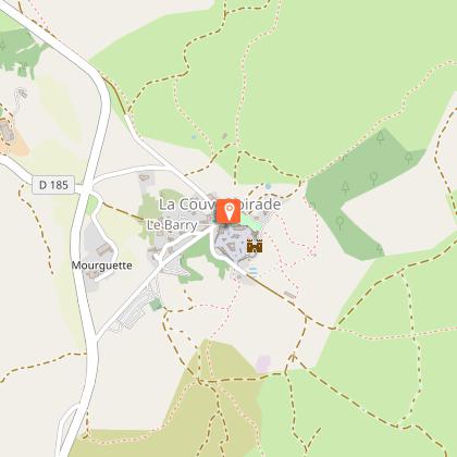
La Couvertoirade, 42 km south-east of Millau by the D809 (or by the A75 motorway) and the D185
Arrival
Parking at the entrance of the village
Ambiance
The climb to the Larzac causse allows to relocate the jewel of la Couvertoirade in its natural setting. In an arid site shaped by the sheep breeding, the “lavogne” (cobbled watering place) and tank-roofs bear witness to a “caussenarde” architecture dedicated to the water canalization. A whole typical heritage refers to the historic building of the Templar city.
Departure
Parking at the entrance of the village
Data author
